West Vancouver neighbourhood guide
Cedardale, West Vancouver: Homes for Sale, Prices, Schools and Daily Life
Cedardale is a small residential neighbourhood on the east side of West Vancouver, between Taylor Way and the Capilano River and south of the Upper Levels Highway. Every home this page listed on October 11, 2026 was a detached house, and more than half were finished before 1970. It suits a family that wants a house on a large lot a short drive from Park Royal and the Lions Gate Bridge, with a French immersion school and a river trail close by.
For sale now
11
houses, townhouses, duplexes
Asking prices
$1.60M to $9.69M
Middle asking price
$3.08M
West Vancouver detached benchmark
$2.82M
September 2026, GVR
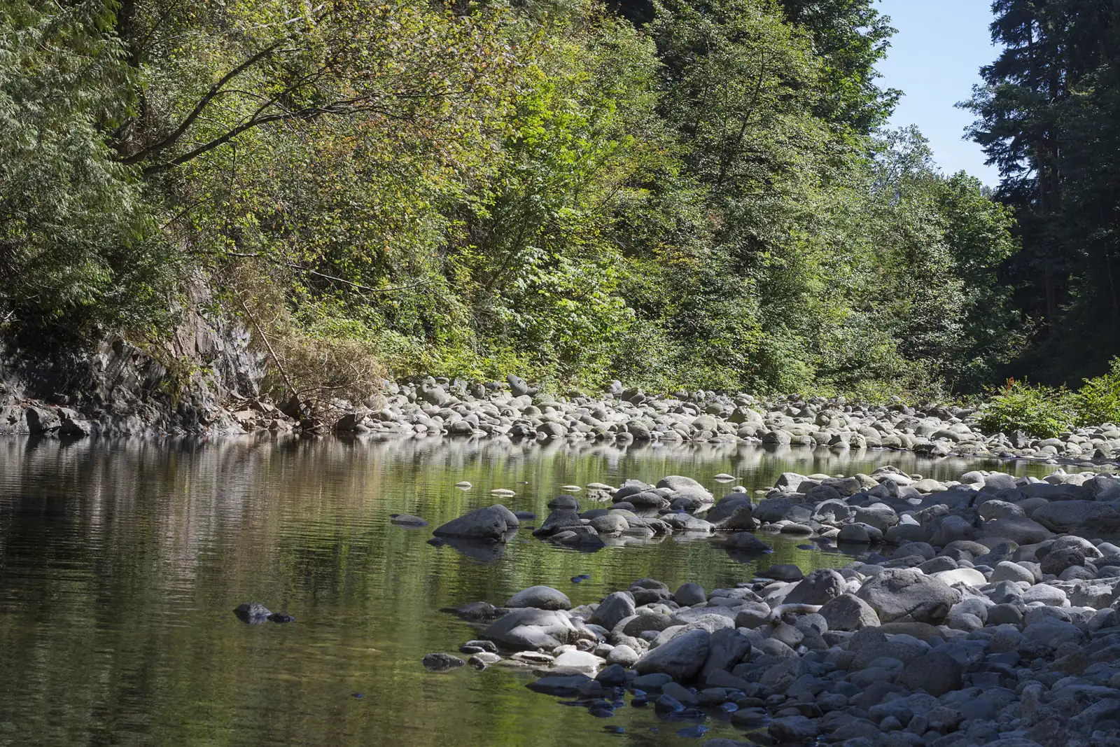
Photo: Jeff Macleod, Wikimedia Commons, CC BY-SA 3.0
Cedardale is in the District of West Vancouver. The province's place name record puts it on the south-east side of the District, east of Taylor Way, and North Vancouver is on the other side of the Capilano River. On October 11, 2026, most listings here left the municipality line blank and the others said West Vancouver.
What Cedardale is like
Cedardale covers the south-east corner of West Vancouver. The West Vancouver Archives describes it as the area from the Capilano River in the east to Taylor Way in the west, and from Keith Road in the south to the Upper Levels Highway in the north. Park Royal lies south of Keith Road, Sentinel Hill rises on the far side of Taylor Way, and North Vancouver is across the river.
The land climbs from south to north. Natural Resources Canada's elevation data gives 22 metres above sea level for a point on Keith Road, 57 metres for the middle of the area and 74 metres for Taylor Way at Inglewood Avenue. Inglewood Avenue and Keith Road cross the neighbourhood from west to east, and 3rd Street runs north and south on the east side.
The streets are residential, and the map on this page marks no grocery store, cafe, pharmacy or clinic inside Cedardale. A French immersion elementary school, four sports fields, a garden park and a riverside trail are all inside the area or on its edge.
In our view, Cedardale suits a buyer who wants a detached house and a large garden on ground that is less steep than the hills to the west and north, and who drives to the shops.
Live from the MLS® system
Homes for sale in Cedardale
11 houses, townhouses and duplex homes are listed for sale in Cedardale today, checked against the MLS® system within the last hour. Condos and apartments are not shown on this page.


.jpeg)
Prices
What a home in Cedardale costs
Two kinds of numbers, kept apart. The dots are asking prices of the homes listed in Cedardale today, counted on this page. The cards are Greater Vancouver REALTORS benchmark prices for all of West Vancouver, which describe a typical home sold anywhere in West Vancouver.
Asking prices today
Each dot is one home for sale. The dark line marks the middle price.
Detached house
$2,822,900
- One year
- down 9.9%
- Ten years
- down 21.9%
West Vancouver benchmark, Greater Vancouver REALTORS, September 2026
All home types
$2,244,700
- One year
- down 7.4%
- Ten years
- down 26.7%
West Vancouver benchmark, Greater Vancouver REALTORS, September 2026
Greater Vancouver REALTORS published no West Vancouver townhouse benchmark in its September 2026 report, so none is shown.
What the homes are like
Every home this page listed in Cedardale on October 11, 2026 was a detached house. No townhouse or duplex home was listed that day. Condo apartments are also listed under the Cedardale name, and this page leaves them out. Streets with houses listed included Macbeth Crescent, Inglewood Avenue, Newlands Road, 3rd Street, Margaree Place and Newdale Place.
More than half of those houses were finished before 1970, in equal shares before 1960 and during the 1960s. The 1980s formed the next largest group, and the rest came from the 1990s, the 2010s and the 2020s in equal shares. The middle year was 1964.
The houses and the lots are large. The middle house had four bedrooms and 3,590 square feet of floor space. The middle lot measured 12,446 square feet, which is more than a quarter of an acre.
Fewer than one in five listing descriptions mentioned a view. More than one in four house listings stated a suite and called it unauthorized, the word a listing uses for a suite that has no approval from the District. No listing stated a legal suite. The others said the house had no suite or left the line blank.
When the homes were built
Year built of the 11 listings that state it.
- Before 19603
- 1960s3
- 1980s2
- 1990s1
- 2010s1
- 2020 and later1
Bedrooms
Bedrooms in the 11 listings that state it.
- 32
- 44
- 52
- 6 or more3
Suites: of the 4 houses for sale whose listing states it, 0 list a legal or licensed suite, 3 list a suite the municipality has not approved, and 1 list none. The rest leave the field blank.
The homes listed today have been on the market for 56 days at the middle, counted from each listing date to today. That is how long they have waited so far, which is a different number from how long homes take to sell.
Cedardale on the map
- Home for sale
- Public school
- Park
History
The name, the school and Klee Wyck
Cedardale has been an official place name since November 26, 1979. BC Geographical Names, the province's place name office, adopted it from a map that the District of West Vancouver supplied in September of that year. Its record adds that the community is east of Taylor Way. The record gives no reason for the name, and no source we read says who chose it.
People used the name 25 years before the province adopted it. The West Vancouver Archives holds a photograph dated April 28, 1954 that shows the playing field of Cedardale Elementary School under construction. A 1994 photograph in the same collection shows the building at 595 Burley Drive as the Cedardale Centre, and the record says it was first built as Cedardale Elementary School. That address is École Cedardale today.
Brothers Creek, which crosses the neighbourhood, has a recorded story. The provincial record says that "about 1909" workmen opening Mathers Avenue found three creeks close together and called them the Sisters Creeks. When the municipality applied for water rights on one of them in 1914, a search found a Sister Creek farther north, so this one became Brothers Creek.
The property at 200 Keith Road, in the south-east corner, has the longest record we found. The District says the house there was built in 1925 and was the home of Dr. Ethlyn Trapp from 1942 until she died in 1972. She gave the 6.2 acre property to the District in 1960, on the agreement that it be used for recreation, a nursery garden, a playground or other community use. By the District's account she named it Klee Wyck in honour of her friend, the artist Emily Carr. The District removed the house and the studio in 2021.
Daily life
Daily life in Cedardale
Shopping means a trip to Park Royal, the shopping centre on Marine Drive, south of Keith Road. The table on this page gives the straight line distance. In our experience, most households make this trip by car.
One bus route serves the same trip. The 256 leaves Park Royal, climbs Taylor Way, stops on Inglewood Avenue at Burley Drive and on Keith Road at 3rd Street, then returns to Park Royal. In TransLink's schedule for September 7, 2026 to January 3, 2027, it comes once an hour on weekdays, from 6:08 a.m. to 7:08 p.m. at the Inglewood Avenue stop. The ride from that stop to Park Royal is given 12 to 13 minutes, and from Keith Road at 3rd Street 8 to 9 minutes.
For sport, Hugo Ray Park is at 1290 3rd Street. The District's field list, as saved on September 11, 2026, shows four grass fields there. Cedardale Park is mapped south of it, and the grounds of École Cedardale are on the west side near Taylor Way. The nearest recreation centre on the map is across the river in North Vancouver.
Grocery stores
Nearest: Loblaws, 1.1 km away.
Cafes
Nearest: Starbucks, 1.1 km away.
Libraries and rec centres
- Capilano Tennis Club820 m
- Lions Gate Community Recreation Centre950 m
How far it is
- Downtown Vancouver (Waterfront Station)5.4 km
- Lonsdale Quay and the SeaBus4.2 km
- Lions Gate Hospital4.6 km
- Park Royal shopping centre1.0 km
Places from OpenStreetMap, read October 10, 2026. Distances are in a straight line from the middle of the area, so the trip by road is longer.
Outdoors
The Capilano River, its trail and the local parks
The Capilano Pacific Trail runs along the river side of Cedardale. The District describes the route. It starts at the dog walk area of Ambleside Park and follows the river until signs send walkers up to Keith Road. From Keith Road it heads east past Klee Wyck Park, then north on a roadway to the forest.
North of Cedardale the trail is closed. The route once continued through Capilano River Regional Park to the fish hatchery and the Cleveland Dam. A landslide on January 6, 2021, in the area of Moyne Drive, removed a section of the trail. The District's page, as saved on August 17, 2025, states that the park can no longer be reached from West Vancouver this way. In October 2024, Metro Vancouver told the District that rebuilding the trail on its old line was not feasible because of the unstable ground. Read the District's page and Metro Vancouver's park page before you plan a walk to the dam.
Klee Wyck Park, at 200 Keith Road, is the former garden estate described in the history section. The District uses part of it as a plant nursery for its parks department. After the buildings came down, it landscaped the open ground for park use and finished that work in February 2022.
Take care beside the river. Metro Vancouver warns that water can be released over the Cleveland Dam, which makes the river rise fast, and that alarms along the river sound when a large unplanned release happens. Its park page also says the regional park is home to bears, cougars and coyotes.
Schools
Schools in and near Cedardale
Cedardale is served by West Vancouver Schools (School District 45), and one of its schools is inside the neighbourhood. École Cedardale, at 595 Burley Drive, teaches Kindergarten to Grade 7. The district calls it a single-track French immersion school, which means every class there is taught in French immersion. The district also says the school was authorized in 2016 to offer the International Baccalaureate Primary Years Programme, and that this programme has a fee.
Check how places are given out before you buy for this school. The district fills Kindergarten places in early French immersion by lottery, with one draw for École Cedardale and one for École Pauline Johnson. A family that buys near the school still enters the draw. For the 2027 to 2028 school year, the district accepts applications from 8:00 a.m. on October 15, 2026 to 3:00 p.m. on November 30, 2026, and holds the draws in early December. From Grade 2 to Grade 7, only children who are already in early French immersion may apply.
For the English program, the table on this page lists Westcot Elementary on Westcot Road and Ridgeview Elementary on Mathers Avenue as the nearest West Vancouver schools. Capilano Elementary also appears in the table, and it belongs to the North Vancouver School District across the river. The nearest public high schools are Sentinel Secondary, where the district continues French immersion after Grade 7, and West Vancouver Secondary. St. Anthony's, an independent school, is on Keith Road.
The nearest school and the catchment school for an address can be two different schools. Enter each address in the district's school locator before you make an offer.
| School | Type | French programs | Distance |
|---|---|---|---|
Ecole Cedardale 595 Burley Dr, West Vancouver, BC | Public, elementary | Early immersion | 310 m |
Westcot Elementary 760 Westcot Rd, West Vancouver, BC | Public, elementary | None listed | 930 m |
Capilano Elementary 1230 20th St W, North Vancouver, BC | Public, elementary | None listed | 1.5 km |
Ridgeview Elementary 1250 Mathers Ave, West Vancouver, BC | Public, elementary | None listed | 1.6 km |
Sentinel Secondary 1250 Chartwell Dr, West Vancouver, BC | Public, secondary | Early immersion | 2.1 km |
West Vancouver Secondary 1750 Mathers Ave, West Vancouver, BC | Public, secondary | None listed | 2.5 km |
St. Anthony's 595 Keith Rd, West Vancouver, BC | Independent, elementary | None listed | 440 m |
Bodwell High School 955 Harbourside Drive, North Vancouver, BC | Independent, secondary | None listed | 2.9 km |
St. Thomas Aquinas 541 Keith Rd W, North Vancouver, BC | Independent, secondary | None listed | 3.4 km |
Andre-Piolat 380 Kings Rd W, North Vancouver, BC | Public, elementary-secondary | Francophone | 3.6 km |
Your address decides your assigned school, which can differ from the closest one. Check any address with the West Vancouver Schools school locator. School list from the BC Ministry of Education, updated October 8, 2026.
Getting around
Getting around
Taylor Way is the main road. It runs down the west edge of Cedardale to Marine Drive, Park Royal and the Lions Gate Bridge, and up to the Upper Levels Highway (Highway 1). The highway crosses the Capilano River toward North Vancouver and the Second Narrows (Ironworkers Memorial) Bridge, and leads west toward Horseshoe Bay.
On the Lions Gate Bridge, the province changes the direction of a lane to match the traffic. Its schedule, which it calls approximate and last updated on April 8, 2026, lists two lanes toward Vancouver and one toward the North Shore from 6:00 to 9:30 a.m. on weekdays, and mostly two lanes toward the North Shore from 3:00 to 7:00 p.m. In our experience, cars waiting for the bridge fill Marine Drive and the lower part of Taylor Way at those hours and on summer weekends.
The 254 bus runs on Taylor Way between the British Properties and Park Royal, and the table on this page counts the weekday trips. In TransLink's fall 2026 schedule, three weekday morning buses continue to downtown Vancouver. They pass the Taylor Way stop at the highway overpass at 7:24, 7:54 and 8:36 a.m. and are given 24 to 27 minutes to West Georgia Street at Burrard Street. Those three then turn off Taylor Way toward Sentinel Hill, so the first 254 at the stop beside Anderson Crescent, near Inglewood Avenue, comes at 9:02 a.m. From that stop the ride to Park Royal is given 2 to 5 minutes.
In our view, a morning rider to downtown has two practical choices: the 254 at the highway overpass stop, or the hourly 256 to Park Royal and a change there to a bus that crosses the bridge.
Routes that stop in Cedardale
Trips on a regular weekday that stop at one of the 5 stops inside the area, from TransLink's published schedule valid to January 3, 2027.
- 254British Properties/Park Royal/Van39 trips
- 256Whitby Estate/Park Royal/Spuraway14 trips
Before you buy
Things to check in Cedardale
Creeks on or beside the lot
OpenStreetMap, a map drawn by volunteers, shows Brothers Creek crossing the south-west part of Cedardale, past Taylor Way, Inglewood Avenue and Keith Road. It also shows an unnamed stream running south through the middle of the area, past Macbeth Crescent. In the District's existing neighbourhoods, any development within 15 metres of the top of a creek bank needs an Environmental Development Permit, and the District counts work on hazard trees as development. Ask the seller where the creek and the 15 metre strip fall on the lot.
The river bank
The ground drops to the Capilano River on the east side. Natural Resources Canada's data gives 68 metres above sea level for Hugo Ray Park and 26 metres for a point on the river beside it. On January 6, 2021, a landslide near Moyne Drive, north of the highway, carried away a section of the riverside trail and the sewer pipe under it, after a smaller slide at the same place in December 2019. For a lot that reaches the top of the river bank, ask the seller for any engineer's report on the slope, and ask the District what its file holds.
Forest edge and the wildfire permit
The District's Wildfire Hazard permit area takes in properties within 100 metres of forest, and forest lines the river. Inside the area, a new or replacement house needs a wildfire permit before its building permit, and the District says the permit typically takes four to six weeks. Renovations are exempt. We could not open WestMap, the District's online map, for this guide, so look up each address there and phone an insurer.
Suites
More than one in four house listings on October 11, 2026 stated an unauthorized suite. The District requires owners to register a secondary suite. Its page, as saved on August 15, 2025, sets the first registration fee at $450 and warns that an unregistered suite breaks the Zoning Bylaw and can bring fines of up to $10,000. Ask the seller for the registration before you rely on the rent.
Road noise and the bridge
In our experience, the houses nearest to the highway or Taylor Way hear traffic indoors with the windows open. Visit at 8 a.m. and again at 5 p.m. on a weekday, stand in the back garden, and then drive to the Lions Gate Bridge to time the trip yourself.
Houses from the 1950s and 1960s
More than half of the houses listed on October 11, 2026 were finished before 1970. For one of these, ask for the dates of the last roof, wiring and drain work, and ask whether an oil tank was ever buried in the yard. Compare the answers with the District's permit record for the address.
Buying
Buying a home in Cedardale
Decide first how much road noise you accept and how much garden you want. In our experience, a house beside the highway or Taylor Way is priced below a similar house in the middle of the area or on the river side.
Then check the ground. Look up each address on WestMap for creek lines and the wildfire area. The price dots on this page show today's asking prices. The range is wide because houses from the 1950s are listed beside houses finished in the 2020s.
If French immersion is part of your plan, read the school section on this page before you set a budget, because a Kindergarten place at École Cedardale depends on a draw.
Michael Lee helps buyers in Cedardale and the rest of West Vancouver. Send the form on this page with your budget, the bedrooms you need and your view on suites and road noise. He will reply with the Cedardale houses that fit and times to see them.
Selling
Selling a home in Cedardale
A buyer who visits your Cedardale house has usually seen the other houses on this page first. The cards show how many are listed today and the range of their asking prices. In our experience, the same buyer also tours Sentinel Hill and the lower British Properties.
In our experience, four things set the price of a house here: the size and shape of the lot, the condition of the house, its distance from the highway and Taylor Way, and whether a creek crosses the lot. Before you list, collect the District's permit record, the registration for any suite, and any survey or permit that shows the creek line.
Real estate board rules keep sold prices off public pages like this one. Michael Lee can go through recent Cedardale sales with you in a private price review and explain the list price he would suggest. Ask for one with the form on this page.
Houses listed
11
$1.60M to $9.69M
Our view
Who buys in Cedardale
In our experience, three groups buy in Cedardale. Families with young children come for a detached house with a garden near École Cedardale and the sports fields. Two generations who buy together look for a large house with a separate floor, and they should read the suite check on this page first. The third group works downtown or elsewhere on the North Shore and wants both the bridge and the highway a short drive from home.
Cedardale and the areas next to it
Homes listed for sale today, counted on this page.
| Area | For sale | Middle asking price | Houses, middle price |
|---|---|---|---|
| Cedardale | 11 | $3.08M | $3.08M |
| Park Royal | 3 | $3.24M | $3.32M |
| Sentinel Hill | 17 | $2.88M | $2.88M |
| British Properties | 56 | $5.09M | $5.09M |
| Pemberton (North Vancouver) | 12 | $1.34M | $1.70M |
| Capilano (North Vancouver) | 5 | $2.50M | $2.50M |
Questions about Cedardale
Where is Cedardale in West Vancouver?
Cedardale is in the south-east corner of West Vancouver. The West Vancouver Archives describes it as the area between the Capilano River and Taylor Way, from Keith Road north to the Upper Levels Highway.
Is Cedardale in West Vancouver or North Vancouver?
Cedardale is in the District of West Vancouver, and its property tax, permits and local rules come from the District. North Vancouver starts on the other side of the Capilano River. Most listings leave the municipality line blank, so the tax notice for a home is the paper to check.
What kind of homes are for sale in Cedardale?
Every home this page listed in Cedardale on October 11, 2026 was a detached house. More than half were finished before 1970, and the middle house had four bedrooms. Condo apartments are also listed under the Cedardale name, and this page leaves them out.
How much does a house in Cedardale cost?
The price dots on this page mark the asking price of each house listed in Cedardale today and show the middle price. Beside them, the page gives the latest monthly benchmark from Greater Vancouver REALTORS for a detached house across West Vancouver, so you can compare the two.
Does a home in Cedardale come with a place at École Cedardale?
Kindergarten places at École Cedardale are drawn by lottery. West Vancouver Schools takes applications for the 2027 to 2028 school year from October 15 to November 30, 2026 and holds the draw in early December. A family that lives near the school enters the same draw.
Which schools serve Cedardale?
Cedardale is in West Vancouver Schools (School District 45). École Cedardale, a French immersion school for Kindergarten to Grade 7, is inside the area. Westcot and Ridgeview elementary schools are the nearest for the English program. Check each address in the district's school locator.
How do I get from Cedardale to downtown Vancouver by bus?
In TransLink's fall 2026 schedule, three weekday morning 254 buses pass Taylor Way at the highway overpass at 7:24, 7:54 and 8:36 and reach West Georgia Street at Burrard Street in 24 to 27 minutes. The 256 also runs once an hour to Park Royal, where other buses cross the Lions Gate Bridge.
Is the Capilano Pacific Trail open from Cedardale?
The part from Keith Road south to Ambleside Park is the route the District describes for walkers. North of Cedardale, a landslide on January 6, 2021 removed a section, and the District says the regional park can no longer be reached this way. Check the District's and Metro Vancouver's pages for the present state.
Are there creek or slope risks in Cedardale?
Brothers Creek and a smaller stream cross the area, and the river bank on the east side is steep. The District requires an Environmental Development Permit for development within 15 metres of the top of a creek bank. Look up each address on WestMap, and ask for any engineer's report on a lot beside the river.
Do Cedardale houses have suites?
Some listings state one. On October 11, 2026, more than one in four house listings stated an unauthorized suite and none stated a legal suite. The District requires a secondary suite to be registered, so ask the seller for the registration.
How did Cedardale get its name?
No source we read gives the reason. The province adopted Cedardale as an official name on November 26, 1979, from a map supplied by the District of West Vancouver. The name was already in use in 1954, when the West Vancouver Archives dates a photograph of Cedardale Elementary School's playing field.
What is Klee Wyck Park?
Klee Wyck Park is a 6.2 acre park at 200 Keith Road, beside the Capilano River. Dr. Ethlyn Trapp gave the property to the District of West Vancouver in 1960 for community use. The District removed the old house in 2021 and uses part of the site as a plant nursery.
How do I find out what my Cedardale home is worth?
Ask for a price review with the form on this page. Michael Lee will compare your house with recent Cedardale sales and with the houses for sale now, look at the lot, any creek and any suite, and explain a list price to you in private.
Who should I talk to about buying or selling in Cedardale?
Michael Lee, REALTOR®, Personal Real Estate Corporation, with eXp Realty, is the MultiLiving agent for West Vancouver. Phone him at 604-803-9863 or send the form on this page, and say whether you plan to buy, sell or both.
Sources
Written content checked October 11, 2026. Listing numbers counted from the MLS® system on October 12, 2026.
- Cedardale (community): official name, adoption date and location note, BC Geographical Names, Government of British Columbia. Read October 11, 2026.
- Brothers Creek: adoption date and origin notes, BC Geographical Names, Government of British Columbia. Read October 11, 2026.
- Cedardale (West Vancouver, B.C.), place record with boundaries (archived copy of May 7, 2024), West Vancouver Archives. Read October 11, 2026.
- Cedardale Elementary School playing field, photograph, April 28, 1954 (archived copy of May 20, 2024), West Vancouver Archives. Read October 11, 2026.
- 595 Burley Drive, Cedardale Centre, photograph, 1994 (archived copy of December 7, 2023), West Vancouver Archives. Read October 11, 2026.
- Klee Wyck Park improvements (archived copy of August 24, 2025), District of West Vancouver. Read October 11, 2026.
- Capilano Pacific Trail: route, the 2021 landslide and the closed section (archived copy of August 17, 2025), District of West Vancouver. Read October 11, 2026.
- Capilano River Regional Park (park notices, dam water releases and wildlife), Metro Vancouver. Read October 11, 2026.
- Field conditions, Hugo Ray fields 1 to 4 (archived copy of September 11, 2026), District of West Vancouver. Read October 11, 2026.
- École Cedardale (French Immersion/IB World School), West Vancouver Schools. Read October 11, 2026.
- Early French: the Kindergarten lottery and application dates for 2027 to 2028, West Vancouver Schools. Read October 11, 2026.
- French Immersion (early, late and secondary programs), West Vancouver Schools. Read October 11, 2026.
- Elevation service (Canadian Digital Elevation Model), height at the middle of Cedardale, Natural Resources Canada. Read October 11, 2026.
- TransLink schedule data (GTFS), in effect September 7, 2026 to January 3, 2027, TransLink. Read October 11, 2026.
- Traffic Counterflow Operations, Lions Gate Bridge (last updated April 8, 2026), Government of British Columbia. Read October 11, 2026.
- Environmental Development Permits (archived copy of August 11, 2025), District of West Vancouver. Read October 11, 2026.
- Wildfire Hazard Development Permits (archived copy of August 5, 2025), District of West Vancouver. Read October 11, 2026.
- Secondary Suites: registration fee and penalties (archived copy of August 15, 2025), District of West Vancouver. Read October 11, 2026.
- MLS® Home Price Index, September 2026 stats package, Greater Vancouver REALTORS. Read October 9, 2026.
- K-12 school locations (school names, addresses and programs), BC Ministry of Education and Child Care, through the BC Data Catalogue. Read October 9, 2026.
- Places, parks and shops, OpenStreetMap contributors (Open Database License). Read October 9, 2026.
- Bus, SeaBus and train schedules (GTFS feed 26SEP_20261009), TransLink. Read October 9, 2026.
General information only. The prices, benchmarks, strata rules, tax and fee figures, lease terms, permit rules and school details on this page are based on the sources and dates listed above. They are not financial, mortgage, tax or legal advice, and not a guarantee of any outcome. Prices, tax rates, fees, municipal rules and school catchments change. Before you buy or sell, confirm each one with its source and speak with a licensed REALTOR®, a mortgage broker and a real estate lawyer.