North Vancouver neighbourhood guide
Upper Lonsdale, North Vancouver: Homes for Sale, Prices, Schools and Daily Life
Upper Lonsdale is the hillside neighbourhood above the Upper Levels Highway in North Vancouver, where Lonsdale Avenue climbs toward the mountain forest. Most homes for sale are detached houses, more of them from before 1960 than from any later decade, with a small number of townhouses. The lower blocks are in the City of North Vancouver and the upper streets are in the District, so two sets of local rules apply.
For sale now
52
houses, townhouses, duplexes
Asking prices
$658K to $6.00M
Middle asking price
$2.20M
North Vancouver detached benchmark
$2.04M
September 2026, GVR
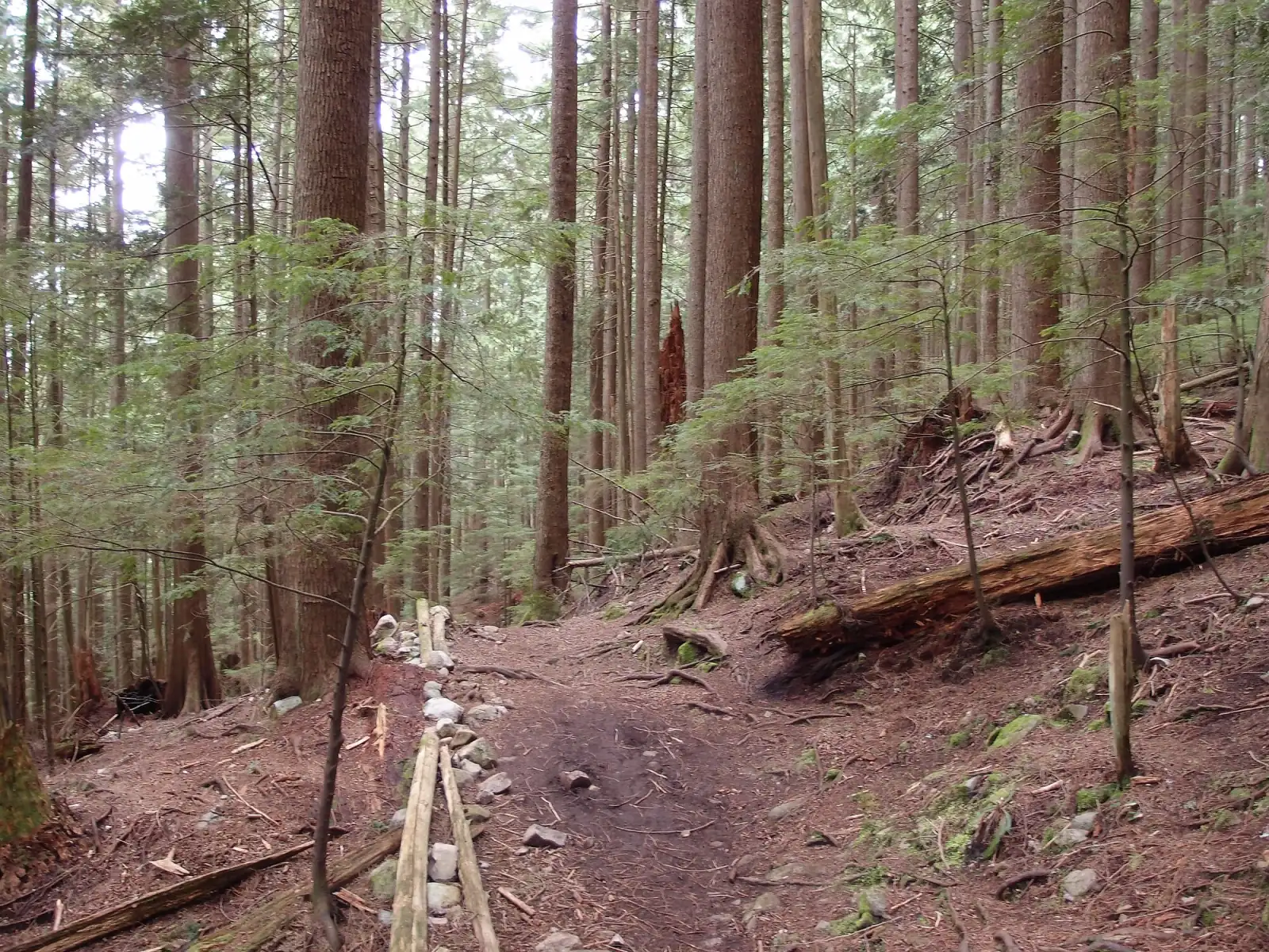
Photo: Guilhem Vellut, Wikimedia Commons, CC BY 2.0
Upper Lonsdale is split between two municipalities. The City of North Vancouver's map draws its north boundary close to 29th Street, and the streets above that line are in the District of North Vancouver. Some listings here name the District, some name only "North Vancouver", and most leave the line blank, so read the municipality on the property tax notice for each home.
What Upper Lonsdale is like
Upper Lonsdale begins where Lonsdale Avenue crosses the Upper Levels Highway (Highway 1) and continues uphill until the streets end at the forest. The avenue is the main road. Residential streets branch east and west from it: numbered streets in the lower blocks, then roads named Queens, Kings, Windsor, Carisbrooke and Braemar as you go up.
The District of North Vancouver treats its part of the hillside and Delbrook as one community. It describes that community as mainly residential and known for views of Vancouver, English Bay, the Lions Gate Bridge and the North Shore mountains. District Hall is here, on West Queens Road. In our experience, the streets are quiet once the evening commute ends, and most shopping and dining means a trip down the avenue to Central Lonsdale.
In our view, Upper Lonsdale suits a buyer who wants a detached house with a yard, a view or both, and who accepts a steep hill between home and the shops. The trails are close, and the SeaBus is a bus ride away. A buyer who wants to walk to a supermarket, a library and a hospital will find Central Lonsdale a better match.
Live from the MLS® system
Homes for sale in Upper Lonsdale
52 houses, townhouses and duplex homes are listed for sale in Upper Lonsdale today, checked against the MLS® system within the last hour. Condos and apartments are not shown on this page.


.jpg)
Prices
What a home in Upper Lonsdale costs
Two kinds of numbers, kept apart. The dots are asking prices of the homes listed in Upper Lonsdale today, counted on this page. The cards are Greater Vancouver REALTORS benchmark prices for all of North Vancouver, which describe a typical home sold anywhere in North Vancouver.
Asking prices today
Each dot is one home for sale. The dark line marks the middle price.
Detached house
$2,042,000
- One year
- down 6.2%
- Ten years
- up 18.7%
North Vancouver benchmark, Greater Vancouver REALTORS, September 2026
Townhouse
$1,230,400
- One year
- down 4.9%
- Ten years
- up 43.2%
North Vancouver benchmark, Greater Vancouver REALTORS, September 2026
All home types
$1,290,400
- One year
- down 3.9%
- Ten years
- up 16.9%
North Vancouver benchmark, Greater Vancouver REALTORS, September 2026
What the homes are like
Detached houses are most of what is for sale in Upper Lonsdale, and a few townhouses make up the rest. This page counts both and leaves out condo apartments. On October 9, 2026, streets with homes listed included 27th, 28th and 29th Streets, Kings Road, Queens Road, Prospect Road, Norwood Avenue, Chesterfield Avenue and Tempe Crescent.
The houses come from every decade. On that date the largest group had been finished before 1960, and smaller groups dated from the 1980s, the 2000s and the 2010s. A typical house on this page has four or five bedrooms. In our experience, a new house often stands beside one from the 1950s on the same street, and the age and condition of a house explain more of its price than anything else.
Many house listings state a suite. Some sellers describe the suite as legal or licensed. Others describe it as unauthorized, which means the municipality has no approval on file for it. The suite count on this page shows those two kinds separately. The land rises all the way from the highway to the forest, and many listing descriptions mention a view.
The townhouses are newer than most of the houses. A typical one dates from the 2000s and has three bedrooms. In our experience, a townhouse here is a strata home: you own the inside of your home, you share the roof, the outside walls and the grounds with the other owners, and each owner pays a monthly fee toward those shared parts.
When the homes were built
Year built of the 52 listings that state it.
- Before 196023
- 1960s4
- 1970s2
- 1980s7
- 1990s2
- 2000s6
- 2010s5
- 2020 and later3
Bedrooms
Bedrooms in the 52 listings that state it.
- 1 or 22
- 37
- 420
- 511
- 6 or more12
Suites: of the 21 houses for sale whose listing states it, 10 list a legal or licensed suite, 8 list a suite the municipality has not approved, and 2 list none. The rest leave the field blank.
The homes listed today have been on the market for 29 days at the middle, counted from each listing date to today. That is how long they have waited so far, which is a different number from how long homes take to sell.
Upper Lonsdale on the map
- Home for sale
- Public school
- Park
History
From streetcar suburb to family neighbourhood
The City of North Vancouver, which covers the lower blocks, names the Squamish and Tsleil-Waututh Nations as the peoples whose traditional territories it stands on. The avenue takes its name from the Lonsdale Estates Company of 1882, according to the North Shore Heritage Preservation Society. The society says the company's English backer, Arthur Pemberton Heywood-Lonsdale, never came to North Vancouver. A heritage conservation plan filed with the District in 2016 gives the local dates: the District was incorporated in 1891 and at first covered the whole North Shore, and the City was formed in 1907 from the settled area near the water.
The same plan says Upper Lonsdale, directly north of the line between the City and the District, grew as a suburb in the early 1910s as the Lonsdale Avenue streetcar reached it. The tracks reached Windsor Road in 1912. The Museum of North Vancouver (MONOVA) says the Lonsdale line was one of three that the British Columbia Electric Railway ran in North Vancouver from 1906 to 1947. Streetcar 153, now restored and kept by the museum, ran on the Lonsdale line from August 1912 to September 1946.
A MONOVA newsletter from March 2016 uses the older name, North Lonsdale, and says the area became a fashionable address in the early 1900s. Chesterfield School for Boys, founded in 1908 at 14th and Lonsdale, moved to 3371 Chesterfield Avenue and started classes there in 1913. Its Boy Scout troop helped the North Lonsdale Fire Brigade put out brush and tree fires. The school closed in 1942, and two years later its main house was turned into apartments.
Houses from those years still stand. Green Gables, at 114 West Windsor Road, was finished in 1915 for Robert Gibson, a printer at the News-Advertiser, to a design by the architect James C. Mackenzie. The conservation plan says a financial depression in 1913 had already ended that first period of fast growth. The homes for sale today reflect those early years: more of them date from before 1960 than from any later decade.
Daily life
Daily life in Upper Lonsdale
Few shops are mapped inside Upper Lonsdale. The nearest grocery store on the map is Persia Foods, on the way to Central Lonsdale, where Loblaws City Market and Whole Foods Market are also mapped. The City's map marks Westview Shopping Centre beside the highway at Westview Drive. The counts on this page show how many cafes, pharmacies and clinics are mapped within the area.
Two public recreation centres are a short drive away. Delbrook Community Recreation Centre, at 851 West Queens Road, has a 25 metre pool with six lanes, a leisure pool, a gymnasium, a fitness centre and courts for squash and racquetball, according to the North Vancouver Recreation and Culture Commission. The City's new Harry Jerome Community Recreation Centre is at 130 East 23rd Street, south of the highway. It opened on July 25, 2026. On October 10, 2026, the City's project page still gave no opening date for its pools.
The closest library on the map is the North Vancouver City Library in Central Lonsdale, and Lions Gate Hospital is in the same part of Lonsdale. The distance table on this page gives the straight line distance to the hospital, Lonsdale Quay, Park Royal and downtown Vancouver. District Hall, at 355 West Queens Road, is where owners in the District ask about property tax, permits and the records for a house.
Grocery stores
- Persia Foods1.1 km
- Kourosh Foods Market1.3 km
- Kin's Farm Market1.3 km
Cafes
- Starbucks220 m
- Nomad Espressor Bar & Bakery780 m
- Bubble Tea Bluemoon1.1 km
- Coco1.2 km
- Roastmastir's1.3 km
Libraries and rec centres
- Silver Harbour Senior's Activity Centre830 m
- Harry Jerome Community Recreation Centre900 m
- Memoria Community Center900 m
- Silver Harbour Senior Centre940 m
- Confederation Field1.3 km
How far it is
- Downtown Vancouver (Waterfront Station)6.4 km
- Lonsdale Quay and the SeaBus3.2 km
- Lions Gate Hospital1.9 km
- Park Royal shopping centre4.8 km
Places from OpenStreetMap, read October 9, 2026. Distances are in a straight line from the middle of the area, so the trip by road is longer.
Outdoors
Parks, creeks and mountain trails
Carisbrooke Park is the neighbourhood park in the middle of the area, on the 3400 block of Lonsdale Avenue. A photograph from 1916, reproduced in the 2016 conservation plan, was taken from the park looking south over Upper Lonsdale. Princess Park, to the east, is a forest park that the District opens from 6 a.m. to 10 p.m. St. Albans Park is a second forest park, entered from the end of the street that shares its name. In the City blocks, Tempe Heights Park has a playground.
Mosquito Creek runs down the west side. The District's trail data marks the Mosquito Creek trail and the North Lonsdale and Delbrook trail as beginner routes for walkers and cyclists. Higher up, it rates the Baden-Powell Trail and the St. Marys Trail as intermediate, and it lists the St. Georges trail for hiking. Metro Vancouver describes the Baden-Powell as a 50 km trail across the North Shore from West Vancouver to Deep Cove. The District warns that many of its forest trails have no cell phone signal, so tell someone your route before you leave.
The 232 bus runs to Grouse Mountain. Metro Vancouver's regional park there holds the Grouse Grind, a 2.5 km climb that gains 800 metres, and dogs are banned on it. The Grind closes for yearly maintenance in the fall, from October 13 to November 10 in 2026. Closer to home, the City is planning the Upper Levels Greenway, a walking and cycling route north of the highway from Lynn Valley Road to Westview Drive. The City's project page puts its length at 3 km.
Schools
Schools in and near Upper Lonsdale
Upper Lonsdale is in the North Vancouver School District. Carisbrooke Elementary on East Carisbrooke Road, Braemar Elementary on Mahon Avenue and Larson Elementary on Larson Road are the neighbourhood public elementary schools closest to the middle of the area. The province's school data lists early and late French immersion at Braemar and early French immersion at Larson.
The district's list of feeder schools shows the high school each elementary school leads to, and it places all three with Carson Graham Secondary. For French immersion, the same list sends Larson students on to Argyle Secondary and names Handsworth and Windsor for Braemar students. The BC government held the grand opening of a new Carson Graham building on October 12, 2012, with room for 1,100 students.
École André-Piolat on West Kings Road is a public French-language school with elementary and secondary grades, run by the province's francophone school board. Holy Trinity School on West 27th Street is an independent elementary school. Two entries in the table at 3365 Mahon Avenue are district-wide programs: continuing education and online learning.
Each public school has a catchment, the area whose children it must take. The catchment school for a home can be a different school from the nearest one, so look up the address in the district's school locator before you make an offer.
| School | Type | French programs | Distance |
|---|---|---|---|
Continuing Ed SD 44 3365 Mahon Ave, North Vancouver, BC | Public, elementary | None listed | 700 m |
Braemar Elementary 3600 Mahon Ave, North Vancouver, BC | Public, elementary | Early immersion, Late immersion | 800 m |
Carisbrooke Elementary 510 Carisbrooke Rd E, North Vancouver, BC | Public, elementary | None listed | 860 m |
Larson Elementary 2605 Larson Rd, North Vancouver, BC | Public, elementary | Early immersion | 1.0 km |
Andre-Piolat 380 Kings Rd W, North Vancouver, BC | Public, elementary-secondary | Francophone | 410 m |
North Vancouver Online Learning 3365 Mahon Ave, North Vancouver, BC | Public, secondary | Early immersion | 700 m |
Holy Trinity School 128 27th St W, North Vancouver, BC | Independent, elementary | None listed | 350 m |
Vancouver Waldorf School 2725 St. Christophers Rd, North Vancouver, BC | Independent, elementary-secondary | None listed | 1.9 km |
Cousteau L'ecole Francaise Interna'le 3657 Fromme Rd, North Vancouver, BC | Independent, elementary jr. secondary | Early immersion | 2.1 km |
St. Edmund's 535 Mahon Ave, North Vancouver, BC | Independent, elementary | None listed | 2.2 km |
Your address decides your assigned school, which can differ from the closest one. Check any address with the North Vancouver School District school locator. School list from the BC Ministry of Education, updated October 8, 2026.
Getting around
Getting around
Buses are the public transit in Upper Lonsdale. The 229 and 230 follow Lonsdale Avenue down through Central Lonsdale to Lower Lonsdale, where the SeaBus leaves from Lonsdale Quay. The 232 runs between Grouse Mountain and Phibbs Exchange, and the 241 links Upper Lonsdale with downtown Vancouver. The N24 is the night bus. The table on this page counts the weekday trips on each route from TransLink's schedule.
TransLink says the SeaBus takes 12 minutes to cross to downtown Vancouver and leaves every 15 minutes during the day. In our experience, residents who work downtown choose between the 241, a Lonsdale bus to the SeaBus, and the car, and the fastest choice depends on the time of day.
Drivers join Highway 1 at Lonsdale Avenue. The highway leads east to the Second Narrows (Ironworkers Memorial) Bridge and west toward the Lions Gate Bridge and West Vancouver, and both bridges are slow at rush hour. In our experience, the climb from the highway to the top streets is steep enough that few people cycle home from Lonsdale Quay without an electric bike.
Routes that stop in Upper Lonsdale
Trips on a regular weekday that stop at one of the 35 stops inside the area, from TransLink's published schedule valid to January 3, 2027.
- 229Lonsdale Ave98 trips
- 230Lonsdale Ave91 trips
- 232Grouse Mountain/Phibbs Exchange69 trips
- 241Upper Lonsdale/Downtown30 trips
- N24Downtown/Lynn Valley8 trips
Before you buy
Things to check in Upper Lonsdale
City or District
The City's map puts its north boundary close to 29th Street. A home below that line pays City property tax and follows City rules, and a home above it deals with the District. Most listings here leave the municipality blank. Read it on the property tax notice before you compare two homes.
Slopes and creek ravines
The District calls a slope steep when it is steeper than 20 degrees and more than 10 metres high, and a lot within 20 metres of the top or bottom of one is in its Slope Hazard area. Its map shows Slope Hazard and Creek Hazard areas on parts of the top streets, and a Creek Hazard area near Queens Road. In the City's northwest corner, a storm in October 2024 eroded the banks of Thain Creek, and the City repaired them in 2025. Look up the address on GeoWeb, the District's online property map, or ask City engineering staff.
The forest edge and wildfire
The District's map places the streets nearest the forest in its Wildfire Hazard area, including the streets above the top of Lonsdale Avenue. A new house there needs a wildfire report, signed by a registered forest professional, before the District accepts the permit application. Phone your insurer with the address before you make an offer, and ask what the policy says about trees close to the house.
Snow on the hill
The District's snow plan aims to make main roads and bus routes passable within 12 hours after the snow stops, streets that lead to schools within 48 hours and local streets within 96 hours. Owners must clear the sidewalk beside their property by 10 a.m. In our experience, the top streets get snow on days when Lonsdale Quay gets rain, so look at the slope of the driveway.
Houses from before 1960
More of the houses for sale here were finished before 1960 than in any later decade. Book a full inspection, and ask about the age of the roof, the wiring, the drain pipes around the foundation and any buried oil tank. If a house is on the District's heritage register, the District can delay some permits while it inspects the house. The register is its list of recognized older properties.
Two sets of suite rules
The District has allowed a suite inside most detached houses since 1997. It limits a suite to 130 square metres or 49% of the main house, whichever is less, and every suite must be registered, which adds a yearly water and sewer charge. The City has allowed suites since 1993 on the condition that the owner lives on the property, and it adopted new rules for some lots on December 8, 2025. Ask the municipality the home is in what its file shows for the address.
Buying
Buying a home in Upper Lonsdale
Start by finding out which municipality the home is in. The answer decides the tax bill, the suite rules and which office holds the records for the house. Then compare houses of a similar age, because buyers pay for different things in a house from the 1950s and a house from the 2010s. The price dots on this page show today's asking prices for houses and for townhouses.
A buyer who needs the rent from a suite to qualify for a mortgage should first learn which kind of suite it is. In our experience, lenders and insurers treat an approved suite and an unapproved one differently, so ask the City or the District for the answer in writing.
For a townhouse, ask for the Form B, the strata's information certificate. The BC government says the strata must supply it within 7 days of a request and may charge up to $35 plus 25 cents a page. It states the monthly fee, any extra charge the owners have already approved and the balance of the repair savings. A strata of five or more homes must also renew a depreciation report every five years, which plans repairs to the shared parts 30 years ahead. A strata of four or fewer homes is exempt.
In our experience, the houses that attract the most buyers here have a view, a level yard and a street away from the highway. Gary Paul works with buyers in every part of North Vancouver. Send the form on this page with your budget and the streets you like, and he will reply with matching listings and times to view them.
Selling
Selling a home in Upper Lonsdale
Buyers who come to see your home will also see the other Upper Lonsdale homes of its type. In our experience, many of them also tour Central Lonsdale, Delbrook and Princess Park on the same weekend. The cards on this page show what is listed in Upper Lonsdale today and at what asking prices.
In our experience, four things set the price of a house here: its age and condition, the view, the lot, and whether the suite is approved. Before you list, collect the permit records for the suite and for any work on the house from the municipality your home is in. If the lot is in one of the District's hazard areas, have the map and any engineer's report ready, because a careful buyer will look the address up.
Real estate board rules keep sold prices off public pages like this one. Gary Paul can review recent Upper Lonsdale sales with you in private and suggest a price. Ask for a price review with the form on this page.
Houses listed
46
$1.43M to $6.00M
Townhouses listed
6
$658K to $1.79M
Our view
Who buys in Upper Lonsdale
In our experience, the most common buyer is a family with children that has outgrown a condo or a townhouse lower on Lonsdale and wants a yard, a neighbourhood school and trails nearby. A second group is two generations buying together. They choose a house with a suite so that parents or adult children have their own entrance.
A third group buys an older house on a good lot and plans to update it over several years. People who hike or ride on the mountain most weekends also choose the upper streets, in our experience, for the short trip to the trails.
Upper Lonsdale and the areas next to it
Homes listed for sale today, counted on this page.
| Area | For sale | Middle asking price | Houses, middle price |
|---|---|---|---|
| Upper Lonsdale | 52 | $2.20M | $2.22M |
| Central Lonsdale | 52 | $1.80M | $2.58M |
| Princess Park | 6 | $2.05M | $2.34M |
| Delbrook | 15 | $2.45M | $2.45M |
| Braemar | 3 | $2.95M | $2.95M |
| Boulevard | 8 | $3.33M | $3.33M |
Questions about Upper Lonsdale
Is Upper Lonsdale in the City or the District of North Vancouver?
Both. The City of North Vancouver's map draws its north boundary close to 29th Street, so the blocks between the Upper Levels Highway and that line are in the City. The streets above it are in the District of North Vancouver. Confirm the municipality on the property tax notice for any home.
What kind of homes are for sale in Upper Lonsdale?
Most homes for sale in Upper Lonsdale are detached houses, and a few are townhouses. More of the houses date from before 1960 than from any later decade, and newer houses stand among them. Many house listings state a suite. This page leaves out condo apartments.
How much does a house in Upper Lonsdale cost?
The price dots on this page mark the asking price of each house listed in Upper Lonsdale today and show the middle price. The page also shows the monthly benchmark price that Greater Vancouver REALTORS publishes for a detached house across North Vancouver, with the month it covers.
Which schools serve Upper Lonsdale?
Upper Lonsdale is in the North Vancouver School District. Carisbrooke, Braemar and Larson are the closest neighbourhood public elementary schools, and the district's list of feeder schools places all three with Carson Graham Secondary. Check the catchment school for any address with the district's school locator.
Is there French immersion near Upper Lonsdale?
Yes. The province's school data lists early and late French immersion at Braemar Elementary and early French immersion at Larson Elementary. École André-Piolat on West Kings Road is a separate public French-language school run by the province's francophone school board. Ask each school which addresses and families it accepts.
How do I get from Upper Lonsdale to downtown Vancouver?
The 241 bus links Upper Lonsdale with downtown Vancouver. The 229 and 230 run down Lonsdale Avenue to Lower Lonsdale, where the SeaBus crosses to downtown in 12 minutes, according to TransLink. Drivers join Highway 1 at Lonsdale Avenue and use the Second Narrows Bridge or the Lions Gate Bridge.
Is Upper Lonsdale good for families?
In our view, yes, for a family that wants a house and a yard. Three public elementary schools, Carisbrooke Park, forest parks and two recreation centres are in or close to the area. Shops are few, the hill is steep, and many errands need a car or a bus.
Can a house in Upper Lonsdale have a rental suite?
Usually, and the rules depend on the municipality. The District of North Vancouver has allowed a suite in most detached houses since 1997 and requires every suite to be registered. The City has allowed suites since 1993 when the owner lives on the property. Ask which rules cover the address.
Are there landslide, flood or wildfire risks in Upper Lonsdale?
The risk depends on the lot. The District of North Vancouver's map shows Slope Hazard, Creek Hazard and Wildfire Hazard areas on the streets nearest the forest, and these areas affect future work on a property. Check any District address on the GeoWeb viewer, and ask the City about lots near a creek in the lower blocks.
Does Upper Lonsdale get more snow than the rest of North Vancouver?
In our experience, the top streets get snow on some days when the waterfront gets rain, because they are higher. The District of North Vancouver aims to make main roads and bus routes passable within 12 hours after snow stops and local streets within 96 hours.
Did a streetcar run to Upper Lonsdale?
Yes. A heritage conservation plan filed with the District of North Vancouver says the Lonsdale Avenue streetcar reached Windsor Road in 1912. The Museum of North Vancouver says the British Columbia Electric Railway ran three streetcar lines in North Vancouver from 1906 to 1947, and that Streetcar 153 ran on the Lonsdale line until September 1946.
Is North Lonsdale the same place as Upper Lonsdale?
The two names cover the same hillside. A Museum of North Vancouver newsletter from 2016 calls the area North Lonsdale when it describes the early 1900s, and a 2016 heritage plan filed with the District uses both names for the streets near Windsor Road. Listings today use Upper Lonsdale.
What was Chesterfield School in North Vancouver?
Chesterfield School for Boys was a private school founded in 1908 at 14th and Lonsdale. A Museum of North Vancouver newsletter says it moved to 3371 Chesterfield Avenue in Upper Lonsdale, started classes there in 1913 and closed in 1942. Its main house became apartments two years later.
Which hiking trails are close to Upper Lonsdale?
The District of North Vancouver's trail data lists the Mosquito Creek trail as a beginner route and the Baden-Powell Trail and St. Marys Trail as intermediate. The 232 bus runs to Grouse Mountain, where Metro Vancouver's regional park holds the Grouse Grind, a 2.5 km climb that gains 800 metres.
Where are the nearest pool and recreation centre?
Delbrook Community Recreation Centre at 851 West Queens Road has a 25 metre pool, a leisure pool, a gymnasium and a fitness centre. The City's new Harry Jerome Community Recreation Centre at 130 East 23rd Street opened on July 25, 2026, and its pools had no opening date on the City's page on October 10, 2026.
How do I find out what my Upper Lonsdale home is worth?
Ask for a price review with the form on this page. Gary Paul will compare your home with recent sales of similar homes nearby, consider its age, view, lot and suite, and explain the price he would suggest. Sold prices are shared with you in private under real estate board rules.
Who should I talk to about buying or selling in Upper Lonsdale?
Gary Paul, REALTOR®, Personal Real Estate Corporation, of Grand Central Realty, is the MultiLiving agent for North Vancouver. Phone him at 778-828-7476 or send the form on this page, and say which streets and home types interest you.
Sources
Written content checked October 10, 2026. Listing numbers counted from the MLS® system on October 10, 2026.
- City of North Vancouver map (City boundary, Westview and Tempe neighbourhoods), City of North Vancouver. Read October 10, 2026.
- Delbrook / Upper Lonsdale, District of North Vancouver. Read October 10, 2026.
- Public hearing binder for 114 West Windsor Road (Green Gables), with the conservation plan of August 2016, District of North Vancouver. Read October 10, 2026.
- Express newsletter, March 2016 (Chesterfield School and North Lonsdale), MONOVA: Museum and Archives of North Vancouver. Read October 10, 2026.
- The Story of Streetcar 153, MONOVA: Museum and Archives of North Vancouver. Read October 10, 2026.
- Street names in North Vancouver, North Shore Heritage Preservation Society. Read October 10, 2026.
- Slope Hazard Development Permit Area: frequently asked questions (2024), District of North Vancouver. Read October 10, 2026.
- Creek Hazard Development Permit Area: frequently asked questions (2024), District of North Vancouver. Read October 10, 2026.
- Wildfire Hazard Report requirements, District of North Vancouver. Read October 10, 2026.
- GeoWeb property viewer (hazard areas by address), District of North Vancouver. Read October 10, 2026.
- GeoWeb open data (parks, public trails and hazard areas), District of North Vancouver. Read October 10, 2026.
- Thain Creek Restoration, City of North Vancouver. Read October 10, 2026.
- Build or register a secondary suite, District of North Vancouver. Read October 10, 2026.
- Secondary Suites, City of North Vancouver. Read October 10, 2026.
- Preparing for and removing snow, District of North Vancouver. Read October 10, 2026.
- Community heritage register, District of North Vancouver. Read October 10, 2026.
- Hiking and cycling trails in parks, District of North Vancouver. Read October 10, 2026.
- Parks in the City (Tempe Heights Park), City of North Vancouver. Read October 10, 2026.
- Upper Levels Greenway, City of North Vancouver. Read October 10, 2026.
- Grouse Mountain Regional Park, Metro Vancouver. Read October 10, 2026.
- Families of Schools (feeder schools), North Vancouver School District. Read October 10, 2026.
- Grand opening of new Carson Graham Secondary school (news release, October 12, 2012), Government of British Columbia. Read October 10, 2026.
- Delbrook Community Recreation Centre, North Vancouver Recreation and Culture Commission. Read October 10, 2026.
- Harry Jerome Community Recreation Centre (project page), City of North Vancouver. Read October 10, 2026.
- SeaBus schedules, TransLink. Read October 10, 2026.
- Form B: Information Certificate, Government of British Columbia. Read October 10, 2026.
- Strata depreciation report requirements, Government of British Columbia. Read October 10, 2026.
- MLS® Home Price Index, September 2026 stats package, Greater Vancouver REALTORS. Read October 9, 2026.
- K-12 school locations (school names, addresses and programs), BC Ministry of Education and Child Care, through the BC Data Catalogue. Read October 9, 2026.
- Places, parks and shops, OpenStreetMap contributors (Open Database License). Read October 9, 2026.
- Bus, SeaBus and train schedules (GTFS feed 26SEP_20261009), TransLink. Read October 9, 2026.
General information only. Prices, benchmarks and school details change. Confirm anything you plan to rely on with the source, a licensed REALTOR® and, for money questions, a mortgage broker or lawyer.