North Vancouver neighbourhood guide
Windsor Park, North Vancouver: Homes for Sale, Prices, Schools and Daily Life
Windsor Park is a small residential neighbourhood in the District of North Vancouver, on the south side of Mount Seymour Parkway around Windsor Secondary and the Ron Andrews Community Recreation Centre. On October 11, 2026, 60% of the few homes listed here were new townhouses and 40% were detached houses, typically from the early 1960s. It suits a family that wants a high school, a pool and a bus to Phibbs Exchange within a short walk, and that will drive for groceries.
For sale now
5
houses, townhouses, duplexes
Asking prices
$1.35M to $2.40M
Middle asking price
$1.47M
North Vancouver detached benchmark
$2.04M
September 2026, GVR
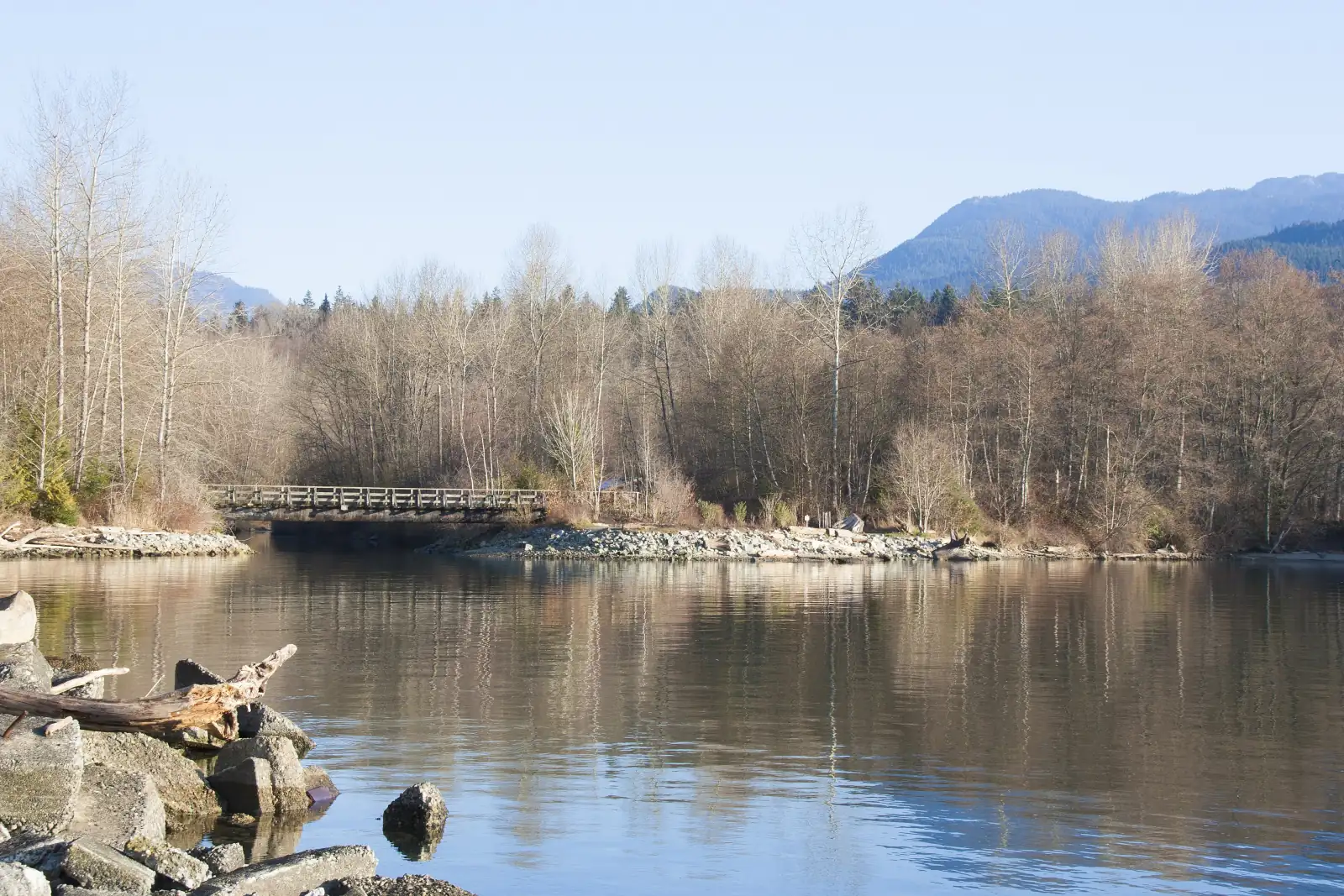
Photo: Bosancich123, Wikimedia Commons, CC BY-SA 4.0
Windsor Park is in the District of North Vancouver. The District names it among the neighbourhoods of its Seymour community, and its boundary data returned the District for all seven points we tested. Every listing here left the municipality line blank on October 11, 2026, so confirm it on the property tax notice.
What Windsor Park is like
Windsor Park covers a slope that faces south toward Burrard Inlet. Mount Seymour Parkway runs along the top, the forest of Windridge Park is on the west side, and reserve land of the Tsleil-Waututh Nation is on the east side. Plymouth Drive is the main street. It leaves the parkway at the east end, turns south past Tollcross Road and Fairfield Road, and goes downhill to Ellis Street, which continues to Dollarton Highway.
Three short streets lead south from the parkway: Lytton Street to the recreation centre, Broadview Drive to Windsor Secondary and Tollcross Road to Lions Gate Christian Academy.
Natural Resources Canada's elevation data gives 91 metres above sea level where Plymouth Drive meets the parkway, 71 metres at Tollcross Road and 34 metres at Ellis Street. Ellis Street meets Dollarton Highway at 12 metres. The District's street data puts 1.3 kilometres of road between the top and the bottom.
Several street names come from the south coast of England: Plymouth, Bournemouth, Brixham and Exmouth are towns there, and the Eddystone rocks lie off Plymouth. In our view, Windsor Park suits a family with children in or near high school, because the school, the pool and two bus routes are inside the area. Shops and restaurants are a drive or a bus trip away.
Live from the MLS® system
Homes for sale in Windsor Park
5 houses, townhouses and duplex homes are listed for sale in Windsor Park today, checked against the MLS® system within the last hour. Condos and apartments are not shown on this page.


Prices
What a home in Windsor Park costs
Two kinds of numbers, kept apart. The dots are asking prices of the homes listed in Windsor Park today, counted on this page. The cards are Greater Vancouver REALTORS benchmark prices for all of North Vancouver, which describe a typical home sold anywhere in North Vancouver.
Asking prices today
Each dot is one home for sale. The dark line marks the middle price.
Detached house
$2,042,000
- One year
- down 6.2%
- Ten years
- up 18.7%
North Vancouver benchmark, Greater Vancouver REALTORS, September 2026
Townhouse
$1,230,400
- One year
- down 4.9%
- Ten years
- up 43.2%
North Vancouver benchmark, Greater Vancouver REALTORS, September 2026
All home types
$1,290,400
- One year
- down 3.9%
- Ten years
- up 16.9%
North Vancouver benchmark, Greater Vancouver REALTORS, September 2026
What the homes are like
Few homes were for sale in Windsor Park on October 11, 2026. This is a small residential area, and the pages for Blueridge, Seymour and Northlands next door show more homes. With so few listings, one new home changes every share in this section. That day, 60% of the homes this page listed were townhouses and 40% were detached houses. Condos were also for sale here, and this page leaves them out. The streets with homes listed were Lytton Street and Plymouth Drive.
The houses were the older group. The typical house listed that day was finished in the early 1960s and had five bedrooms and more than 2,500 square feet of floor space. No house listing filled in the suite line, so ask the seller whether a lower floor with its own kitchen is registered with the District as a suite. Across all the homes, 20% of listings said the home had a view.
The townhouses were new. The typical one gave 2026 as its year of completion and had four bedrooms and more than 1,500 square feet. Every home listed here from the 2020s was a townhouse. The District's 2023 report places the Seymour Estates project on Lytton Street, one of the two streets with listings.
You buy a townhouse as a strata lot. The unit is yours, the land, roofs and lanes belong to all the owners together, and each owner pays a monthly fee toward their upkeep. The card on new townhouses below lists what to ask for.
When the homes were built
Year built of the 5 listings that state it.
- Before 19601
- 1960s1
- 2020 and later3
Bedrooms
Bedrooms in the 5 listings that state it.
- 31
- 43
- 6 or more1
The homes listed today have been on the market for 13 days at the middle, counted from each listing date to today. That is how long they have waited so far, which is a different number from how long homes take to sell.
Windsor Park on the map
- Home for sale
- Public school
- Park
History
How Windsor Park began
The oldest recorded name here belongs to McCartney Creek, which runs south through the area between Broadview Drive and Tollcross Road. The BC Geographical Names Office says the name was adopted on February 6, 1948. It honours Alan Edward McCartney, a Vancouver civil engineer, architect and land surveyor who lived from 1852 to 1901. He marked the stream as "Alan Creek" on a map of the municipality that he drew in 1899.
Dollarton Highway runs along the bottom of the hill. The timeline in the District's 1997 inventory of buildings from 1930 to 1965 says work on it began in 1931, paid for as a relief measure after a committee on unemployment recommended the road, and that it opened the next year. The highway crosses Tsleil-Waututh reserve land, and the District's page on the Spirit Trail states that it was built without payment to the Nation.
The houses came after the bridge. The same timeline records that the new Second Narrows Bridge opened in August 1960 and led to new suburbs in the eastern part of the District. The houses for sale in Windsor Park on October 11, 2026 match that period: half were finished before 1960 and half in the 1960s. No source we read says who chose the name Windsor Park.
Later changes came to the school and to Lytton Street. The school district started a hockey academy at Windsor Secondary in 2004, a soccer academy in 2012 and a dance academy in 2014. On Lytton Street, a District report dated April 25, 2023 lists a project named Seymour Estates at numbers 900 to 944 among the sites that council approved for new housing between November 2018 and November 2022. The report counts 341 homes there: 252 to be sold, 56 to be rented at market rates and 33 social housing rentals.
Daily life
Daily life in Windsor Park
The Ron Andrews Community Recreation Centre is at 931 Lytton Street. North Vancouver Recreation and Culture, which runs it, lists a 37.5 metre pool with six lanes, a squash court, a fitness studio and two rooms for rent, the larger one named the Windsor Room. The building opens at 5 a.m. from Monday to Friday. On Friday evenings it is closed to the public from 8 to 10 for a youth night.
Windsor Secondary fills the middle of the area. On OpenStreetMap its grounds hold an artificial turf field with lights, a running track and four tennis courts. The District says the turf was first laid in 2011, that work to replace it began in the summer of 2025, and that the new field has lines for soccer, football, rugby and field hockey.
Windsor Park has no shopping street. The map on this page shows no supermarket, pharmacy or clinic inside the area, and one cafe, across the parkway. The nearest supermarket on the map is Stong's Market on Dollarton Highway in Maplewood, 1.6 kilometres west of Ellis Street by the District's street data. The nearest library branch is at Parkgate, to the east.
Grocery stores
Nearest: Stong's Market, 1.7 km away.
Cafes
- United Strangers220 m
Libraries and rec centres
- Windsor Bubble280 m
- Ron Andrews Community Recreation Centre290 m
- Tsleil-Waututh Community Centre840 m
How far it is
- Downtown Vancouver (Waterfront Station)8.9 km
- Lonsdale Quay and the SeaBus6.3 km
- Lions Gate Hospital5.2 km
- Park Royal shopping centre10.3 km
Places from OpenStreetMap, read October 10, 2026. Distances are in a straight line from the middle of the area, so the trip by road is longer.
Outdoors
Windridge Park, McCartney Creek and the shore
Windridge Park is the forest on the west side, beside the recreation centre. The District's park data lists it at 931 Lytton Street as a forested neighbourhood park for quiet use, and dogs must be on a leash there. Blueridge Creek runs through it toward the inlet. OpenStreetMap shows gravel paths and small bridges under the trees.
McCartney Creek runs through a strip of forest between the school grounds and the houses on Plymouth Drive. OpenStreetMap maps footpaths south of the school fields and a wooden footbridge there. McCartney Creek Park, a sports park in the District's data, is north of the parkway.
The Spirit Trail, the North Shore's long walking and cycling route, now reaches the west side of the area. The District reports that the section from the Seymour River to Windridge Park is complete. The next section is planned from Windridge Park to Roche Point Drive. Its route is undecided, the District says, and its largest cost is a crossing of McCartney Creek. On September 15, 2025, council moved the date for finishing the trail to 2029.
The shore is across Dollarton Highway. The District's park data lists the Maplewood conservation area on the south side of the highway, and the District says the Wild Bird Trust of BC, a non-profit society, manages it and that visitors can see large clam beds and many kinds of birds. The photo at the top of this page was taken there.
Schools
Schools in and near Windsor Park
Windsor Park is in the North Vancouver School District, and Windsor Secondary, at 931 Broadview Drive, is inside the area. The district's list of feeder schools groups three elementary schools with it: Seymour Heights, Blueridge and Lynnmour. Seymour Heights, on Carnation Street, is the nearest of the three on the map. It is north of the parkway, so a child from Windsor Park crosses that road on the way to class.
Windsor Secondary also teaches French immersion. The district's feeder list sends immersion students there from four elementary schools: Dorothy Lynas, Sherwood Park, Boundary and Braemar. The province's school data shows no immersion program at the three elementary schools nearest Windsor Park. The nearest early immersion school on the map is Dorothy Lynas, on Inlet Crescent.
Three of the district's sports academies are based at Windsor Secondary: hockey skills, soccer with the North Shore Girls' Soccer Club, and dance with Seymour Dance. The district says all three take students in Grades 8 to 12 from across the district, give the physical education credit for the grade and charge a yearly fee.
Lions Gate Christian Academy, an independent school, is on Tollcross Road inside the area. The school table on this page gives the distance to each school. Buyers of a new townhouse should read the registration rules on Windsor Secondary's website. Your current address decides your catchment school, and a pre-sale agreement is not accepted as proof of address. A purchase agreement is accepted once its conditions have been removed.
| School | Type | French programs | Distance |
|---|---|---|---|
Seymour Heights Elementary 2640 Carnation St, North Vancouver, BC | Public, elementary | None listed | 560 m |
Blueridge Elementary 2650 Bronte Dr, North Vancouver, BC | Public, elementary | None listed | 1.1 km |
Lynnmour Elementary School 800 Forsman Ave, North Vancouver, BC | Public, elementary | None listed | 2.4 km |
Dorothy Lynas Elementary 4000 Inlet Cres, North Vancouver, BC | Public, elementary | Early immersion | 2.7 km |
Windsor Secondary 931 Broadview Dr, North Vancouver, BC | Public, secondary | Early immersion | 180 m |
Seycove Secondary Community 1204 Caledonia Ave, North Vancouver, BC | Public, secondary | None listed | 3.3 km |
Lions Gate Christian Academy 919 Tollcross Rd, North Vancouver, BC | Independent, elementary-secondary | None listed | 250 m |
Kenneth Gordon 420 Seymour River Pl, North Vancouver, BC | Independent, elementary-secondary | None listed | 1.5 km |
St. Pius X Elementary School 1150 Mt. Seymour Road, North Vancouver, BC | Independent, elementary | None listed | 2.1 km |
North Star Montessori Elementary School 1325 Keith Rd E, North Vancouver, BC | Independent, elementary | None listed | 2.9 km |
Your address decides your assigned school, which can differ from the closest one. Check any address with the North Vancouver School District school locator. School list from the BC Ministry of Education, updated October 8, 2026.
Getting around
Getting around
Mount Seymour Parkway has four lanes in the District's street data. From Broadview Drive, that data gives 2.4 kilometres west along the parkway to Lillooet Road, beside the Highway 1 ramps for the Ironworkers Memorial Second Narrows Crossing, and 2.0 kilometres east to Mount Seymour Road at Parkgate. A second way out is at the bottom of the hill, where Ellis Street meets Dollarton Highway. In our experience, the queue for the bridge sets the length of an afternoon drive to Vancouver or Burnaby.
Three bus routes serve the area, and the table on this page counts the weekday trips on each. The 211 runs along the parkway. TransLink's schedule for September 7, 2026 to January 3, 2027 gives 38 to 45 minutes from the stop at Broadview Drive to Burrard Station for weekday buses that leave between 7 and 9 a.m. Buses that leave Burrard Station between 4 and 6 p.m. take 46 to 51 minutes to the stop at Tollcross Road. The last weekday 211 that continues downtown passes Broadview Drive at 6:01 p.m. Later buses end at Phibbs Exchange, 7 to 13 minutes away.
The 215 runs through the middle of Windsor Park on Plymouth Drive and Ellis Street. From the stop at Tollcross Road, weekday buses leave from 6:33 a.m. to 11:07 p.m. and reach Phibbs Exchange in 7 to 9 minutes. In the other direction, the 215 takes 3 to 4 minutes from Plymouth Drive at Fairfield Road to the stop at Parkgate Avenue. The 214 stops on Emerson Way, on the north side of the parkway, and five morning buses from 6:58 to 8:43 a.m. continue to Burrard Station in 39 to 41 minutes. Plymouth Drive climbs 57 metres between Ellis Street and the parkway.
Routes that stop in Windsor Park
Trips on a regular weekday that stop at one of the 19 stops inside the area, from TransLink's published schedule valid to January 3, 2027.
- 211Seymour/Phibbs Exchange/Burrard Station89 trips
- 215Indian River/Phibbs Exchange88 trips
- 214Blueridge/Phibbs Exchange/Burrard Station75 trips
Before you buy
Things to check in Windsor Park
Two creeks
Blueridge Creek runs down the west side of Windsor Park and McCartney Creek runs through the middle, in the District's creek data. On October 11, 2026, Creek Hazard areas that the District labels a potential flood hazard lay within 40 metres of Lytton Street south of the parkway and of Ellis Street. A lawful house inside such an area may stay as it is. Any building work, including work indoors, goes to the District's environment staff first.
Wildfire areas
We tested 13 Windsor Park streets against the District's map data. Wildfire Hazard areas lay within 40 metres of 12 of them, and Exmouth Road was the exception. The data labels 32 of the 33 areas in and around Windsor Park as Wildfire Interface Area. Give an insurer the address and ask for a quote before your offer becomes firm.
The slope above Dollarton Highway
The ground drops 22 metres along Ellis Street between Plymouth Drive and Dollarton Highway. Slope Hazard areas lay within 40 metres of Ellis Street and Bournemouth Crescent on the same date, and of none of the other 11 streets tested. For a home on the lower crescents, search the address on GeoWeb, the District's online property map.
New townhouses
The company that builds a strata writes its first budget. BC's Strata Property Act calls this the interim budget and requires the company to give you a copy before you sign a contract to buy. If the strata's real costs before the owners pass their first yearly budget are higher than that estimate, the company must pay the difference within 8 weeks after the first annual general meeting. Ask whether that meeting has been held and how the monthly fee changed afterward.
Reserve land next door
The District's map data shows reserve land, labelled IR3, within 25 metres of Exmouth Road and of the short branch of Plymouth Drive numbered 704 to 724, and within 100 metres of Fairfield Road, Hartford Place and Eddystone Crescent. The same data marks each of those streets as a District street. Each listing states freehold title, which includes the land, or leasehold title, which is the right to use a home for a set number of years. Ask your lawyer or notary to confirm it.
Snow on the hill
The District clears snow in three steps. Bus routes come first, with a target of 12 hours after the snow stops, and its map data puts Plymouth Drive and most of Ellis Street in that group. Streets that lead to schools come second, with a target of 48 hours: Tollcross Road and parts of Lytton Street and Broadview Drive. The crescents and dead-end streets are third, at 96 hours.
Buying
Buying a home in Windsor Park
The first choice here is between two kinds of home. On October 11, 2026, the typical house for sale was more than 60 years older than the typical townhouse and had one more bedroom and more than 1,000 extra square feet of floor space. The price dots on this page show today's asking prices for each type.
For a house, book a full inspection and ask for the permits behind any addition or lower-floor kitchen. Search the address on GeoWeb for the creek, wildfire and slope areas described on this page. For a new townhouse, read the interim budget with your lawyer or notary, and ask the school district which proof of address it will accept.
Gary Paul works with buyers across North Vancouver. Send the form on this page with your budget, the bedrooms you need and whether you prefer a house or a townhouse. He will reply with the Windsor Park homes that fit and with similar homes in the areas next door.
Selling
Selling a home in Windsor Park
A house for sale in Windsor Park competes with few other homes inside the area, because few are listed here at once. In our experience, the buyer who comes to see it has also toured houses in Blueridge and Northlands and has looked at new townhouses. The cards on this page show how many homes are listed today and the range of their asking prices.
In our view, four things decide the price of a house here: the condition of the kitchen, bathrooms and roof, whether a suite is registered with the District, the view, and how close the house is to the parkway. Before you list, gather the permits for past work and print the GeoWeb map for your address, because a buyer's agent will check the creek, wildfire and slope areas.
Sold prices are kept off public pages such as this one by real estate board rules. Gary Paul can go through recent Windsor Park sales with you in private and recommend a list price. Ask for a price review with the form on this page.
Houses listed
2
$1.80M to $2.40M
Townhouses listed
3
$1.35M to $1.47M
Our view
Who buys in Windsor Park
In our experience, the buyer of a house here is most often a family with children between 8 and 16 who want to walk to Windsor Secondary and the pool.
The new townhouses, in our experience, bring a second group: couples and young families leaving a condo in Lower Lonsdale, Burnaby or East Vancouver who want four bedrooms and a home that needs no work. A third group works across the Second Narrows and values the short bus trip to Phibbs Exchange.
Windsor Park and the areas next to it
Homes listed for sale today, counted on this page.
| Area | For sale | Middle asking price | Houses, middle price |
|---|---|---|---|
| Windsor Park | 5 | $1.47M | $2.10M |
| Blueridge | 9 | $2.35M | $2.35M |
| Seymour | 9 | $1.80M | $2.08M |
| Northlands | 9 | $1.50M | $850K |
| Roche Point | 11 | $1.50M | $2.13M |
Questions about Windsor Park
Is Windsor Park in the City or the District of North Vancouver?
Windsor Park is in the District of North Vancouver, which names it as a neighbourhood of its Seymour community. On October 11, 2026, every listing here left the municipality line blank, so check the property tax notice for each home.
Where is Windsor Park in North Vancouver?
Windsor Park is on the south side of Mount Seymour Parkway, between Windridge Park on the west and Tsleil-Waututh reserve land on the east. Plymouth Drive runs through it, and Windsor Secondary and the Ron Andrews Community Recreation Centre are inside it. Windsor Park NV is the MLS® area name.
What kind of homes are for sale in Windsor Park?
On October 11, 2026, 60% of the homes this page listed in Windsor Park were new townhouses and 40% were detached houses, typically finished in the early 1960s. Condos were also listed, and this page leaves them out. The streets with listings were Lytton Street and Plymouth Drive.
How much does a home in Windsor Park cost?
The price dots on this page mark the asking price of each house and townhouse listed in Windsor Park today, with the middle price for each type. The page also shows the monthly benchmark prices that Greater Vancouver REALTORS publishes for North Vancouver.
Which schools serve Windsor Park?
Windsor Secondary on Broadview Drive is inside the area. The North Vancouver School District groups Seymour Heights, Blueridge and Lynnmour elementary schools with it, and Seymour Heights is the nearest on the map. Enter each address in the district's school locator before you write an offer.
What programs does Windsor Secondary offer?
The North Vancouver School District lists Windsor Secondary as a French immersion high school and bases three sports academies there: hockey skills, soccer and dance. The academies take students in Grades 8 to 12 from across the district and charge a yearly fee.
How long is the bus ride from Windsor Park to downtown Vancouver?
TransLink's schedule for September 7, 2026 to January 3, 2027 gives the 211 bus 38 to 45 minutes from Mount Seymour Parkway at Broadview Drive to Burrard Station on weekdays between 7 and 9 a.m. The trip back between 4 and 6 p.m. is given 46 to 51 minutes.
Is Windsor Park good for families?
In our view, yes, most of all for a family with older children. A high school, a pool and a turf field are inside the area, and two bus routes reach Phibbs Exchange in under 15 minutes. The trade-offs are a hill, a drive for groceries and hazard checks on each address.
Are there flood, wildfire or slope risks in Windsor Park?
Some lots are in the District's hazard areas. On October 11, 2026, its map data showed wildfire areas near 12 of the 13 streets we tested, potential flood areas near Lytton Street and Ellis Street, and slope areas near Ellis Street and Bournemouth Crescent. Search each address on GeoWeb, the District's property map.
Is any of Windsor Park on leasehold or reserve land?
The District's data marks the Windsor Park streets we tested as District streets. Reserve land lies beside the east and south-east edge, within 25 metres of Exmouth Road. Each listing states freehold or leasehold title, so read that line and have your lawyer or notary confirm it.
Where does the name Windsor Park come from?
No source we read gives the origin. Several streets carry the names of towns on the south coast of England, such as Plymouth and Bournemouth. The creek through the area is named after Alan Edward McCartney, a surveyor who mapped the municipality in 1899.
How do I find out what my Windsor Park home is worth?
Use the form on this page to ask for a price review. Gary Paul will compare your home with recent Windsor Park sales and with the homes for sale now, here and next door, and tell you in private the list price he would recommend.
Who should I talk to about buying or selling in Windsor Park?
Gary Paul, REALTOR®, Personal Real Estate Corporation, with Grand Central Realty, works with buyers and sellers across North Vancouver for MultiLiving. Send the form on this page or phone him at 778-828-7476.
Sources
Written content checked October 11, 2026. Listing numbers counted from the MLS® system on October 12, 2026.
- Seymour (the community and its neighbourhoods; page last edited October 2, 2026), District of North Vancouver. Read October 11, 2026.
- Public map service (streets, boundary, creeks, reserve land, parks, dogs in parks, snow routes and hazard areas), District of North Vancouver. Read October 11, 2026.
- GeoWeb property viewer (hazard areas by address), District of North Vancouver. Read October 11, 2026.
- Elevation service, Canadian Digital Elevation Model (heights at street corners), Natural Resources Canada. Read October 11, 2026.
- McCartney Creek (name record 8384), BC Geographical Names Office, Government of British Columbia. Read October 11, 2026.
- District of North Vancouver Heritage Inventory Update 1930 to 1965 (1997), chronology of historical events, District of North Vancouver. Read October 11, 2026.
- Pace of Development, 2022 Update (information report to council, April 25, 2023), Figure 14, District of North Vancouver. Read October 11, 2026.
- Spirit Trail Eastern Extension (page last edited August 11, 2026), District of North Vancouver. Read October 11, 2026.
- Windsor artificial turf field (page last edited February 4, 2026), District of North Vancouver. Read October 11, 2026.
- Maplewood Village Centre and area (page last edited July 22, 2025), District of North Vancouver. Read October 11, 2026.
- Ron Andrews Community Recreation Centre, North Vancouver Recreation and Culture Commission. Read October 11, 2026.
- Families of Schools (feeder schools and French immersion feeder schools), North Vancouver School District. Read October 11, 2026.
- Academies (2026 to 2027 school year), North Vancouver School District. Read October 11, 2026.
- Windsor Secondary: About Our School (proof of address for registration), North Vancouver School District. Read October 11, 2026.
- Creek Hazard Development Permit Area: frequently asked questions (2024), District of North Vancouver. Read October 11, 2026.
- Preparing for and removing snow, District of North Vancouver. Read October 11, 2026.
- Strata Property Act, Part 3: Duties of the company that created the strata (sections 13 and 14), BC Laws. Read October 11, 2026.
- TransLink schedule data (GTFS), in effect September 7, 2026 to January 3, 2027, TransLink. Read October 11, 2026.
- MLS® Home Price Index, September 2026 stats package, Greater Vancouver REALTORS. Read October 9, 2026.
- K-12 school locations (school names, addresses and programs), BC Ministry of Education and Child Care, through the BC Data Catalogue. Read October 9, 2026.
- Places, parks and shops, OpenStreetMap contributors (Open Database License). Read October 9, 2026.
- Bus, SeaBus and train schedules (GTFS feed 26SEP_20261009), TransLink. Read October 9, 2026.
General information only. The prices, benchmarks, strata rules, tax and fee figures, lease terms, permit rules and school details on this page are based on the sources and dates listed above. They are not financial, mortgage, tax or legal advice, and not a guarantee of any outcome. Prices, tax rates, fees, municipal rules and school catchments change. Before you buy or sell, confirm each one with its source and speak with a licensed REALTOR®, a mortgage broker and a real estate lawyer.