West Vancouver neighbourhood guide
Canterbury, West Vancouver: Homes for Sale, Prices, Schools and Daily Life
Canterbury is a small neighbourhood of large detached houses at the top of the built slope in West Vancouver, above Chippendale Road and west of Chartwell. On October 11, 2026, most houses for sale here dated from the 1990s and most listings mentioned a view. Forest trails start at the top of Pinecrest Drive. It suits a family that wants a large house and a view, and that drives to school, shops and work.
For sale now
7
houses, townhouses, duplexes
Asking prices
$5.00M to $9.68M
Middle asking price
$6.88M
West Vancouver detached benchmark
$2.82M
September 2026, GVR
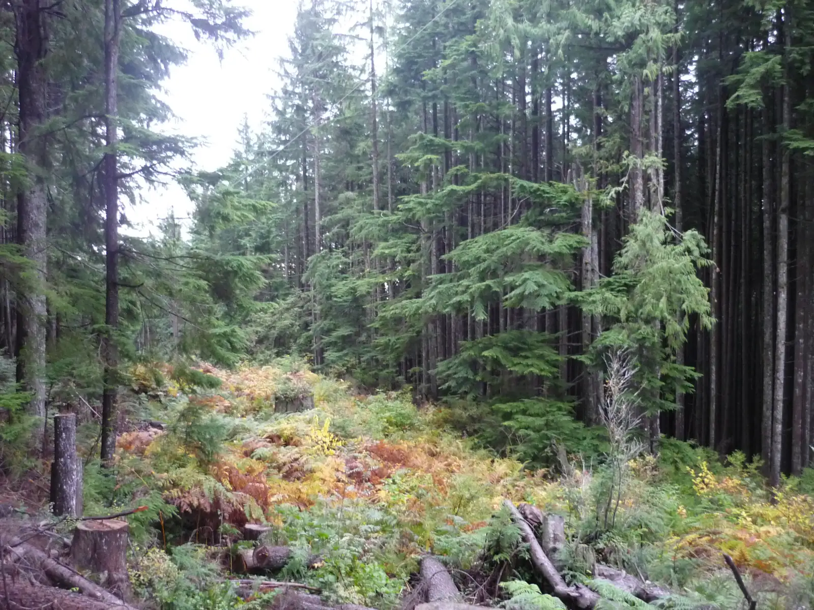
Photo: Guilhem Vellut, Wikimedia Commons, CC BY 2.0
Canterbury is in the District of West Vancouver, the only municipality in West Vancouver. On October 11, 2026, 57% of listings here stated West Vancouver on the municipality line and the others left it blank.
What Canterbury is like
Canterbury lies high on the south slope of Hollyburn Ridge. The West Vancouver Archives describes it as the area from Lawson Creek in the east to McDonald Creek in the west, and from Chippendale Road in the south up to the 1,200 foot level of the ridge, which is 366 metres above the sea. The same record places Chartwell to the east, Whitby Estates to the west and Cammeray to the south. MLS® listings file these streets under the area name Canterbury WV.
The street plan is short. Chippendale Road runs along the bottom, Finch Hill climbs from it and Pinecrest Drive crosses the top. Errigal Place, Langton Place, Marlowe Place and Chippendale Court are the short streets around them. Pinecrest Drive is the most northern street on the map, and the forest trails begin at its upper end.
Two sources agree on the height. The District's 1998 parks map, printed in its Lawson Creek walk brochure, draws the 300 metre height line beside Chippendale Road and the 350 metre line at Finch Hill and Pinecrest Drive. Natural Resources Canada's elevation data gives 295 metres at the bus stop on Chippendale Road and 345 metres on Finch Hill.
In our view, that height is why people buy here: on October 11, 2026, 86% of listing descriptions in Canterbury mentioned a view. We think the area suits a household that wants a large house, a view and forest within a short walk, and that has a car for each driver. A buyer who wants to walk to a cafe or a grocery store will be happier in Ambleside or Dundarave.
Live from the MLS® system
Homes for sale in Canterbury
7 houses, townhouses and duplex homes are listed for sale in Canterbury today, checked against the MLS® system within the last hour. Condos and apartments are not shown on this page.


.jpg)
Prices
What a home in Canterbury costs
Two kinds of numbers, kept apart. The dots are asking prices of the homes listed in Canterbury today, counted on this page. The cards are Greater Vancouver REALTORS benchmark prices for all of West Vancouver, which describe a typical home sold anywhere in West Vancouver.
Asking prices today
Each dot is one home for sale. The dark line marks the middle price.
Detached house
$2,822,900
- One year
- down 9.9%
- Ten years
- down 21.9%
West Vancouver benchmark, Greater Vancouver REALTORS, September 2026
All home types
$2,244,700
- One year
- down 7.4%
- Ten years
- down 26.7%
West Vancouver benchmark, Greater Vancouver REALTORS, September 2026
Greater Vancouver REALTORS published no West Vancouver townhouse benchmark in its September 2026 report, so none is shown.
What the homes are like
Canterbury is a small area of large houses, and few of them are for sale at one time. Every home listed here on October 11, 2026 was a detached house. The streets with houses for sale that day were Chippendale Court, Pinecrest Drive, Langton Place, Finch Hill and Errigal Place. For a longer list of similar houses, open the Chartwell and British Properties pages, which are linked on this page.
The middle house on that list had 7,089 square feet of floor area and six bedrooms, and it was finished in 1997. The middle lot measured 13,110 square feet, which is 0.30 of an acre.
Houses finished in the 1990s made up 86% of the list, which fits the approval dates above, and the others were finished in the 2010s. With so few homes listed, one new listing changes these shares, so treat them as true for that day only.
No listing that day stated a legal suite or an unauthorized one. On the suite line, 43% of listings said the house had none, 43% left the line blank and the others said "Other". In our experience, families who share a Canterbury house across generations use a lower floor with its own entrance. Ask the District what it has on file for the address before you count on rent from that floor.
When the homes were built
Year built of the 7 listings that state it.
- 1990s6
- 2010s1
Bedrooms
Bedrooms in the 7 listings that state it.
- 41
- 51
- 6 or more5
Suites: of the 4 houses for sale whose listing states it, 0 list a legal or licensed suite, 0 list a suite the municipality has not approved, and 3 list none. The rest leave the field blank.
The homes listed today have been on the market for 77 days at the middle, counted from each listing date to today. That is how long they have waited so far, which is a different number from how long homes take to sell.
Canterbury on the map
- Home for sale
- Public school
- Park
History
From a shingle dam to a 1990s subdivision
Loggers worked this slope long before builders did. The District's brochure for the Lawson Creek Forestry Heritage Walk says the Shields log dam, near the Pinecrest Bridge, was built in 1917. Its pond stored floating blocks of red cedar and fed a flume, a wooden channel of running water, that carried the blocks to a shingle mill 2 km below. A cable railway built in the early 1920s to bring cedar down the slope was last used in 1926. The brochure adds that all the trees on the private land between the bridge, at 350 metres, and the Skyline Trail, at 540 metres, were cut during the 1950s. The North Shore News named the dam's builders in 1995 as Bob and Ross Shields of the Vedder River Shingle Co.
Houses came in the 1990s. A subdivision is a piece of land divided into building lots. The West Vancouver Archives notes that British Pacific Properties, the company that began the British Properties, proposed one here under the name Canterbury Precinct. On March 20, 1992, an advertisement in the North Shore News under the names of British Pacific Properties and Ottmann Development Ltd. offered 28 building lots in Canterbury, priced from $510,000 to $695,000 with GST included.
On December 18, 1992, the same paper reported that a 79-lot Canterbury subdivision had been approved. The report placed the land on the western boundary of the British Properties, between McDonald Creek and the east branch of Lawson Creek and north of the Westhill subdivision. Four creeks ran through it, so the plan needed eight creek crossings. The creek corridors were to be protected, with trails along them and a link to the Baden-Powell Trail to the north. One of the plan's three parks was to follow Lawson Creek and include the dam.
The dam was before council again in 1995. On February 13, council agreed to spend $6,000 on a further study of it. The paper, which now wrote of an 80-lot subdivision, reported that British Pacific Properties would pay $25,000 toward removing or restoring the dam and was dedicating it to the municipality as a park. The map on this page marks Shield's Dam Park today.
Daily life
Daily life in Canterbury
Canterbury has houses, small parks and trails, and no shops. The map data on this page shows no grocery store, cafe, pharmacy or clinic inside the area. It names an IGA as the nearest grocery store and the West Vancouver Memorial Library as the nearest library.
In our experience, residents drive down Westhill Drive and 21st Street to Marine Drive for daily shopping and go to Park Royal for a larger trip. The 256 bus uses the same roads. TransLink's schedule gives it 12 minutes from Chippendale Road to Marine Drive at 17th Street and 19 minutes to Park Royal.
Small parks lie among the houses. The map marks Finch Hill Park, Normanby Park and Shield's Dam Park inside the area, with Westhill Park and Douglas Woodward Park past its edges.
Grocery stores
Nearest: IGA, 2.2 km away.
Cafes
Nearest: Delany's Coffee House, 2.2 km away.
Libraries and rec centres
Nearest: West Vancouver Recreation Centre, 2.3 km away.
How far it is
- Downtown Vancouver (Waterfront Station)8.1 km
- Lonsdale Quay and the SeaBus7.4 km
- Lions Gate Hospital7.7 km
- Park Royal shopping centre3.2 km
Places from OpenStreetMap, read October 10, 2026. Distances are in a straight line from the middle of the area, so the trip by road is longer.
Outdoors
Forest trails, the old dam and Cypress Provincial Park
The trails start at the top of Pinecrest Drive. The District puts the start of its Lawson Creek Forestry Heritage Walk on the west side of the Pinecrest Bridge, rates the walk moderate and allows 3.5 hours for it. The brochure numbers ten stops. The first is the dam, and later ones include the route of the cable railway and a trench where loggers of the early 1900s dragged logs downhill with a steam engine.
Higher up, the brochure's map marks the Skyline Trail and the Baden-Powell Trail along the power line above Canterbury. The photo at the top of this page was taken on the Baden-Powell Trail between Capilano Lake and Horseshoe Bay. The brochure says walkers may see birds and small mammals, and now and then a deer or a bear.
Check who owns the ground before you treat the whole forest as a park. The brochure, reprinted in December 2006, says parts of these trails cross private land owned by British Pacific Properties. It names the Skyline Trail as the boundary, with private land on the downhill side and public land on the uphill side. Park Dedication Bylaw No. 5337 took effect on June 3, 2024 and dedicates the District's own land above the 1,200 foot level as park.
Cypress Provincial Park covers the mountains above. BC Parks lists Hollyburn Mountain, at 1,325 metres, among its peaks, and says Cypress Mountain Resort lies entirely inside the park and has 11 km of snowshoe trails. The park takes its name from the yellow cypress trees that grow near its ridge tops.
Schools
Schools near Canterbury
Canterbury is served by West Vancouver Schools (School District 45), and no school stands inside the area. The table on this page lists Chartwell Elementary, at 1300 Chartwell Drive, as the nearest public elementary school and Sentinel Secondary, at 1250 Chartwell Drive, as the nearest public high school. The district lists Chartwell for Kindergarten to Grade 7 and Sentinel for Grades 8 to 12, with Advanced Placement courses and French immersion.
For French immersion in the younger grades, the district describes École Pauline Johnson, on 22nd Street, as offering early and late immersion in a single-track setting, a term for a school where immersion is the only program. The table also lists Ridgeview Elementary and West Vancouver Secondary, both on Mathers Avenue, and two independent schools, Collingwood School and Mulgrave School.
The 256 bus stops at 21st Street and Haywood Avenue eight minutes after it leaves Chippendale Road. Irwin Park Elementary has its address on Haywood Avenue and École Pauline Johnson on 22nd Street, so measure the walk from that stop if a child will ride the bus.
Each public school takes the children who live inside its catchment, the set of addresses the district assigns to it. The nearest school and the catchment school can differ. Enter each address in the district's school locator, linked on this page, before you write an offer.
| School | Type | French programs | Distance |
|---|---|---|---|
Chartwell Elementary 1300 Chartwell Dr, West Vancouver, BC | Public, elementary | None listed | 940 m |
Ridgeview Elementary 1250 Mathers Ave, West Vancouver, BC | Public, elementary | None listed | 1.9 km |
Ecole Pauline Johnson Elementary 1150 22nd St, West Vancouver, BC | Public, elementary | Early immersion, Late immersion | 1.9 km |
Irwin Park Elementary 2455 Haywood Ave, West Vancouver, BC | Public, elementary | None listed | 2.1 km |
Sentinel Secondary 1250 Chartwell Dr, West Vancouver, BC | Public, secondary | Early immersion | 1.2 km |
West Vancouver Secondary 1750 Mathers Ave, West Vancouver, BC | Public, secondary | None listed | 1.5 km |
Collingwood School 70 Morven Dr, West Vancouver, BC | Independent, elementary-secondary | None listed | 1.6 km |
Mulgrave School 2330 Cypress Bowl Lane, West Vancouver, BC | Independent, elementary-secondary | None listed | 2.2 km |
St. Anthony's 595 Keith Rd, West Vancouver, BC | Independent, elementary | None listed | 3.1 km |
Bodwell High School 955 Harbourside Drive, North Vancouver, BC | Independent, secondary | None listed | 6.1 km |
Your address decides your assigned school, which can differ from the closest one. Check any address with the West Vancouver Schools school locator. School list from the BC Ministry of Education, updated October 8, 2026.
Getting around
Getting around
Most trips start in a car. The District's walk brochure maps two ways up from the Upper Levels Highway (Highway 1): from Exit 10 at 21st Street by Westhill Drive to Chippendale Road, and from Exit 11 at 15th Street by Cross Creek Road and Chartwell Drive.
One bus route has a stop in Canterbury, the 256, and the stop is the end of the line, on Chippendale Road at Westhill Drive. In TransLink's schedule for September 7, 2026 to January 3, 2027, a bus leaves that stop at 40 minutes past each hour from 6:40 a.m. to 7:40 p.m., Monday to Thursday. It goes down Westhill Drive and 21st Street, turns east on Marine Drive and reaches Park Royal 19 minutes after it set out. Buses back leave Park Royal at 21 minutes past the hour, from 6:21 a.m. to 7:21 p.m., and climb by 21st Street, Skilift Road and Folkestone Way.
The schedule adds later buses on Fridays, when the last one leaves Chippendale Road at 10:40 p.m. Saturday buses leave from 7:40 a.m. to 9:40 p.m. and Sunday buses from 9:40 a.m. to 8:40 p.m. The 254 stops at Chartwell Drive and Chippendale Road, east of Canterbury, and the Chartwell page gives its times.
In our experience, few residents walk or cycle home from the shops. The elevation data puts the Marine Drive stop at Park Royal at 10 metres above the sea and the Chippendale Road stop at 295 metres, so the trip home climbs 285 metres.
Routes that stop in Canterbury
Trips on a regular weekday that stop at one of the 1 stops inside the area, from TransLink's published schedule valid to January 3, 2027.
- 256Whitby Estate/Park Royal/Spuraway28 trips
Before you buy
Things to check in Canterbury
The wildfire permit area
Forest lies above Pinecrest Drive. The District's Wildfire Hazard permit area, approved on December 14, 2020, takes in every property within 100 metres of a forested area. Inside it, most new houses need a wildfire permit before they are built. Work on an existing house needs none, and the fire department recommends the same guidelines for existing homes too. The District also thins forest at the edge of neighbourhoods under the wildfire plan it adopted in 2019, and its page, as saved on September 6, 2025, lists three finished phases. Look up the address on WestMap, the District's online map, and phone an insurer before you make an offer.
A creek on the lot
The 1992 report counted four creeks on the Canterbury land. Where a creek crosses private property, the District's page, as saved on August 15, 2025, makes the owner responsible for its upkeep and for any repair of erosion. The owner has no right to work in or around the creek without permits. The page notes rare exceptions, such as a public right of way for the creek recorded on the title. Ask your lawyer or notary to look for one, and ask the seller for any engineer's report on the creek bank.
Snow at 300 metres
The streets here rise from 295 metres above the sea at the Chippendale Road bus stop to 350 metres at the Pinecrest Bridge. In our experience, snow settles on them on some days when rain falls on Marine Drive. The District's winter page, as saved on September 1, 2025, says bus routes are ploughed first and many times over during a long storm, and the 256 runs on Chippendale Road and Westhill Drive. Local roads and dead-end streets wait until the storm has passed. A car that blocks the plough can be ticketed and towed, so check that the garage and driveway hold every car.
Trees between the house and the view
Trees decide how long a view lasts. The District's Tree Bylaw page, as saved on August 5, 2025, says an owner cannot cut a protected tree unless the property is being redeveloped or a professional arborist, a trained tree specialist, finds the tree hazardous. Permits are refused when the only purpose is a better view, and cutting includes topping a tree again after it was topped before. Ask the seller for past tree permits, and look at what grows on the lots below the house.
Houses from the 1990s
Most houses for sale here on October 11, 2026 were finished in the 1990s, so an original roof, furnace or set of windows is now 27 to 36 years old. Book a full inspection, and ask the seller for the date and the receipt for each replacement.
Buying
Buying a home in Canterbury
Expect a short list. Few Canterbury houses are for sale at one time, so a buyer who wants only this area may wait months for the right one. In our experience, most buyers here also view houses in Chartwell, Westhill and the Whitby Estates area during the same search.
Visit each house twice: on a clear day for the view, and in rain or after snow for the driveway. From the main rooms, note which trees and roofs stand between the windows and the water. In our view, a buyer should assume those trees will stay, because the District refuses permits to cut protected trees for a view.
Before your offer is final, look up the address on WestMap for the wildfire area and phone an insurer. Ask your lawyer or notary to read every restriction on the title, including any right of way for a creek.
Michael Lee works with West Vancouver buyers for MultiLiving. Send the form on this page with your budget, the bedrooms you need and how high on the hill you want to live. He will reply with the Canterbury houses that match and with similar houses in the areas next door.
Selling
Selling a home in Canterbury
A Canterbury house has few rivals on its own streets and many in the areas beside it. In our experience, the buyer who tours your house has already seen houses in Chartwell and the British Properties, where more are for sale. The cards on this page show today's Canterbury listings and their asking prices.
Three questions decide most offers here, in our experience: what the main rooms look out on, what has been replaced since the house was built, and how a car gets in and out when it snows. Before you list, collect the District's permit records, the receipts for a new roof or furnace, any tree permits and any report on a creek or slope.
This page shows asking prices only, because real estate board rules keep sold prices in private settings. In a private price review, Michael Lee compares your house with recent sales in Canterbury and next door and suggests a list price. To ask for one, pick "What is my home worth?" on the form on this page.
Houses listed
7
$5.00M to $9.68M
Our view
Who buys in Canterbury
In our experience, the typical Canterbury buyer is a family that needs more room than its house lower in West Vancouver gave it. They want six or more bedrooms, a view and space for relatives who stay for months at a time.
A second group, in our experience, is families of two or three generations who buy one house together and give each generation a floor.
Canterbury and the areas next to it
Homes listed for sale today, counted on this page.
| Area | For sale | Middle asking price | Houses, middle price |
|---|---|---|---|
| Canterbury | 7 | $6.88M | $6.88M |
| Westhill | 4 | $6.29M | $6.29M |
| Chartwell | 33 | $4.68M | $4.68M |
| Panorama Village | 6 | $2.14M | $4.48M |
| Deer Ridge and Whitby Estates | 13 | $5.48M | $6.43M |
| British Properties | 56 | $5.09M | $5.09M |
Questions about Canterbury
Is Canterbury in the City or the District of West Vancouver?
Canterbury is in the District of West Vancouver. West Vancouver has one municipality, so the District sends the property tax bill and sets the tree, creek and wildfire rules for every address here. On October 11, 2026, 43% of listings left the municipality line blank.
What kind of homes are for sale in Canterbury?
Large detached houses. Every home listed under the Canterbury WV area name on October 11, 2026 was one. The middle house had 7,089 square feet of floor area and six bedrooms, the middle lot was 0.30 of an acre, and 86% of descriptions mentioned a view.
How much does a house in Canterbury cost?
The price dots on this page mark the asking price of every Canterbury house listed today and show the middle price. The page also carries the monthly benchmark price that Greater Vancouver REALTORS publishes for a detached house in West Vancouver.
Where is Canterbury, and is it part of the British Properties?
The West Vancouver Archives places Canterbury between Lawson Creek and McDonald Creek, from Chippendale Road up to the 1,200 foot level of Hollyburn Ridge. British Pacific Properties proposed the subdivision, the North Shore News put it on the western boundary of the British Properties, and MLS® listings give it its own area name.
When was Canterbury built?
In the 1990s. An advertisement offered 28 building lots in Canterbury in March 1992, and the North Shore News reported the approval of a 79-lot subdivision in December 1992. On October 11, 2026, 86% of the houses for sale here had been finished in the 1990s.
Which schools are near Canterbury?
The nearest public schools on this page's table are Chartwell Elementary and Sentinel Secondary, both on Chartwell Drive, in West Vancouver Schools (School District 45). École Pauline Johnson offers early and late French immersion. Check each address in the district's school locator, linked on this page, because catchments decide which school takes a child.
Is there a bus from Canterbury?
Yes, the 256. In TransLink's fall 2026 schedule it leaves Chippendale Road at Westhill Drive at 40 minutes past each hour from 6:40 a.m. to 7:40 p.m., Monday to Thursday, and reaches Park Royal in 19 minutes. Fridays have later buses, and weekend service starts later in the morning.
How high is Canterbury, and does it get more snow than the waterfront?
The District's parks map draws the 300 metre height line beside Chippendale Road, and its walk brochure gives 350 metres for the Pinecrest Bridge. In our experience, snow settles here on some days when rain falls on Marine Drive. The District ploughs bus routes first and local streets after the storm.
Is Canterbury in a wildfire hazard area?
The District's Wildfire Hazard permit area covers every property within 100 metres of a forested area, and forest lies above Pinecrest Drive. Look up each address on WestMap, the District's online map. Inside the area, most new houses need a wildfire permit, and work on an existing house needs none.
What is the Shields dam?
It is a log dam on Lawson Creek, built in 1917 for a cedar shingle business. Its pond fed a wooden channel that floated blocks of cedar to a mill lower on the hill. On the District's Lawson Creek Forestry Heritage Walk, it comes into view within 100 metres of the Pinecrest Bridge.
Can I cut trees to open up a view in Canterbury?
Only with a permit if the Tree Bylaw protects the tree, and the District's page says permits are refused when the only purpose is a better view. A protected tree can be cut when the property is being redeveloped or when an arborist finds it hazardous. Hedges fall outside the bylaw.
How do I find out what my Canterbury home is worth?
Pick "What is my home worth?" on the form on this page. Michael Lee will compare your house with recent sales in Canterbury and the areas beside it, look at its view, lot and updates, and explain the list price he suggests in private.
Who should I talk to about buying or selling in Canterbury?
Michael Lee, REALTOR®, Personal Real Estate Corporation, with eXp Realty, works with buyers and sellers in West Vancouver for MultiLiving. Phone him at 604-803-9863, or send the form on this page with the street you like or the address you plan to sell.
Sources
Written content checked October 11, 2026. Listing numbers counted from the MLS® system on October 12, 2026.
- Canterbury (West Vancouver, B.C.): place record with boundaries and origin note (archived copy of April 18, 2024), West Vancouver Archives. Read October 11, 2026.
- 79-lot Canterbury development above the Upper Levels (Maureen Curtis, December 18, 1992, front page), North Shore News, through North Shore Digital Libraries. Read October 11, 2026.
- Advertisement for 28 building lots in Canterbury (March 20, 1992, page 87), North Shore News, through North Shore Digital Libraries. Read October 11, 2026.
- West Van Lawson Creek dam built to log in 1917 (Maureen Curtis, report on the council meeting of February 13, 1995), North Shore News, through North Shore Digital Libraries. Read October 11, 2026.
- Lawson Creek dam built by Vedder River Shingle Co. (second page of the same 1995 report), North Shore News, through North Shore Digital Libraries. Read October 11, 2026.
- Lawson Creek Forestry Heritage Walk brochure and Upper Lands trail map, reprinted December 2006 (archived copy of September 3, 2025), District of West Vancouver and the West Vancouver Historical Society. Read October 11, 2026.
- Lawson Creek Heritage Walk (archived copy of August 17, 2025), District of West Vancouver. Read October 11, 2026.
- Park Dedication Bylaw No. 5337, 2024 (Upper Lands), effective June 3, 2024 (archived copy of April 5, 2025), District of West Vancouver. Read October 11, 2026.
- Cypress Park: peaks, forests and winter activities, BC Parks, Government of British Columbia. Read October 11, 2026.
- Elevation service, Canadian Digital Elevation Model (heights at bus stops and on Finch Hill), Natural Resources Canada. Read October 11, 2026.
- Wildfire Hazard Development Permits (archived copy of August 5, 2025), District of West Vancouver. Read October 11, 2026.
- Wildfire Fuel Management: three finished phases (archived copy of September 6, 2025), District of West Vancouver. Read October 11, 2026.
- Watercourses on Private Properties (archived copy of August 15, 2025), District of West Vancouver. Read October 11, 2026.
- Winter Preparedness: snow clearing routes and parking (archived copy of September 1, 2025), District of West Vancouver. Read October 11, 2026.
- Tree Bylaw: when a protected tree can be cut, views and hedges (archived copy of August 5, 2025), District of West Vancouver. Read October 11, 2026.
- Primary and elementary schools, West Vancouver Schools. Read October 11, 2026.
- Secondary schools, West Vancouver Schools. Read October 11, 2026.
- TransLink schedule data (GTFS), in effect September 7, 2026 to January 3, 2027, TransLink. Read October 11, 2026.
- MLS® Home Price Index, September 2026 stats package, Greater Vancouver REALTORS. Read October 9, 2026.
- K-12 school locations (school names, addresses and programs), BC Ministry of Education and Child Care, through the BC Data Catalogue. Read October 9, 2026.
- Places, parks and shops, OpenStreetMap contributors (Open Database License). Read October 9, 2026.
- Bus, SeaBus and train schedules (GTFS feed 26SEP_20261009), TransLink. Read October 9, 2026.
General information only. The prices, benchmarks, strata rules, tax and fee figures, lease terms, permit rules and school details on this page are based on the sources and dates listed above. They are not financial, mortgage, tax or legal advice, and not a guarantee of any outcome. Prices, tax rates, fees, municipal rules and school catchments change. Before you buy or sell, confirm each one with its source and speak with a licensed REALTOR®, a mortgage broker and a real estate lawyer.