North Vancouver neighbourhood guide
Pemberton Heights, North Vancouver: Homes for Sale, Prices, Schools and Daily Life
Pemberton Heights is a small neighbourhood of detached houses on top of a hill in the District of North Vancouver, above Marine Drive, south of Highway 1 and west of Mackay Creek. On October 11, 2026, every home listed here was a house, and 63% of them were built before 1960. Capilano Elementary is in the middle of the street grid. It suits a family that wants a yard and a school within a walk.
For sale now
8
houses, townhouses, duplexes
Asking prices
$1.68M to $4.60M
Middle asking price
$2.35M
North Vancouver detached benchmark
$2.04M
September 2026, GVR
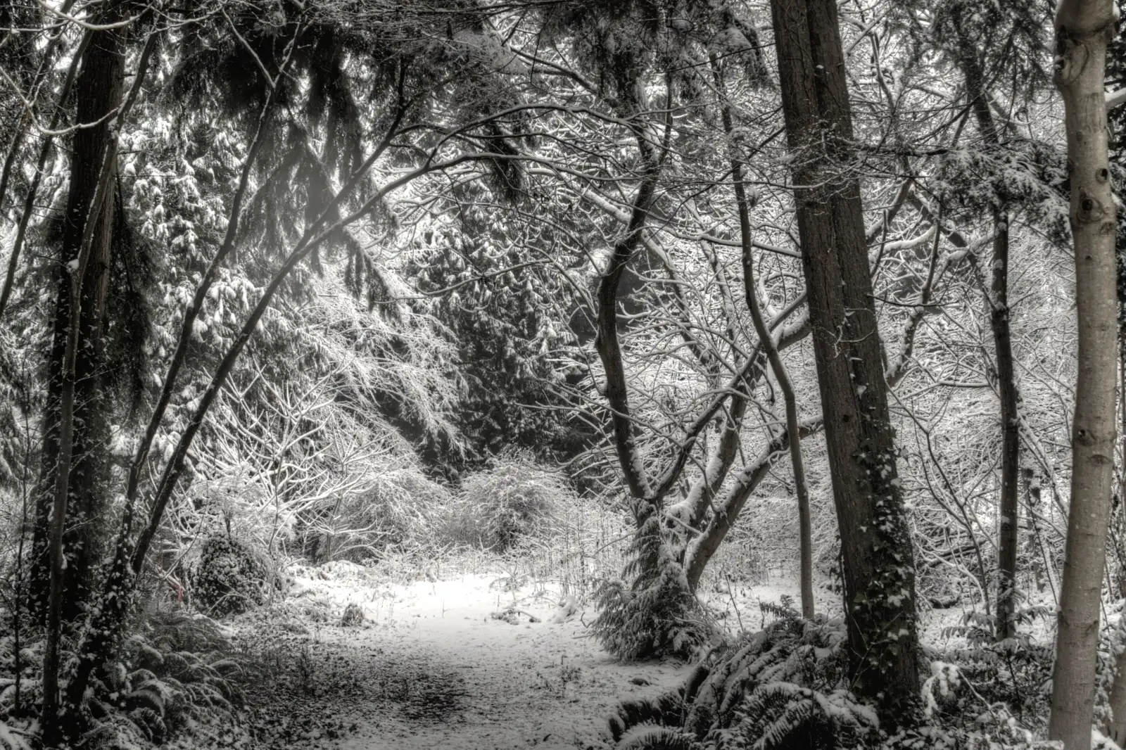
Photo: RestfulC401, Wikimedia Commons, CC0 1.0
Pemberton Heights is in the District of North Vancouver, which names it among the neighbourhoods of its Lions Gate and Lower Capilano community. South of West 23rd Street, the District's boundary map ends beside Mackay Avenue, and the City of North Vancouver begins there. On October 11, 2026, 25% of listings named the District and the others left the line blank, so confirm the municipality on each property tax notice.
What Pemberton Heights is like
Pemberton Heights covers the top of one hill. Marine Drive runs along the foot of it on the south side and Highway 1 passes on the north side. Mackay Creek runs in a ravine to the east, and Capilano Road is to the west. On top, West 19th to West 24th streets cross Bowser, Philip, Bridgman, Pemberton and Lloyd avenues, and West Keith Road follows the south edge.
The top is a plateau, which is a level area of high ground, and the south side is a steep slope. Natural Resources Canada's elevation data gives 47 to 63 metres above sea level at the 15 street corners we checked on top. Marine Drive at Pemberton Avenue is at 13 metres. West Keith Road at Pemberton Avenue, 224 metres to the north, is at 58 metres.
The slope interrupts the street grid. The District's street data shows a gap in Pemberton, Lloyd, Bridgman and Philip avenues where the slope is, so none of them runs straight up from Marine Drive. Drivers come up by Mackay Avenue and West Keith Road on the east side, or from Capilano Road on the west side.
In our view, Pemberton Heights suits a buyer who wants a detached house on a small grid of residential streets with an elementary school in the middle. Supermarkets and the frequent buses are at the foot of the hill, so most errands begin with a walk down or a drive. A buyer who wants a new townhouse should look at Pemberton, on the flat ground below.
Live from the MLS® system
Homes for sale in Pemberton Heights
8 houses, townhouses and duplex homes are listed for sale in Pemberton Heights today, checked against the MLS® system within the last hour. Condos and apartments are not shown on this page.


Prices
What a home in Pemberton Heights costs
Two kinds of numbers, kept apart. The dots are asking prices of the homes listed in Pemberton Heights today, counted on this page. The cards are Greater Vancouver REALTORS benchmark prices for all of North Vancouver, which describe a typical home sold anywhere in North Vancouver.
Asking prices today
Each dot is one home for sale. The dark line marks the middle price.
Detached house
$2,042,000
- One year
- down 6.2%
- Ten years
- up 18.7%
North Vancouver benchmark, Greater Vancouver REALTORS, September 2026
Townhouse
$1,230,400
- One year
- down 4.9%
- Ten years
- up 43.2%
North Vancouver benchmark, Greater Vancouver REALTORS, September 2026
All home types
$1,290,400
- One year
- down 3.9%
- Ten years
- up 16.9%
North Vancouver benchmark, Greater Vancouver REALTORS, September 2026
What the homes are like
Every home this page listed in Pemberton Heights on October 11, 2026 was a detached house. No townhouses, duplex homes or condos were listed here that day. The group of homes was small, so the shares below will move from month to month. The streets with homes listed were West Keith Road, Mackay Avenue, West 22nd Street, Bridgman Avenue and Philip Avenue.
Old and new houses share the same blocks. Of the homes listed that day, 63% were built before 1960, and the 1970s, the 1990s and the 2010s each made up 13%. The middle house had five bedrooms and more than 3,200 square feet of floor space. In our experience, an older house of that size here has been extended at least once, and some older houses have been replaced with larger new ones.
The suite line differed from listing to listing. That day 25% of house listings stated an unauthorized suite, which means a suite with no approval from the District. A further 13% stated a legal suite and 13% a licensed suite. Another 13% said the house had no suite, and 38% left the line blank.
Half of the listings mentioned a view and 38% said the home had none. The District's 1997 inventory describes a 1946 house on West Keith Road at the edge of a cliff with a view to the south. A house in the middle of the grid may look out on its neighbours only, so stand in each main room before you decide what a view is worth to you.
When the homes were built
Year built of the 8 listings that state it.
- Before 19605
- 1970s1
- 1990s1
- 2010s1
Bedrooms
Bedrooms in the 8 listings that state it.
- 31
- 42
- 53
- 6 or more2
Suites: of the 5 houses for sale whose listing states it, 2 list a legal or licensed suite, 2 list a suite the municipality has not approved, and 1 list none. The rest leave the field blank.
The homes listed today have been on the market for 31 days at the middle, counted from each listing date to today. That is how long they have waited so far, which is a different number from how long homes take to sell.
Pemberton Heights on the map
- Home for sale
- Public school
- Park
History
How Pemberton Heights got its name and its streetcar
The name comes from the family behind the Lonsdale Estates company. The North Shore Heritage Preservation Society writes that an English father and son set up the company in North Vancouver in 1882 and that a nephew, James Pemberton Fell, was appointed to manage it. In the Society's account, Pemberton Heights and the nearby Pemberton and Fell avenues take their names from him.
West Keith Road is named after James Cooper Keith. The Society writes that he started the building of a road across the North Shore and put up the first $40,000. Its article says the road appears again in Pemberton Heights at Mackay Avenue, heads west and then north, and that one branch leads to Capilano Road.
Streetcars reached the hill in 1911. Henry Ewert wrote in a North Shore newspaper article of April 23, 1997 that the Capilano line was extended that year by way of 20th Street and 22nd Street to a last stop at School Street and Bowser Avenue. It crossed Mackay Creek at 20th Street on a trestle, a bridge held up by a tall frame, that was 450 feet long and 98 feet high. That is 137 metres by 30 metres. The trestle was condemned, and on October 1, 1943 the line was shortened to end at 20th Street and Hamilton Avenue, east of the creek.
The District's heritage records describe houses from those decades. The list of heritage properties in its 2019 heritage plan includes a 1914 house on West 23rd Street that is on the heritage register and a 1918 house on the same street. Its 1997 inventory of buildings from 1930 to 1965 describes a log house on West Keith Road, built in 1938 for John and Laura Howse at a cost of $1,925, as one of several log houses built in this area before the Second World War. The plan also records the Capilano Timber Company's logging railway, dated 1917 to 1933, and names the Bowser Trail as part of its route.
Daily life
Daily life in Pemberton Heights
A few daily needs are on the hill itself. Capilano Elementary is on West 20th Street, close to the middle of the area. The nearest cafe on this page's map, The Corner Stone Bistro, is on West 22nd Street at Lloyd Avenue. Sowden Park is at 23rd Street and Lloyd Avenue. The District calls it a community sports park, and its park data records two baseball diamonds and a soccer field there.
For groceries, residents go down the hill. The map shows Save-On-Foods as the nearest supermarket, with Bulk Barn and Sungiven Foods next, and all three are on the flat ground beside Marine Drive. Natural Resources Canada's data puts the Save-On-Foods site at 15 metres above sea level, so the walk home to West Keith Road at Pemberton Avenue is a climb of 43 metres. The distances on this page are straight lines and leave that climb out.
Highway 1 passes the north edge of the neighbourhood, beside West 24th Street and Plateau Drive. In our experience, houses on those two streets hear the highway, and houses in the middle of the grid are quieter. Visit at 5 p.m. on a weekday before you choose a street.
Grocery stores
- Save-On-Foods410 m
- Bulk Barn710 m
- Sungiven Foods790 m
- The Cheese Man980 m
Cafes
- The Corner Stone Bistro300 m
- Starbucks480 m
- Bean Around The World Coffees580 m
- Bisou Bake House580 m
- Douce Diner680 m
Libraries and rec centres
- Capilano Tennis Club850 m
- North Vancouver Tennis Centre950 m
How far it is
- Downtown Vancouver (Waterfront Station)4.7 km
- Lonsdale Quay and the SeaBus2.7 km
- Lions Gate Hospital3.0 km
- Park Royal shopping centre2.2 km
Places from OpenStreetMap, read October 10, 2026. Distances are in a straight line from the middle of the area, so the trip by road is longer.
Outdoors
Bowser Trail, Heywood Park and Mackay Creek
The Bowser Trail runs along the foot of the slope. The District's park data calls it a neighbourhood trail from Capilano Road to Pemberton Avenue and records a playground, swings and stairs on it. The District's heritage landscape inventory, last updated in March 1996 and reprinted in its 2019 heritage plan, lists the Zigzag Steps on the trail at the north end of Pemberton Avenue, dated 1917, with 110 steps and 11 landings. At the top of the slope, the map on this page shows Ashdown Park where Pemberton Avenue meets West Keith Road.
Mackay Creek runs through a ravine on the east side, and the District's creek data marks it as a creek with fish. Heywood Park, a City of North Vancouver park, lies along the creek east of Mackay Avenue. The City describes a green ravine around the salmon-bearing creek, with a playground, washrooms in the Mackay Creek Hatchery field house, a footbridge and a network of trails.
North of Highway 1 the creek continues into Murdo Frazer Park, where the photo at the top of this page was taken. The District's park data gives its entrance as Elizabeth Way and records a fenced area where dogs may run off leash and a nine hole pitch and putt course that is closed from November to March.
Schools
Schools in and near Pemberton Heights
Pemberton Heights is in the North Vancouver School District. Capilano Elementary, at 1230 West 20th Street, is the closest school to the middle of the area. The district says Capilano offers the International Baccalaureate Primary Years Programme, which runs from kindergarten to Grade 7.
The district groups Capilano with Carson Graham Secondary on Jones Avenue, in one family of schools with Braemar, Carisbrooke, Larson, Norgate, Queen Mary and Westview. By the district's account, Carson Graham offers the International Baccalaureate Middle Years Programme for Grades 8 to 10 and the Diploma Programme for Grades 11 and 12. A family of schools tells you which schools work together. The district's school locator tells you which school must take a child from a given address, so enter each address there before you write an offer.
French immersion is taught at other schools. The district's feeder list sends French immersion students from Larson to Argyle Secondary and those from Cleveland and Braemar to Handsworth Secondary. Independent schools on the map include Bodwell High School, St. Thomas Aquinas, St. Anthony's and St. Edmund's.
| School | Type | French programs | Distance |
|---|---|---|---|
Capilano Elementary 1230 20th St W, North Vancouver, BC | Public, elementary | None listed | 130 m |
Norgate Community Elementary 1295 Sowden St, North Vancouver, BC | Public, elementary | None listed | 860 m |
Highlands Elementary 3150 Colwood Dr, North Vancouver, BC | Public, elementary | None listed | 1.3 km |
Westview Elementary 641 17th St W, North Vancouver, BC | Public, elementary | None listed | 1.4 km |
Carson Graham Secondary 2145 Jones Ave, North Vancouver, BC | Public, secondary | None listed | 1.8 km |
Mountainside Secondary 3365 Mahon Ave, North Vancouver, BC | Public, secondary | None listed | 2.3 km |
Bodwell High School 955 Harbourside Drive, North Vancouver, BC | Independent, secondary | None listed | 1.6 km |
St. Thomas Aquinas 541 Keith Rd W, North Vancouver, BC | Independent, secondary | None listed | 1.8 km |
St. Anthony's 595 Keith Rd, West Vancouver, BC | Independent, elementary | None listed | 1.8 km |
St. Edmund's 535 Mahon Ave, North Vancouver, BC | Independent, elementary | None listed | 2.1 km |
Your address decides your assigned school, which can differ from the closest one. Check any address with the North Vancouver School District school locator. School list from the BC Ministry of Education, updated October 8, 2026.
Getting around
Getting around
Highway 1 runs along the north edge of the hill, and the District's street data shows its ramps near Capilano Road, at the northwest corner. Marine Drive, at the foot of the hill, leads west to the Lions Gate Bridge and Park Royal and east to Lower Lonsdale. In our experience, the line of cars waiting for the bridge decides how long a morning drive downtown takes.
One bus route crosses the top of the hill. The 236 runs along West 22nd Street between Grouse Mountain and Lonsdale Quay and leaves the hill by Mackay Avenue. TransLink's schedule for September 7, 2026 to January 3, 2027 has 40 weekday buses toward Lonsdale Quay from the stop at Pemberton Avenue and allows 9 to 16 minutes for the ride. Four of them leave between 7 and 9 a.m. The SeaBus to downtown Vancouver leaves from Lonsdale Quay.
The frequent buses are on Marine Drive. From the stop at Pemberton Avenue, 23 buses on routes 240 and 241 leave on weekdays between 7 and 9 a.m., and the schedule allows them 19 to 23 minutes to reach West Georgia Street at Burrard Street. The R2 RapidBus stops at the same corner, and the schedule allows it 6 to 9 minutes to Park Royal. Add the 45 metre climb between Marine Drive and West Keith Road to each of these trips.
Routes that stop in Pemberton Heights
Trips on a regular weekday that stop at one of the 22 stops inside the area, from TransLink's published schedule valid to January 3, 2027.
- R2Marine-Willingdon283 trips
- 240Lynn Valley/Downtown188 trips
- 255Dundarave/Capilano University101 trips
- 236Grouse Mountain/Lonsdale Quay77 trips
- 241Upper Lonsdale/Downtown25 trips
- N24Downtown/Lynn Valley9 trips
Before you buy
Things to check in Pemberton Heights
The slope at the edge of the hill
The District treats a slope as steep when it is steeper than 20 degrees and more than 10 metres high. Every lot within 20 metres of the top or bottom of such a slope is in its Slope Hazard area, and any work there goes to the District's environment staff first. On October 11, 2026, its map showed these areas within 40 metres of 11 of the 16 named streets on the hill, among them West Keith Road, Bowser Avenue and Cortell Street. None lay within 40 metres of West 20th, West 21st or West 22nd streets.
Creeks and ravines
The District's Streamside Protection area covers land within 15 metres of the top of a stream bank, and an owner there may need a permit to build or to change the land. On the same date the map showed these areas within 40 metres of 12 of the 16 streets, with the most along West Keith Road, Bowser Avenue and Mackay Avenue. No flood hazard area on the District's Creek Hazard map came within 40 metres of any of the 16 streets.
Forest edge
Wildfire Hazard areas lay within 40 metres of 8 of the 16 streets: Mackay, Lloyd and Philip avenues, George Street, Plateau Drive and West 22nd, West 23rd and West 24th streets. Most are what the District calls wildfire interface areas, meaning properties beside land it has mapped as a wildfire risk. Ask an insurer for a quote on the address before you make a firm offer.
Snow on the way up
The District clears snow in three levels. Its map data puts West 22nd Street, the bus route, in the first level, which it aims to make passable within 12 hours after the snow stops. Most of West Keith Road is in the second level, with a target of 48 hours, along with the blocks of West 20th Street, Bridgman Avenue and Pemberton Avenue beside the school. Most other blocks are in the third level, with a target of 96 hours.
Suites
The District has allowed secondary suites since 1997 in most single-family homes. Every suite must be registered with the District, with or without a building permit, and registration adds yearly water and sewer charges to the tax bill. On October 11, 2026, one quarter of house listings here called their suite unauthorized. Ask the District what its file shows before you rely on the rent.
Houses on the heritage list
The District's list of heritage properties includes houses in Pemberton Heights. The District says a place on its heritage register lets it delay a demolition, building or development permit while it inspects the house or reviews other options with the owner. It also says the register leaves an owner free to alter the house within the existing laws. Ask the District whether a house is on the register before you plan changes.
Buying
Buying a home in Pemberton Heights
Choose between the edge and the middle first. Houses along West Keith Road and Bowser Avenue stand at the top of the slope, and those two streets had the most Streamside Protection areas nearby on the District's map. West 20th and West 21st streets are in the middle of the grid beside the school, and no slope, streamside or wildfire area came within 40 metres of either street on October 11, 2026. The price dots on this page show what sellers are asking today.
Then look at the age of the house. For a house from the 1950s or earlier, ask the seller for the permits behind each addition and each suite. Search every address on GeoWeb, the District's property map, for the areas described on this page. If the listing calls a suite unauthorized, ask a mortgage broker whether the lender will count its rent.
Gary Paul works with buyers across North Vancouver. Send the form on this page with your budget, the number of bedrooms you need and whether you want a view or a suite. He will reply with the Pemberton Heights homes that match and arrange showings.
Selling
Selling a home in Pemberton Heights
On October 11, 2026, the group of homes for sale in Pemberton Heights was small, so a buyer compares each new listing with only a few others. In our experience, the same buyer has also toured houses in Edgemont, Norgate and Capilano. The cards on this page count the homes listed here today and give the range of asking prices.
In our experience, four things decide what a buyer will pay for a house here: whether it has a view, how much of the house has been updated, what the District's file says about any suite, and whether the lot is in a slope, streamside or wildfire area. Before you list, ask the District for the permit records for the house, print the GeoWeb map for your lot and keep any engineer's report ready.
Real estate board rules keep sold prices off public pages such as this one. Gary Paul can go through recent Pemberton Heights sales with you in a private price review and suggest a list price. Ask for one with the form on this page.
Houses listed
8
$1.68M to $4.60M
Our view
Who buys in Pemberton Heights
In our experience, the most common buyer in Pemberton Heights is a family with children in elementary school, or about to start, who want a detached house within a walk of Capilano Elementary. Many already live on the North Shore in a townhouse or a condo.
A second group, in our experience, buys an older house on a lot with a view and plans to renovate it or replace it. A third group is two generations of one family who share a house with a suite.
Pemberton Heights and the areas next to it
Homes listed for sale today, counted on this page.
| Area | For sale | Middle asking price | Houses, middle price |
|---|---|---|---|
| Pemberton Heights | 8 | $2.35M | $2.35M |
| Pemberton | 12 | $1.34M | $1.70M |
| Norgate | 8 | $1.40M | $1.50M |
| Capilano | 5 | $2.50M | $2.50M |
| Mosquito Creek | 13 | $1.30M | $2.20M |
| Edgemont | 19 | $2.20M | $2.79M |
Questions about Pemberton Heights
Is Pemberton Heights in the City or the District of North Vancouver?
Pemberton Heights is in the District of North Vancouver, which names it as a neighbourhood of its Lions Gate and Lower Capilano community. The City of North Vancouver begins beside Mackay Avenue south of West 23rd Street, so check the property tax notice for any home on that avenue.
What kind of homes are for sale in Pemberton Heights?
Detached houses. On October 11, 2026, every home this page listed in Pemberton Heights was a house, 63% were built before 1960 and 13% were built in the 2010s. The middle house had five bedrooms.
How much does a house in Pemberton Heights cost?
The price dots on this page mark the asking price of every house listed in Pemberton Heights today, with the middle price shown. The page also gives the monthly benchmark price from Greater Vancouver REALTORS for a detached house across North Vancouver.
What is the difference between Pemberton Heights and Pemberton?
They are two MLS® areas. Pemberton Heights is the grid of houses on top of the hill, 47 to 63 metres above sea level where we checked. Pemberton is the flat ground below, beside Marine Drive, where most homes listed on October 11, 2026 were new townhouses.
Which schools serve Pemberton Heights?
Capilano Elementary, at 1230 West 20th Street, is in the middle of Pemberton Heights, and the North Vancouver School District groups it with Carson Graham Secondary. Enter each address in the district's school locator to see which school must take a child from there.
Does Capilano Elementary offer the International Baccalaureate programme?
Yes. The North Vancouver School District says Capilano Elementary offers the International Baccalaureate Primary Years Programme for kindergarten to Grade 7, and that Carson Graham Secondary offers the Middle Years Programme and the Diploma Programme for Grades 8 to 12.
How long is the bus ride from Pemberton Heights to downtown Vancouver?
From Marine Drive at Pemberton Avenue, at the foot of the hill, TransLink's schedule for September 7, 2026 to January 3, 2027 allows routes 240 and 241 between 19 and 23 minutes to West Georgia Street at Burrard Street on weekdays between 7 and 9 a.m.
Is Pemberton Heights good for families?
In our view, yes. An elementary school stands in the middle of the grid, Sowden Park has sports fields, and Heywood Park is on the east side. The trade-offs are older houses and a steep climb from the shops and frequent buses on Marine Drive.
Do Pemberton Heights houses have suites?
Some do. On October 11, 2026, 25% of house listings here stated an unauthorized suite, 13% a legal suite and 13% a licensed suite. The District requires every suite to be registered, so ask the District what its file shows.
Are there slope, creek or wildfire risks in Pemberton Heights?
Some lots are in the District's Slope Hazard, Streamside Protection or Wildfire Hazard areas. On October 11, 2026, slope areas lay within 40 metres of 11 of the 16 streets on the hill and wildfire areas within 40 metres of 8. Search any address on GeoWeb, the District's property map.
Where does the name Pemberton Heights come from?
The North Shore Heritage Preservation Society writes that Pemberton Heights and the nearby Pemberton and Fell avenues take their names from James Pemberton Fell, who managed the Lonsdale Estates company in North Vancouver.
Did a streetcar run through Pemberton Heights?
Yes. Henry Ewert wrote in 1997 that the Capilano streetcar line was extended in 1911 across a trestle over Mackay Creek and along 22nd Street to Bowser Avenue. On October 1, 1943 the line was shortened to end on the east side of the creek.
How do I find out what my Pemberton Heights home is worth?
Ask for a price review with the form on this page. Gary Paul will compare your home with recent Pemberton Heights sales and with the homes for sale now, and explain a list price to you in private.
Who should I talk to about buying or selling in Pemberton Heights?
Gary Paul, REALTOR®, Personal Real Estate Corporation, with Grand Central Realty, works with buyers and sellers across North Vancouver for MultiLiving. Send the form on this page or phone him at 778-828-7476.
Sources
Written content checked October 11, 2026. Listing numbers counted from the MLS® system on October 12, 2026.
- Lions Gate / Lower Capilano (the community, its edges and its neighbourhoods), District of North Vancouver. Read October 11, 2026.
- Public map service and GeoWeb property map (boundary, streets, creeks, parks, snow routes and hazard areas), District of North Vancouver. Read October 11, 2026.
- Elevation service, Canadian Digital Elevation Model (heights at street corners), Natural Resources Canada. Read October 11, 2026.
- Legacy Parks in North Vancouver (October 4, 2025), North Shore Heritage Preservation Society. Read October 11, 2026.
- James Cooper Keith and the Ubiquitous, Eponymous Keith Road (May 26, 2023), North Shore Heritage Preservation Society. Read October 11, 2026.
- Henry Ewert on North Vancouver's streetcar system, 1906 to 1947 (newspaper article, April 23, 1997, page text), North Shore Digital Libraries. Read October 11, 2026.
- Heritage Strategic Plan: Supporting Documentation (2019), lists of heritage properties and heritage landscape sites, District of North Vancouver. Read October 11, 2026.
- District of North Vancouver Heritage Inventory Update 1930 to 1965 (1997), houses on West Keith Road, District of North Vancouver. Read October 11, 2026.
- Community heritage register, District of North Vancouver. Read October 11, 2026.
- Families of Schools (feeder schools), North Vancouver School District. Read October 11, 2026.
- International Baccalaureate (IB), North Vancouver School District. Read October 11, 2026.
- Park Recreation Shelters (Heywood Park), City of North Vancouver. Read October 11, 2026.
- Slope Hazard Development Permit Area: frequently asked questions (2024), District of North Vancouver. Read October 11, 2026.
- Streamside Protection Development Permit Area: frequently asked questions (2024), District of North Vancouver. Read October 11, 2026.
- Wildfire Hazard Development Permit Area, District of North Vancouver. Read October 11, 2026.
- Preparing for and removing snow, District of North Vancouver. Read October 11, 2026.
- Build or register a secondary suite, District of North Vancouver. Read October 11, 2026.
- TransLink schedule data (GTFS), in effect September 7, 2026 to January 3, 2027, TransLink. Read October 11, 2026.
- MLS® Home Price Index, September 2026 stats package, Greater Vancouver REALTORS. Read October 9, 2026.
- K-12 school locations (school names, addresses and programs), BC Ministry of Education and Child Care, through the BC Data Catalogue. Read October 9, 2026.
- Places, parks and shops, OpenStreetMap contributors (Open Database License). Read October 9, 2026.
- Bus, SeaBus and train schedules (GTFS feed 26SEP_20261009), TransLink. Read October 9, 2026.
General information only. The prices, benchmarks, strata rules, tax and fee figures, lease terms, permit rules and school details on this page are based on the sources and dates listed above. They are not financial, mortgage, tax or legal advice, and not a guarantee of any outcome. Prices, tax rates, fees, municipal rules and school catchments change. Before you buy or sell, confirm each one with its source and speak with a licensed REALTOR®, a mortgage broker and a real estate lawyer.