North Vancouver neighbourhood guide
Grouse Woods, North Vancouver: Homes for Sale, Prices, Schools and Daily Life
Grouse Woods is a small neighbourhood of houses and townhouses from the 1970s and 1980s in the District of North Vancouver. It lies along Nancy Greene Way, between the Cleveland Dam and the lifts at the base of Grouse Mountain. It suits a family that wants the forest trails and the ski hill within a walk of home and accepts a bus or car trip for every errand.
For sale now
5
houses, townhouses, duplexes
Asking prices
$1.10M to $2.80M
Middle asking price
$1.90M
North Vancouver detached benchmark
$2.04M
September 2026, GVR
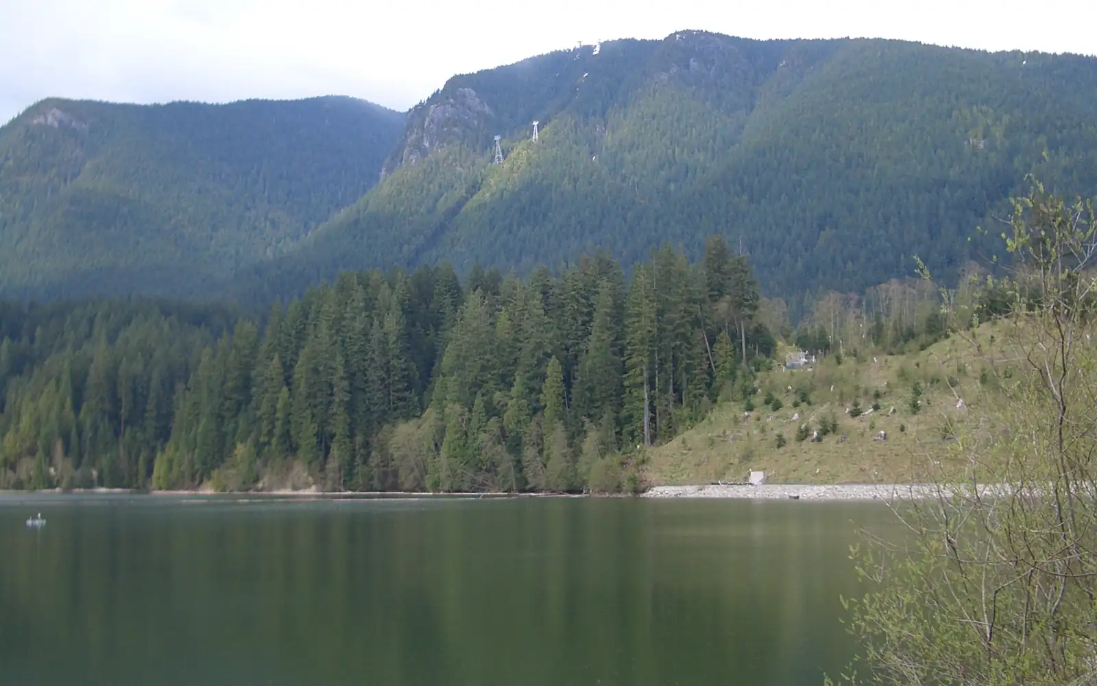
Photo: Vmenkov, Wikimedia Commons, CC BY-SA 3.0
Grouse Woods is in the District of North Vancouver. The District writes the name as Grousewoods and lists it among the neighbourhoods of Upper Capilano, and its street records give the District as the municipality for every street here. On October 11, 2026, most listings left the municipality line blank, so confirm it on the property tax notice for each home.
What Grouse Woods is like
Grouse Woods is the last neighbourhood on the road to Grouse Mountain. Capilano Road ends at Prospect Avenue, near the Cleveland Dam, and Nancy Greene Way continues from that corner for 1.5 km to the parking lots at the lifts. Some homes face Nancy Greene Way. Most stand on Grousewoods Drive, a loop that leaves the main road and returns to it, and on the short lanes, courts and places that branch off. Many street names come from the forest, such as Huckleberry Lane, Swordfern Place, White Pine Lane and Owl Court.
The whole neighbourhood is high above the harbour. Natural Resources Canada's elevation data gives 161 metres above sea level where Nancy Greene Way begins, 224 metres at the south corner of Grousewoods Drive and 293 metres at the north end of the road. Owl Court, near the top of the neighbourhood, is at 266 to 269 metres, and Blueberry Lane, near the bottom, at 200 to 207 metres.
In our view, Grouse Woods suits a buyer whose main reason to move is the mountain: someone who hikes before work, skis with the children after school or wants forest behind the back fence. Every shop is a trip down the hill, and visitors to the mountain use the same main road. A buyer who wants a grocery store within a walk will be happier in Edgemont.
Live from the MLS® system
Homes for sale in Grouse Woods
5 houses, townhouses and duplex homes are listed for sale in Grouse Woods today, checked against the MLS® system within the last hour. Condos and apartments are not shown on this page.


Prices
What a home in Grouse Woods costs
Two kinds of numbers, kept apart. The dots are asking prices of the homes listed in Grouse Woods today, counted on this page. The cards are Greater Vancouver REALTORS benchmark prices for all of North Vancouver, which describe a typical home sold anywhere in North Vancouver.
Asking prices today
Each dot is one home for sale. The dark line marks the middle price.
Detached house
$2,042,000
- One year
- down 6.2%
- Ten years
- up 18.7%
North Vancouver benchmark, Greater Vancouver REALTORS, September 2026
Townhouse
$1,230,400
- One year
- down 4.9%
- Ten years
- up 43.2%
North Vancouver benchmark, Greater Vancouver REALTORS, September 2026
All home types
$1,290,400
- One year
- down 3.9%
- Ten years
- up 16.9%
North Vancouver benchmark, Greater Vancouver REALTORS, September 2026
What the homes are like
Two kinds of homes are for sale in Grouse Woods: detached houses and townhouses. On October 11, 2026, few homes were listed here. Houses made up 60% of them and townhouses 40%, and no duplex homes or condos were for sale in the area. The streets with homes listed that day were Huckleberry Lane, Nancy Greene Way, Owl Court, Deerhorn Lane and White Pine Lane.
The homes are close in age. Of those listed that day, 80% were built in the 1980s and 20% in the 1970s. The typical house was finished in 1980 and had four bedrooms and more than 2,900 square feet of floor space. Expect the room layouts of that period unless an owner has renovated, and ask the seller what has been replaced and in which year.
The townhouses are large. The typical one listed that day dated from the middle of the 1980s and had four bedrooms, the same number as the typical house, with 85% of its floor space. A townhouse is a strata home: you own your unit, you share the land, the roads and the outside of the buildings with your neighbours, and you pay a monthly fee for their upkeep.
Every house listing left the suite line blank on that date, so plan your budget without rent from a suite unless a listing states one. No listing description mentioned a view. In our experience the trees explain that: tall evergreens stand around most lots here.
When the homes were built
Year built of the 5 listings that state it.
- 1970s1
- 1980s4
Bedrooms
Bedrooms in the 5 listings that state it.
- 31
- 43
- 51
The homes listed today have been on the market for 20 days at the middle, counted from each listing date to today. That is how long they have waited so far, which is a different number from how long homes take to sell.
Grouse Woods on the map
- Home for sale
- Public school
- Park
History
How Grouse Woods began
The mountain had its name long before the neighbourhood did. MONOVA, the museum and archives of North Vancouver, writes that a group of settlers reached the summit in 1894 and named the mountain after the blue grouse. Blue Grouse Way, at the south end of the neighbourhood, repeats the name.
MONOVA dates the resort to the fall of 1926, when the Grouse Mountain Chalet and the Grouse Mountain Highway were built. The North Shore Heritage Preservation Society describes that highway as an eight mile toll road. In the society's timeline the log chalet burned down in 1962, and in 1966 the Blue Skyride started running and 900 parking spaces were added. The Skyride's lower station stands at the north end of Nancy Greene Way.
The plan for houses followed in the 1970s. The North Shore News of June 29, 1977 reported that District council had approved a revised housing project planned by Grouse Mountain Resorts Ltd. for what the paper called the Nancy Green Triangle. Council had rejected an earlier version the previous fall after strong opposition from local residents to its density. The approved plan had 245 single-family homes, more than 100 semi-detached homes, each sharing one wall with a neighbour, and 80 townhouses. We read that approval as the start of today's Grouse Woods, because every home listed here on October 11, 2026 was built in the 1970s or 1980s. No source we opened says who chose the name.
The forest above the houses is now a regional park. Metro Vancouver's 2018 plan says the Greater Vancouver Water District bought the land in the 1930s as part of the Capilano watershed, and that Grouse Mountain Regional Park was created on 74 hectares of it in May 2017. The newest lift, the Blue Grouse Gondola, opened to the public on December 12, 2024 and replaced the 1966 Blue Skyride, Global News reported that day.
Daily life
Daily life in Grouse Woods
Grouse Woods has homes, a forested park and bus stops. The map on this page shows one cafe near the area and no grocery store, pharmacy or clinic inside it. Most errands happen in Edgemont Village, where the District lists a grocery store, pharmacies, banks, coffee shops, restaurants, health services and a library. The 232 bus is scheduled to take 8 to 10 minutes from Nancy Greene Way at Grousewoods Drive to Edgemont Boulevard at Highland Boulevard, in the village.
The resort at the top of the road is the other place residents use. In our experience, families here buy season passes and ski after school. Grousewoods Park, on Grousewoods Drive, is listed in the District's park data as a neighbourhood forested park where dogs must be on a leash.
Wild animals are part of life at this edge of the city. The District says skunks, raccoons, coyotes, cougars and bears all live within its borders. It calls cougar sightings rare and adds that cougars have been seen in its neighbourhoods on occasion. Metro Vancouver's plan says the regional park gives black bears and deer a route between the mountain forest and the city. The District's garbage and organics carts lock, and the District warns that an animal can still get into one.
Many visitors come on fine days. Metro Vancouver warns that the Grouse Grind gets crowded on weekends and in summer, and more than three quarters of the people who answered its survey in the summer of 2018 came to the park by car. In our experience, Nancy Greene Way is busiest on sunny summer weekends and on winter days with fresh snow, and the lanes and courts off Grousewoods Drive stay quiet. Visit a home that faces the main road on one of those days before you decide.
Grocery stores
Nearest: Henry's Grocery, 1.3 km away.
Cafes
- Starbucks630 m
Libraries and rec centres
Nearest: Kids Tree Canopy, 1.9 km away.
How far it is
- Downtown Vancouver (Waterfront Station)9.0 km
- Lonsdale Quay and the SeaBus6.4 km
- Lions Gate Hospital5.6 km
- Park Royal shopping centre5.1 km
Places from OpenStreetMap, read October 10, 2026. Distances are in a straight line from the middle of the area, so the trip by road is longer.
Outdoors
Grouse Mountain Regional Park, the Grind and the dam
The trailhead of Grouse Mountain Regional Park is at the north end of Nancy Greene Way, 616 metres past the south corner of Grousewoods Drive by the District's street data. Metro Vancouver lists two steep routes from there to the top. The Grouse Grind is 2.5 km long and climbs 800 metres. The BCMC Route is 2.9 km long and climbs 750 metres. Both are rated challenging, and dogs are banned on both.
Both routes change with the season. In 2026 the Grouse Grind is closed for its yearly maintenance from October 13 to November 10, and the BCMC Route stays open. Metro Vancouver's 2018 plan adds that the Grind is typically closed for safety from November until it is free of snow in spring. The plan describes the BCMC Route as typically open all year, with snow and ice on its upper part in winter.
The Baden-Powell Trail gives an easier walk. The section inside the regional park is 1.1 km long, climbs 150 metres and is rated moderate, and dogs are allowed on a leash. The District's trail data also lists the Grousewoods trail, which runs among the streets, as a beginner route for walking and cycling.
Mackay Creek crosses the neighbourhood, and the District's creek data marks parts of it as home to fish. Northwest of the park lies the Capilano watershed, which Metro Vancouver keeps closed to the public to protect drinking water. Capilano River Regional Park has an entrance at the Cleveland Dam, near the start of Nancy Greene Way. That entrance has washrooms, a picnic area and a viewpoint over Capilano Lake. Metro Vancouver's page says the Capilano River Hatchery closed to the public on October 1, 2026.
Schools
Schools near Grouse Woods
Grouse Woods is in the North Vancouver School District. Montroyal Elementary, on Sonora Drive, is the nearest public elementary school on the map. The district's list of feeder schools places Montroyal with Canyon Heights, Cleveland and Highlands elementary schools in the group that leads to Handsworth Secondary on Handsworth Road. The 232 bus is scheduled to take 3 to 4 minutes from Nancy Greene Way at Grousewoods Drive to Capilano Road at Handsworth Road.
For French immersion, the province's school data shows an early program at Cleveland Elementary on Eldon Road and at Handsworth. The district's list pairs the French immersion programs at Cleveland and at Braemar Elementary with Handsworth as the high school. Braemar, further east on Mahon Avenue, offers early and late French immersion.
The school table on this page gives the distance to each school, public and independent. The nearest school is sometimes a different school from the one that must accept your child, so enter the address of any home you like in the district's school locator before you write an offer.
| School | Type | French programs | Distance |
|---|---|---|---|
Montroyal Elementary 5310 Sonora Dr, North Vancouver, BC | Public, elementary | None listed | 570 m |
Canyon Heights Elementary 4501 Highland Blvd, North Vancouver, BC | Public, elementary | None listed | 1.5 km |
Cleveland Elementary 1255 Eldon Rd, North Vancouver, BC | Public, elementary | Early immersion | 2.4 km |
Braemar Elementary 3600 Mahon Ave, North Vancouver, BC | Public, elementary | Early immersion, Late immersion | 3.0 km |
Handsworth Secondary 1033 Handsworth Rd, North Vancouver, BC | Public, secondary | Early immersion | 1.6 km |
Mountainside Secondary 3365 Mahon Ave, North Vancouver, BC | Public, secondary | None listed | 3.2 km |
Andre-Piolat 380 Kings Rd W, North Vancouver, BC | Public, elementary-secondary | Francophone | 3.5 km |
Holy Trinity School 128 27th St W, North Vancouver, BC | Independent, elementary | None listed | 4.0 km |
St. Anthony's 595 Keith Rd, West Vancouver, BC | Independent, elementary | None listed | 4.5 km |
Cousteau L'ecole Francaise Interna'le 3657 Fromme Rd, North Vancouver, BC | Independent, elementary jr. secondary | Early immersion | 4.7 km |
Your address decides your assigned school, which can differ from the closest one. Check any address with the North Vancouver School District school locator. School list from the BC Ministry of Education, updated October 8, 2026.
Getting around
Getting around
Three bus routes stop on Nancy Greene Way at the two corners of Grousewoods Drive, and all three end at the Skyride. The table on this page counts the weekday trips on each. The 236 goes down Capilano Road and by way of Marine Drive to Lonsdale Quay, where the SeaBus leaves for downtown Vancouver. TransLink's schedule for September 7, 2026 to January 3, 2027 gives it 20 to 31 minutes on weekdays, and 25 minutes for the three buses that leave between 7 and 9 a.m. The last weekday bus to the Quay passes at 12:35 a.m.
The 232 runs through Edgemont Village and along West Queens Road and Lonsdale Avenue to Phibbs Exchange, which takes 36 to 39 minutes for weekday buses that leave between 7 and 9 a.m. The 247 reaches downtown without a change of bus and, in this schedule, runs on weekdays only. Four trips leave Grousewoods Drive at 6:27, 6:48, 7:43 and 8:28 a.m. and take 36 or 37 minutes to West Georgia Street at Burrard Street. Five trips leave Georgia at Burrard between 4:04 and 6:18 p.m. and take 38 or 39 minutes to come home.
Drivers go down Capilano Road to Highway 1, or on to Marine Drive for the Lions Gate Bridge. At rush hour, in our experience, the wait for a bridge decides how long the drive takes. The District's map data marks Nancy Greene Way as a bike route. The road climbs 132 metres between its start and the lifts, so the ride home ends uphill.
Routes that stop in Grouse Woods
Trips on a regular weekday that stop at one of the 7 stops inside the area, from TransLink's published schedule valid to January 3, 2027.
- 236Grouse Mountain/Lonsdale Quay76 trips
- 232Grouse Mountain/Phibbs Exchange68 trips
- 247Grouse Mountain/Downtown10 trips
Before you buy
Things to check in Grouse Woods
Forest edge and wildfire
On October 11, 2026, the District's map data showed Wildfire Hazard areas within 40 metres of all 23 street names in Grouse Woods. Inside such an area, a new or replacement house needs a development permit and a signed report from a qualified wildfire professional, and minor renovations are exempt. Phone a home insurer with the address before you make a firm offer, and ask whether it ever stops selling new policies during a wildfire season.
Creeks and streamside rules
The same data showed Streamside Protection areas within 40 metres of all 23 street names. The District's main test is land within 15 metres of the top of a stream bank, and work there needs a review by its environment staff. Creek Hazard areas, most of them labelled as a potential flood hazard, lay within 40 metres of 15 of the 23 names, among them Grousewoods Drive, Huckleberry Lane, Owl Court and Deerhorn Lane. Search each address on GeoWeb, the District's online property map.
Slopes
Slope Hazard areas lay within 40 metres of 7 of the 23 street names: Blueberry Lane, Deerhorn Lane, Eagle Court, Grousewoods Drive, Owl Court, Sumac Place and Nancy Greene Way. If GeoWeb shows a lot inside one, ask the District's environment staff what that means for the lot, and ask the seller for any engineer's report.
Snow at 200 metres and higher
The points we measured, from Blueberry Lane up to Owl Court, are 200 to 269 metres above sea level. The District aims to make Nancy Greene Way passable within 12 hours after the snow stops and Grousewoods Drive within 48 hours. Every lane, court and place is in its last group, with a target of 96 hours. Ask the seller how the street and the driveway were last winter.
Townhouse strata documents
A strata of five or more homes must get a depreciation report every five years, and the report plans repairs to the shared parts 30 years ahead. Ask for it with the budget and two years of meeting minutes. The District's street records mark the roads inside one group of homes off Nancy Greene Way as private, so ask who pays to repair them and to clear snow.
Homes from the 1970s and 1980s
Every home listed here on October 11, 2026 was built before 1990. Book a full inspection, and ask the age of the roof, the windows, the furnace and the hot water tank. Ask for the permits behind any addition or finished basement.
Buying
Buying a home in Grouse Woods
Make two choices first. One is a house or a townhouse. The other is a home on Nancy Greene Way, close to the bus stops and to the traffic for the mountain, or a home on an inner lane or court. The price dots on this page show today's asking prices. In our experience, few homes are for sale here at one time, so a buyer who wants only this neighbourhood may have to wait for the right one.
Before you make an offer, search the address on GeoWeb for the wildfire, streamside, creek and slope areas described on this page, and get an insurance quote in writing. For a townhouse, read the strata documents with your lawyer or notary. Visit once on a busy weekend.
Gary Paul works with buyers across North Vancouver. Send the form on this page with your budget and whether you want a house or a townhouse, and he will reply with the Grouse Woods homes that match and arrange showings.
Selling
Selling a home in Grouse Woods
On October 11, 2026, few homes were listed in Grouse Woods, so your home may have few others to compete with. In our experience, buyers who visit also tour Canyon Heights and Forest Hills. The cards on this page show how many homes are listed here today and the range of their asking prices.
In our experience, four things set the price of a home here: whether it is a house or a townhouse, how much has been updated since the 1980s, what lies behind the lot, and how close it is to Nancy Greene Way. Before you list, collect the permits for any renovation and print the GeoWeb map for your lot. For a townhouse, ask the strata early for its latest depreciation report, budget and minutes.
Under real estate board rules, sold prices stay off public pages, including this one. Gary Paul can show you recent Grouse Woods sales in private and suggest a list price. Ask for a price review with the form on this page.
Houses listed
3
$1.90M to $2.80M
Townhouses listed
2
$1.10M to $1.82M
Our view
Who buys in Grouse Woods
In our experience, the most common buyer is a family with school-age children who ski, hike or ride bikes together. They are leaving a condo or a smaller townhouse, they want four bedrooms, and they are willing to drive for groceries in exchange for trails at the end of the street.
A second group, in our experience, is owners of larger North Shore houses who want less yard work and choose a townhouse here with the same number of bedrooms. A third group, in our experience, works from home for part of the week and uses the morning 247 bus on office days.
Grouse Woods and the areas next to it
Homes listed for sale today, counted on this page.
| Area | For sale | Middle asking price | Houses, middle price |
|---|---|---|---|
| Grouse Woods | 5 | $1.90M | $2.25M |
| Canyon Heights | 38 | $2.39M | $2.40M |
| Forest Hills | 10 | $3.67M | $3.67M |
| Edgemont | 19 | $2.20M | $2.79M |
| Delbrook | 15 | $2.45M | $2.45M |
Questions about Grouse Woods
Is Grouse Woods in the City or the District of North Vancouver?
Grouse Woods is in the District of North Vancouver, which writes the name as Grousewoods and counts it as a neighbourhood of Upper Capilano. Many listings leave the municipality line blank, so check the property tax notice.
What kind of homes are for sale in Grouse Woods?
Detached houses and townhouses. On October 11, 2026, 60% of the homes listed were houses and 40% were townhouses, all built in the 1970s or 1980s, and both kinds typically had four bedrooms. This page leaves out condos.
How much does a home in Grouse Woods cost?
The price dots on this page mark the asking price of every house and townhouse listed in Grouse Woods today, with the middle price shown. The page also gives the monthly benchmark prices from Greater Vancouver REALTORS for North Vancouver.
When was Grouse Woods built?
The North Shore News of June 29, 1977 reported that District council had approved a plan by Grouse Mountain Resorts Ltd. for 245 houses, more than 100 semi-detached homes and 80 townhouses on land it called the Nancy Green Triangle. Homes listed here on October 11, 2026 dated from the 1970s and 1980s.
Which schools serve Grouse Woods?
Montroyal Elementary on Sonora Drive is the nearest public elementary school, and the North Vancouver School District groups it with Handsworth Secondary. Cleveland Elementary offers early French immersion. Use the district's school locator to confirm which school must accept a child from each address.
How do I get from Grouse Woods to downtown Vancouver by bus?
On weekday mornings the 247 leaves Nancy Greene Way at Grousewoods Drive at 6:27, 6:48, 7:43 and 8:28 a.m. and takes 36 or 37 minutes to West Georgia at Burrard, in TransLink's fall 2026 schedule. At other times the 236 reaches Lonsdale Quay and the SeaBus in 20 to 31 minutes.
Can I walk to the Grouse Grind from Grouse Woods?
Yes. The trailhead is at the north end of Nancy Greene Way, 616 metres past the south corner of Grousewoods Drive. The Grouse Grind is 2.5 km long and climbs 800 metres, and in 2026 it is closed for maintenance from October 13 to November 10.
Does Grouse Woods get snow?
In our experience, yes, on more days than the streets near the harbour, because the streets we measured are 200 to 269 metres above sea level. The District clears Nancy Greene Way first, Grousewoods Drive second and the lanes and courts last.
Is there a wildfire risk in Grouse Woods?
The homes stand at the forest edge. On October 11, 2026, the District's map data showed Wildfire Hazard areas within 40 metres of all 23 street names here. Ask a home insurer for a quote before you make a firm offer.
Are there bears in Grouse Woods?
Yes, at times. The District of North Vancouver says bears and cougars live within its borders, and Metro Vancouver's plan says the regional park gives black bears a route between the mountain and the city. Keep carts locked, and report a sighting at 604-990-2327.
Is traffic to Grouse Mountain a problem for residents?
In our experience, Nancy Greene Way is busy on sunny summer weekends and on winter days with fresh snow, and the inner lanes stay quiet. Metro Vancouver says more than three quarters of the people who answered its 2018 survey reached the park by car.
How do I find out what my Grouse Woods home is worth?
Ask for a price review with the form on this page. Gary Paul will compare your home with recent sales of similar homes nearby and with the homes for sale now, and explain the list price he would suggest.
Who should I talk to about buying or selling in Grouse Woods?
Gary Paul, REALTOR®, Personal Real Estate Corporation, with Grand Central Realty, is the MultiLiving agent for North Vancouver. Phone him at 778-828-7476 or send the form on this page, and say whether you want a house or a townhouse.
Sources
Written content checked October 11, 2026. Listing numbers counted from the MLS® system on October 12, 2026.
- Upper Capilano (the community and its neighbourhoods), District of North Vancouver. Read October 11, 2026.
- Public map service (streets, municipality, parks, dogs, trails, creeks, bike routes, snow routes and hazard areas), District of North Vancouver. Read October 11, 2026.
- Elevation service, Canadian Digital Elevation Model (heights at street corners), Natural Resources Canada. Read October 11, 2026.
- A Century of Grouse Mountain Resort, MONOVA: Museum and Archives of North Vancouver. Read October 11, 2026.
- Grouse Mountain Chair Lift Adventure (February 18, 2023), North Shore Heritage Preservation Society. Read October 11, 2026.
- North Shore News, June 29, 1977, page 8: "Go-ahead for Grouse", North Shore News, through North Shore Digital Libraries. Read October 11, 2026.
- Grouse Mountain's new gondola opens (December 12, 2024), Global News. Read October 11, 2026.
- Grouse Mountain Regional Park (trails, closures, parking), Metro Vancouver. Read October 11, 2026.
- Grouse Mountain Regional Park Management Plan (2018), Metro Vancouver. Read October 11, 2026.
- Capilano River Regional Park, Metro Vancouver. Read October 11, 2026.
- Living safely with bears and other wildlife, District of North Vancouver. Read October 11, 2026.
- Edgemont Village (businesses in the village), District of North Vancouver. Read October 11, 2026.
- Wildfire Hazard Development Permit Area: frequently asked questions, District of North Vancouver. Read October 11, 2026.
- Streamside Protection Development Permit Area: frequently asked questions (2024), District of North Vancouver. Read October 11, 2026.
- Preparing for and removing snow, District of North Vancouver. Read October 11, 2026.
- Families of Schools (feeder schools), North Vancouver School District. Read October 11, 2026.
- TransLink schedule data (GTFS), in effect September 7, 2026 to January 3, 2027, TransLink. Read October 11, 2026.
- Strata depreciation report requirements (published November 12, 2025), Government of British Columbia. Read October 11, 2026.
- MLS® Home Price Index, September 2026 stats package, Greater Vancouver REALTORS. Read October 9, 2026.
- K-12 school locations (school names, addresses and programs), BC Ministry of Education and Child Care, through the BC Data Catalogue. Read October 9, 2026.
- Places, parks and shops, OpenStreetMap contributors (Open Database License). Read October 9, 2026.
- Bus, SeaBus and train schedules (GTFS feed 26SEP_20261009), TransLink. Read October 9, 2026.
General information only. The prices, benchmarks, strata rules, tax and fee figures, lease terms, permit rules and school details on this page are based on the sources and dates listed above. They are not financial, mortgage, tax or legal advice, and not a guarantee of any outcome. Prices, tax rates, fees, municipal rules and school catchments change. Before you buy or sell, confirm each one with its source and speak with a licensed REALTOR®, a mortgage broker and a real estate lawyer.