West Vancouver neighbourhood guide
Bayridge, West Vancouver: Homes for Sale, Prices, Schools and Daily Life
Bayridge is a hillside neighbourhood of detached houses in West Vancouver, above Sandy Cove and below the Upper Levels Highway. On October 11, 2026, 64% of the houses listed here dated from the 1960s and 71% of the listings mentioned a view. It suits a buyer who wants a view and a large yard, and who will drive or take the bus to Caulfeild Village or Dundarave for shopping.
For sale now
14
houses, townhouses, duplexes
Asking prices
$1.55M to $8.88M
Middle asking price
$2.55M
West Vancouver detached benchmark
$2.82M
September 2026, GVR
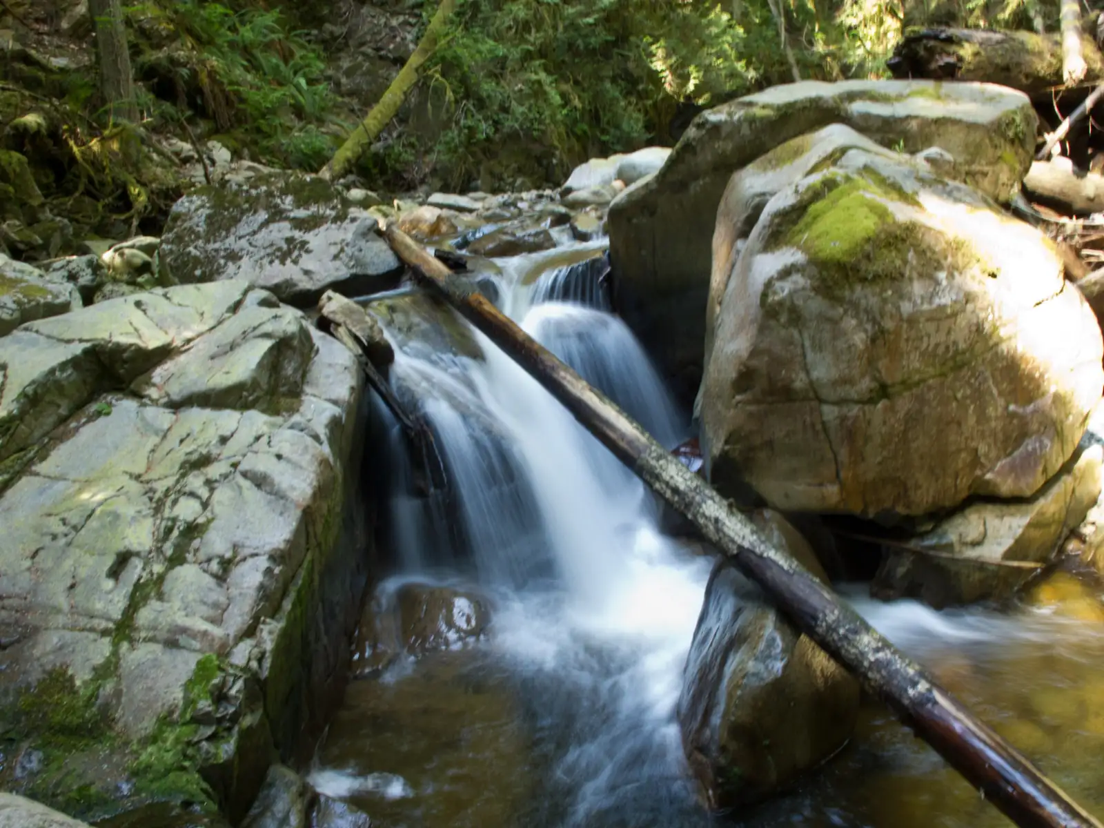
Photo: Andrew Prost, Wikimedia Commons, CC BY-SA 2.0
Bayridge is in the District of West Vancouver. The West Vancouver Archives records it as a neighbourhood of the District, directly north of Sandy Cove. On October 11, 2026, 36% of the listings here named West Vancouver on the municipality line and the others left the line blank.
What Bayridge is like
The West Vancouver Archives describes Bayridge as the land from Bayridge Avenue in the east to Cypress Creek in the west, and from the railway line in the south up to the Upper Levels Highway. Sandy Cove is the neighbourhood below it, between the tracks and the water.
Bayridge Avenue is the main street. It begins at the west end of Mathers Avenue, passes beside McKechnie Park and crosses the hillside to Burkehill Road. Southridge Avenue and Ripple Road climb from it to Westridge Avenue, which runs beside the highway. Short side streets such as Viewridge Place and Bayridge Court branch off.
Every street is on a slope that rises from the railway to the highway and looks south over the water. Walk or drive from the bottom of Sharon Drive up to Westridge Avenue to see how steep it is. On October 11, 2026, 71% of the listing descriptions mentioned a view.
In our view, Bayridge suits a buyer who wants a house on a large lot with a view of the water and who is content to drive for groceries. A buyer who wants level streets, sidewalks and a cafe within a short walk will be happier in Dundarave or Ambleside.
Live from the MLS® system
Homes for sale in Bayridge
14 houses, townhouses and duplex homes are listed for sale in Bayridge today, checked against the MLS® system within the last hour. Condos and apartments are not shown on this page.


.jpg)
Prices
What a home in Bayridge costs
Two kinds of numbers, kept apart. The dots are asking prices of the homes listed in Bayridge today, counted on this page. The cards are Greater Vancouver REALTORS benchmark prices for all of West Vancouver, which describe a typical home sold anywhere in West Vancouver.
Asking prices today
Each dot is one home for sale. The dark line marks the middle price.
Detached house
$2,822,900
- One year
- down 9.9%
- Ten years
- down 21.9%
West Vancouver benchmark, Greater Vancouver REALTORS, September 2026
All home types
$2,244,700
- One year
- down 7.4%
- Ten years
- down 26.7%
West Vancouver benchmark, Greater Vancouver REALTORS, September 2026
Greater Vancouver REALTORS published no West Vancouver townhouse benchmark in its September 2026 report, so none is shown.
What the homes are like
Every home this page listed in Bayridge on October 11, 2026 was a detached house. Townhouses, duplex homes and condos were absent from the list that day. Houses were for sale on Bayridge Avenue, Southridge Avenue, Westridge Avenue, Viewridge Place, Bayridge Place, Ripple Road, Ripple Place and Burkehill Place.
Most of the houses were built in the 1960s. That decade accounted for 64% of the houses listed that day, and the middle year of construction was 1966. Another 14% were finished in the 2020s, and the rest were spread across three other decades. In our experience, a buyer here chooses between a 1960s house in original condition, a 1960s house that has been updated, and a new house on one of the old lots.
The lots are large. The middle lot that day was bigger than one third of an acre, which is 14,520 square feet. The middle house had more than 3,200 square feet of floor space and four or five bedrooms.
Suites were uncommon in the listings. Half of them said the house had no suite, 43% left the suite line blank, and 7% stated a suite and called it unauthorized, which means the District has not approved it. A family that plans to share a house between two generations should ask how the lower floor is laid out before a first visit.
When the homes were built
Year built of the 14 listings that state it.
- Before 19601
- 1960s9
- 1970s1
- 2010s1
- 2020 and later2
Bedrooms
Bedrooms in the 14 listings that state it.
- 33
- 44
- 57
Suites: of the 8 houses for sale whose listing states it, 0 list a legal or licensed suite, 1 list a suite the municipality has not approved, and 7 list none. The rest leave the field blank.
The homes listed today have been on the market for 53 days at the middle, counted from each listing date to today. That is how long they have waited so far, which is a different number from how long homes take to sell.
Bayridge on the map
- Home for sale
- Public school
- Park
History
How Bayridge began
The name Bayridge came from the people who created the subdivision. The archives' record says the developers selected it on the advice of their public relations advisers, and cites a 2004 book of place names by the West Vancouver Historical Society. The record leaves the developers unnamed.
The street names date from 1957. According to the archives, Bayridge Avenue and Burkehill Road were both named under Street Naming Bylaw No. 1603 of that year. The lower part of Burkehill Road, from Marine Drive to Morgan Crescent, had been called Ferndale Avenue. It was renamed when the Burkehill subdivision was developed in the 1950s.
The highway along the top of Bayridge belongs to the same years. A car ferry began to sail from Horseshoe Bay in 1948, and Marine Drive, then the only road into the western part of the municipality, became overloaded, the archives records. The province built a new road in 1955 and 1956 across the higher ground that people already called the Upper Levels.
Houses followed in the early 1960s, and the District later recorded three of them. The Ray House on Westridge Avenue was designed in 1961 by the architect Daniel Evan White. A statement written for the District in February 2015 describes a house on three levels, built around the natural bedrock of a 23,000 square foot lot that looks south. The District added it to its Community Heritage Register on April 27, 2015. The archives also holds files on two Bayridge Avenue houses studied for the District's 1994 Survey of Significant Architecture. Hamish W.F. McIntyre designed one, built in 1962, and Fred T. Hollingsworth and Barry Downs designed the other, built in 1964. We have not checked which of these houses stand today.
Daily life
Daily life in Bayridge
Bayridge has houses, parks and bus stops. The map data on this page shows no grocery store, cafe, pharmacy or clinic inside the area. The nearest supermarket in the tables is at Caulfeild Village, the shopping centre on Headland Drive to the west, where OpenStreetMap also shows a pharmacy, a clinic and a post office.
The 253 bus links the upper streets to that shopping centre. TransLink's schedule for September 7, 2026 to January 3, 2027 gives it three to six minutes from Westridge Avenue at Southridge Avenue to the last stop, beside the shops. For Dundarave, the 250 bus on Marine Drive is given five to six minutes from Rose Crescent to 25th Street, and 16 to 17 minutes to Park Royal.
Trains pass along the bottom of the neighbourhood. Sharon Drive and Burkehill Road are the two roads from Bayridge down to Marine Drive, and each one crosses the track at a public crossing. Transport Canada's inventory of railway crossings, built from data as of December 5, 2022, lists five trains a day at both, with a top train speed of 20 miles per hour, which is 32 kilometres per hour.
Plan your walking routes. OpenStreetMap marks parts of Bayridge Avenue, Southridge Avenue, Ripple Road and Westridge Avenue as having no sidewalk, and shows one sidewalk, 604 metres long, beside Westridge Avenue, starting at the highway ramps. Walk from any house you like to its bus stop before you decide.
Grocery stores
Nearest: Safeway, 2.0 km away.
Cafes
Nearest: Delany's Coffee House, 3.7 km away.
Libraries and rec centres
Nearest: Gleneagles Community Centre, 4.2 km away.
How far it is
- Downtown Vancouver (Waterfront Station)10.6 km
- Lonsdale Quay and the SeaBus11.1 km
- Lions Gate Hospital11.9 km
- Park Royal shopping centre6.8 km
Places from OpenStreetMap, read October 10, 2026. Distances are in a straight line from the middle of the area, so the trip by road is longer.
Outdoors
Westridge Park, Godman Creek and Sandy Cove
Westridge Park is a strip of forest between Westridge Avenue and the highway. OpenStreetMap shows dirt paths in it and two footbridges over Godman Creek. The park has been there since at least 1967: the archives holds an air photo dated to March 30 of that year whose title names it.
Godman Creek runs through the middle of Bayridge. The province's place name office adopted the name on July 28, 1945 and records that the creek flows southwest into Sandy Cove. On OpenStreetMap it passes in pipes under Westridge Avenue, Viewridge Place and Bayridge Avenue on its way down. Sharon Park is a small park on the creek at Sharon Place, above the tracks.
The beach is downhill. Sharon Drive leads across the tracks to Marine Drive, and the tables on this page list Sandy Cove Park and Sandy Cove Beach on the water side of that road. The District keeps dogs off its beaches except where a sign allows them.
For a dog that needs to run, the District's list of 14 off-leash areas includes two near Bayridge. McKechnie Park is beside the east end of Bayridge Avenue. Cypress Falls Park is a District park on Cypress Creek, north of the highway, where the District asks owners to leash dogs near fast-moving water. On OpenStreetMap, Almondel Road leads toward it under the highway bridge at Cypress Creek.
Schools
Schools near Bayridge
Bayridge is in West Vancouver Schools, which is School District 45. All of the public schools in the table on this page are outside the neighbourhood.
Cypress Park Primary is the nearest. It is on Marine Drive beside the foot of Burkehill Road and teaches Kindergarten to Grade 3 in the International Baccalaureate Primary Years Programme. The district says all of its students have the chance to go on to West Bay Elementary, which offers the same program to Grade 7. West Bay Elementary is on Thompson Place, east of Bayridge, and Caulfeild Elementary is on Keith Road to the west.
Rockridge Secondary teaches Grades 8 to 12 on Headland Drive, across from Caulfeild Village. The district says every student in Grades 8 to 10 there takes the International Baccalaureate Middle Years Programme and that Advanced Placement courses are offered in Grades 11 and 12. The 253 bus ends at Caulfeild Drive and Headland Drive, on the school's street. West Vancouver Secondary is the other public high school in the table.
Mulgrave School and Collingwood School are the nearest independent schools. The public school that must take a child depends on the home address. The district's boundary map would not open for us on October 11, 2026. Enter each address you are considering in the district's school locator.
| School | Type | French programs | Distance |
|---|---|---|---|
Cypress Park Primary 4355 Marine Dr, West Vancouver, BC | Public, elementary | None listed | 900 m |
Caulfeild Elementary 4685 Keith Rd, West Vancouver, BC | Public, elementary | None listed | 1.7 km |
West Bay Elementary 3175 Thompson Pl, West Vancouver, BC | Public, elementary | None listed | 1.8 km |
Eagle Harbour Montessori 5575 Marine Dr, West Vancouver, BC | Public, elementary | None listed | 2.5 km |
Rockridge Secondary 5350 Headland Dr, West Vancouver, BC | Public, secondary | None listed | 1.9 km |
West Vancouver Secondary 1750 Mathers Ave, West Vancouver, BC | Public, secondary | None listed | 4.8 km |
Mulgrave School 2330 Cypress Bowl Lane, West Vancouver, BC | Independent, elementary-secondary | None listed | 2.5 km |
Collingwood School 70 Morven Dr, West Vancouver, BC | Independent, elementary-secondary | None listed | 3.1 km |
St. Anthony's 595 Keith Rd, West Vancouver, BC | Independent, elementary | None listed | 7.1 km |
Bodwell High School 955 Harbourside Drive, North Vancouver, BC | Independent, secondary | None listed | 9.8 km |
Your address decides your assigned school, which can differ from the closest one. Check any address with the West Vancouver Schools school locator. School list from the BC Ministry of Education, updated October 8, 2026.
Getting around
Getting around
Exit 7 of the Trans-Canada Highway is at the east end of Westridge Avenue. OpenStreetMap shows the exit signed for Westmount Road and Westridge Avenue, with ramps onto the highway toward Vancouver and toward Horseshoe Bay. In our experience, most drivers in Bayridge use this exit for trips to the Lions Gate Bridge and the ferry.
Two roads lead down to Marine Drive. On OpenStreetMap, Sharon Drive is 316 metres long, and Burkehill Road measures 670 metres between Marine Drive and Bayridge Avenue. Mathers Avenue, a third way out, continues east from the end of Bayridge Avenue.
The 253 bus serves the upper streets in one direction. It comes from Park Royal through Dundarave, climbs by Westmount Road, and runs west on Westridge Avenue, Ripple Road and Almondel Road to Caulfeild Village. On weekdays the first bus passes Westridge Avenue at Southridge Avenue at 6:29 a.m. and the last at 10:40 p.m. The schedule gives 15 to 19 minutes from Park Royal, and 41 minutes from West Georgia Street at Richards Street for the seven buses that leave downtown between 3:55 and 6:55 p.m.
Toward Vancouver in the morning there are two choices. The schedule sends each 253 back toward Park Royal after it reaches Caulfeild Village. Four of those buses pass Westridge Avenue between 6:29 and 7:57 a.m. and reach West Georgia Street at Burrard Street 46 to 48 minutes later. Ask the driver whether you may stay on board at the turn. The other choice is to walk down to Marine Drive for the 250, which is given 32 to 36 minutes from Rose Crescent to the same stop on buses that leave between 7 and 9 a.m.
Routes that stop in Bayridge
Trips on a regular weekday that stop at one of the 9 stops inside the area, from TransLink's published schedule valid to January 3, 2027.
- 250Horseshoe Bay/Dundarave/Vancouver95 trips
- 253Caulfeild/Vancouver/Park Royal48 trips
Before you buy
Things to check in Bayridge
Driveways, stairs and steep lots
The District's community plan uses two measures for what it calls difficult terrain: ground steeper than 35%, and a driveway that cannot be built at less than 20%. Those guidelines apply when land is divided into new lots, and they give any buyer two numbers to compare a lot against. Ask for the slope of the driveway, drive it yourself in the rain, and have an inspector look at the outdoor stairs and at any wall that holds back soil.
Trees and the view
West Vancouver's Tree Bylaw limits what an owner may cut. Its list of protected trees includes every tree on District land, boulevards included, and arbutus, Garry oak, Pacific yew, Pacific dogwood and yellow cedar with a trunk wider than 20 centimetres. Cutting a protected tree needs a permit, and the bylaw sets a fine of up to $10,000 on conviction, counted for each tree. The District may issue a permit for pruning that a tree expert recommends, and the bylaw names pruning for a view among the accepted kinds.
Godman Creek
The community plan protects the land beside creeks in existing neighbourhoods. Work more than 15 metres from the top of a creek bank is exempt from the creek permit. Inside 15 metres, a new building or new paving should be at least as far from the creek as what is there now. For a creek that runs all year, the strip within 5 metres of the top of the bank is to stay free of both. Ask the seller whether Godman Creek or one of its pipes crosses the lot.
The forest edge
The community plan's wildfire permit area is shaded yellow on a District map. We could not read that map for single addresses, so ask the District about each lot. Inside the area, the guidelines ask for a new house to stand at least 10 metres from the edge of the forest where that is possible, with a fire-resistant roof and screens over the vents. Around the house, hedges are kept below 2 metres, and planting cedar or juniper hedges is discouraged. Phone a home insurer with the address before your offer is final.
Trains below, highway above
The railway passes below the lower streets and the highway passes above the upper ones. By the centre lines on OpenStreetMap, Burkeridge Place and Sharon Place are within 30 metres of the track, and Westridge Avenue comes within 25 metres of the highway. Visit at rush hour and again in the evening. Listen from the bedrooms and from the garden with the windows open.
Houses from the 1960s
On October 11, 2026, 64% of the houses listed here had been built in the 1960s. Book a full inspection and ask about the age of the roof, the wiring, the plumbing and the drains. Ask the District whether the house is on its Community Heritage Register. The District says a listing there leaves an owner free to alter the house within the usual laws, and makes the property eligible for incentives, such as extra floor space, under a heritage agreement with the District.
Buying
Buying a home in Bayridge
Start with height on the hill. In our experience, Westridge Avenue and Southridge Avenue have the widest views and the shortest drive to exit 7, and they hear the highway. The lower part of Bayridge Avenue is closer to Sandy Cove and to the 250 bus, and nearer the tracks. The price dots on this page show today's asking prices.
Then judge the house and the lot as two separate things. For an older house, make your offer depend on an inspection. For any house, ask for a survey, the District's record of permits and any report on the slope, the creek or the trees.
Test the daily trips before you offer. Drive to Caulfeild Village and to exit 7, walk to the nearest bus stop, and cross the tracks on Sharon Drive or Burkehill Road at the hour you would leave for work.
Michael Lee works with buyers in Bayridge and across West Vancouver. Send the form on this page with your budget, the bedrooms you need and how much the view matters to you. He will reply with the homes that match and arrange showings.
Selling
Selling a home in Bayridge
A buyer who comes to see your Bayridge house has usually looked at every other house on this page. In our experience, the same buyer also tours Sandy Cove, Westmount and Rockridge. The cards on this page count the Bayridge homes for sale today.
In our experience, buyers in Bayridge look at five things: the view and what could block it, the slope of the driveway, the size of the usable yard, how much of a 1960s house has been renewed, and the distance from the highway or the tracks. Before you list, gather a survey, the District's permit records and any letter or report on trees, the creek, the slope or a heritage listing.
Real estate board rules keep sold prices off public pages such as this one. Michael Lee can show you recent Bayridge sales in a private price review and explain a list price. The form on this page is the way to ask for one.
Houses listed
14
$1.55M to $8.88M
Our view
Who buys in Bayridge
In our experience, the most common buyer in Bayridge is a family with school-age children moving from a smaller house or a condo elsewhere in Metro Vancouver. They want four or more bedrooms, a yard and a view, and they accept a drive to the shops.
A second group, in our experience, buys an older house for its lot and its view and plans to update it over time. A third is couples from larger West Vancouver properties who want less house to look after and the highway close by for trips to the ferry.
Bayridge and the areas next to it
Homes listed for sale today, counted on this page.
| Area | For sale | Middle asking price | Houses, middle price |
|---|---|---|---|
| Bayridge | 14 | $2.55M | $2.55M |
| Sandy Cove | 4 | $4.87M | $4.87M |
| West Bay | 12 | $6.40M | $6.40M |
| Westmount | 8 | $3.97M | $3.97M |
| Cypress | 31 | $3.20M | $2.98M |
| Rockridge | 4 | $4.50M | $4.50M |
Questions about Bayridge
Is Bayridge part of West Vancouver?
Yes. Bayridge is a neighbourhood in the District of West Vancouver. The West Vancouver Archives describes it as the land from Bayridge Avenue west to Cypress Creek, between the railway line and the Upper Levels Highway, directly north of Sandy Cove.
What kind of homes are for sale in Bayridge?
On October 11, 2026, every home this page listed in Bayridge was a detached house. The middle house had more than 3,200 square feet of floor space on a lot bigger than one third of an acre, and 64% of the houses dated from the 1960s.
How much does a house in Bayridge cost?
The price dots on this page mark the asking price of each Bayridge house for sale today, with the middle price shown. The page also gives the West Vancouver benchmark price for a detached house, which Greater Vancouver REALTORS publishes every month.
How did Bayridge get its name?
The West Vancouver Archives records that the developers of the subdivision selected the name Bayridge on the advice of their public relations advisers. Bayridge Avenue was named for the neighbourhood under a street naming bylaw of 1957.
Which schools serve Bayridge?
Bayridge is in West Vancouver Schools (School District 45). Cypress Park Primary on Marine Drive teaches Kindergarten to Grade 3, West Bay Elementary and Caulfeild Elementary teach to Grade 7, and Rockridge Secondary teaches Grades 8 to 12. Use the district's school locator to confirm the school for an address.
How long is the bus ride from Bayridge to downtown Vancouver?
TransLink's fall 2026 schedule gives the 250 bus 32 to 36 minutes from Marine Drive at Rose Crescent to West Georgia Street at Burrard Street, for weekday buses that leave between 7 and 9 a.m. From Westridge Avenue, four morning 253 buses take 46 to 48 minutes by way of Caulfeild Village.
Where do people in Bayridge shop?
The nearest supermarket is at Caulfeild Village on Headland Drive, three to six minutes away on the 253 bus from Westridge Avenue. Dundarave is five to six minutes from Marine Drive at Rose Crescent on the 250 bus. Bayridge itself has no shops on the map.
Do trains run through Bayridge?
A railway runs along the bottom edge of Bayridge. Transport Canada's inventory of crossings, built from data as of December 5, 2022, lists five trains a day at the public crossings on Sharon Drive and Burkehill Road, at no more than 20 miles per hour.
Can I cut trees to open a view in Bayridge?
Ask the District before you cut. Its Tree Bylaw protects every tree on District land and five named kinds, among them arbutus and Pacific dogwood, once the trunk is wider than 20 centimetres. Cutting a protected tree needs a permit, and the fine can reach $10,000 for each tree.
Do Bayridge houses have suites?
Few listings state one. On October 11, 2026, half of the Bayridge listings said the house had no suite, 43% left the line blank and 7% stated a suite that the listing called unauthorized. Ask the District what its records show before you rely on rent.
Is Bayridge good for families?
In our view, yes, for a family that drives. The houses are large, the lots have yards, and a primary school, two elementary schools and a high school are a short trip away. The drawbacks are steep streets, few sidewalks and the lack of shops.
How do I find out what my Bayridge home is worth?
Ask for a price review with the form on this page. Michael Lee will compare your view, your lot and the condition of your house with recent Bayridge sales and with the houses for sale now. Sold prices are shared with you in private, as real estate board rules require.
Who should I talk to about buying or selling in Bayridge?
The MultiLiving agent for West Vancouver is Michael Lee, REALTOR®, Personal Real Estate Corporation, with eXp Realty. Phone him at 604-803-9863 or send the form on this page, and say whether you want to buy, to sell or to do both.
Sources
Written content checked October 11, 2026. Listing numbers counted from the MLS® system on October 12, 2026.
- Bayridge (West Vancouver, B.C.): place record with boundaries and origin note (archived copy of September 29, 2023), West Vancouver Archives. Read October 11, 2026.
- Bayridge Avenue (West Vancouver, B.C.): place record, named under Street Naming Bylaw No. 1603, 1957 (archived copy of April 18, 2024), West Vancouver Archives. Read October 11, 2026.
- Burkehill Road (West Vancouver, B.C.): place record, formerly Ferndale Avenue (archived copy of April 20, 2024), West Vancouver Archives. Read October 11, 2026.
- Upper Levels Highway (B.C.): place record with origin note (archived copy of May 7, 2024), West Vancouver Archives. Read October 11, 2026.
- Archive records tagged Bayridge: files on two Bayridge Avenue houses (1962 and 1964) and the 1967 air photo that names Westridge Park (archived copy of May 4, 2024), West Vancouver Archives. Read October 11, 2026.
- Community Heritage Register: what a listing means, and the Ray House entry, listed April 27, 2015 (archived copy of July 14, 2026), District of West Vancouver. Read October 11, 2026.
- Statement of Significance: Ray House, 3956 Westridge Avenue, by Donald Luxton & Associates, February 2015 (the District's file is no longer online; Internet Archive copy of June 9, 2016), District of West Vancouver. Read October 11, 2026.
- Official Community Plan, Schedule ii: Area-Specific Policies and Guidelines (wildfire NE 1, difficult terrain NE 6, creeks NE 13; file last modified February 4, 2025), District of West Vancouver. Read October 11, 2026.
- Tree Bylaw No. 4892, 2016, consolidated to Amendment Bylaw No. 5373, 2025 (file last modified December 18, 2025), District of West Vancouver. Read October 11, 2026.
- Dogs in parks: off-leash areas, leash rules and beaches (archived copy of August 1, 2025), District of West Vancouver. Read October 11, 2026.
- Godman Creek: official name and location (flows southwest into Sandy Cove), BC Geographical Names, Government of British Columbia. Read October 11, 2026.
- Cypress Park (IB PYP): grades, program and the link to West Bay Elementary, West Vancouver Schools. Read October 11, 2026.
- West Bay (IB PYP): grades and program, West Vancouver Schools. Read October 11, 2026.
- Rockridge: location, grades and programs, West Vancouver Schools. Read October 11, 2026.
- Secondary schools (school locator and boundary map links), West Vancouver Schools. Read October 11, 2026.
- Grade Crossings Inventory, 2023 update (data as of December 5, 2022): Sharon Drive and Burkehill Road crossings, Squamish subdivision, Transport Canada, through the Government of Canada open data portal. Read October 11, 2026.
- TransLink schedule data (GTFS), in effect September 7, 2026 to January 3, 2027, TransLink. Read October 11, 2026.
- MLS® Home Price Index, September 2026 stats package, Greater Vancouver REALTORS. Read October 9, 2026.
- K-12 school locations (school names, addresses and programs), BC Ministry of Education and Child Care, through the BC Data Catalogue. Read October 9, 2026.
- Places, parks and shops, OpenStreetMap contributors (Open Database License). Read October 9, 2026.
- Bus, SeaBus and train schedules (GTFS feed 26SEP_20261009), TransLink. Read October 9, 2026.
General information only. The prices, benchmarks, strata rules, tax and fee figures, lease terms, permit rules and school details on this page are based on the sources and dates listed above. They are not financial, mortgage, tax or legal advice, and not a guarantee of any outcome. Prices, tax rates, fees, municipal rules and school catchments change. Before you buy or sell, confirm each one with its source and speak with a licensed REALTOR®, a mortgage broker and a real estate lawyer.