North Vancouver neighbourhood guide
Princess Park, North Vancouver: Homes for Sale, Prices, Schools and Daily Life
Princess Park is a small residential area in the District of North Vancouver, between Upper Lonsdale and Lynn Valley. Its streets surround a forest park of 16.7 hectares where Hastings Creek runs. Most homes for sale are detached houses from the 1960s and 1970s, with some townhouses, and the nearest shops are in Lynn Valley and on Lonsdale Avenue.
For sale now
6
houses, townhouses, duplexes
Asking prices
$1.27M to $2.70M
Middle asking price
$2.05M
North Vancouver detached benchmark
$2.04M
September 2026, GVR
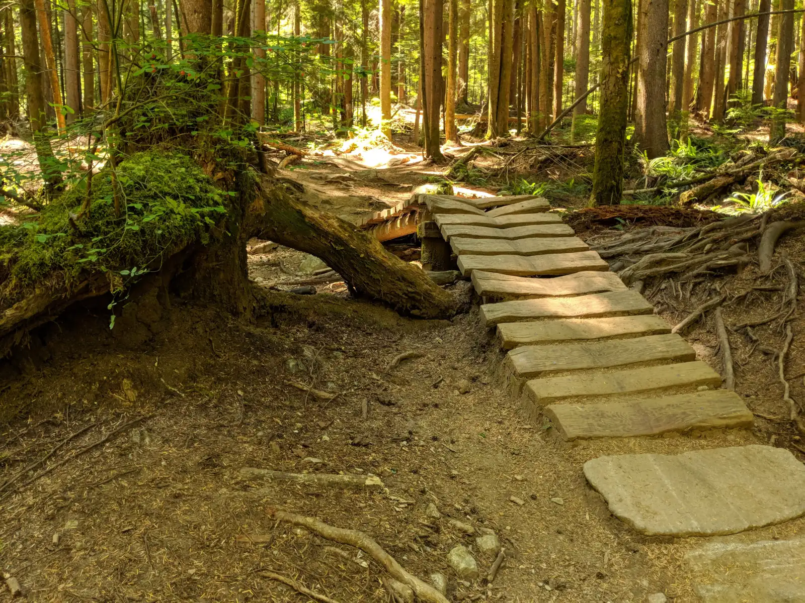
Photo: Shaundd, Wikimedia Commons, CC BY-SA 4.0
Princess Park is in the District of North Vancouver. On October 11, 2026, the District's boundary data returned the District for the middle of the area, and its street data marked the City of North Vancouver along one side of East 29th Street for the blocks numbered 100 to 799. Most listings here leave the municipality line blank and the others name the District, so read it on the property tax notice for each home.
What Princess Park is like
The area takes its name from the District park at its centre. Princess Avenue runs north from East 29th Street, passes the west side of the park and ends at East Braemar Road. Many streets beside it carry royal names: Regent Avenue, Royal Avenue, Duchess Avenue, Regal Crescent, East Kings Road, East Queens Road and East Windsor Road. East of the park, Frederick Road and Hendecourt Road lead toward Argyle Secondary and Lynn Valley.
The streets stand higher than both of the shopping streets a resident uses. Natural Resources Canada's elevation data gives 204 metres above sea level for Princess Avenue at East 29th Street, 226 metres at East Kings Road, 236 metres at Wellington Drive and 274 metres at East Braemar Road. Lonsdale Avenue at East 29th Street is at 161 metres, and Lynn Valley Road at East 29th Street is at 143 metres. Errands start downhill in either direction, and the trip home is a climb.
Princess Park is a small area, and few homes are listed here at one time. In our view, it suits a buyer who wants a detached house on a quiet street with a forest park a short walk away. The map on this page shows no grocery store, cafe or pharmacy inside the area. A buyer who wants more homes to compare should also open the Upper Lonsdale and Lynn Valley pages, which list more.
Live from the MLS® system
Homes for sale in Princess Park
6 houses, townhouses and duplex homes are listed for sale in Princess Park today, checked against the MLS® system within the last hour. Condos and apartments are not shown on this page.


Prices
What a home in Princess Park costs
Two kinds of numbers, kept apart. The dots are asking prices of the homes listed in Princess Park today, counted on this page. The cards are Greater Vancouver REALTORS benchmark prices for all of North Vancouver, which describe a typical home sold anywhere in North Vancouver.
Asking prices today
Each dot is one home for sale. The dark line marks the middle price.
Detached house
$2,042,000
- One year
- down 6.2%
- Ten years
- up 18.7%
North Vancouver benchmark, Greater Vancouver REALTORS, September 2026
Townhouse
$1,230,400
- One year
- down 4.9%
- Ten years
- up 43.2%
North Vancouver benchmark, Greater Vancouver REALTORS, September 2026
All home types
$1,290,400
- One year
- down 3.9%
- Ten years
- up 16.9%
North Vancouver benchmark, Greater Vancouver REALTORS, September 2026
What the homes are like
Few homes were for sale in Princess Park on October 11, 2026, so each share below moves when one home is listed or sold. On that date, two thirds of the homes this page counts were detached houses and one third were townhouses. Some condos were also listed in the area, and this page leaves condos out.
The houses listed that day were large enough for a family. The typical one had been finished in 1968 and had five bedrooms. Two thirds of all the homes listed dated from the 1970s and the others from the 1960s. Streets with homes listed were East Kings Road, Hendecourt Road, Regent Avenue, Princess Avenue, Royal Avenue and Frederick Road.
Half of the house listings stated a suite, and each of those used the word unauthorized, which means the District has no approval on file for it. The other half left the suite line blank. One listing in six said the home had a view.
The townhouses listed that day dated from the middle of the 1970s, and the typical one had four bedrooms. A townhouse is a strata home: you own your unit, and you share the land and the outside of the buildings with the other owners through a monthly fee. Ask for the strata's budget and the minutes of its meetings before you write an offer.
When the homes were built
Year built of the 6 listings that state it.
- 1960s2
- 1970s4
Bedrooms
Bedrooms in the 6 listings that state it.
- 31
- 42
- 52
- 6 or more1
The homes listed today have been on the market for 37 days at the middle, counted from each listing date to today. That is how long they have waited so far, which is a different number from how long homes take to sell.
Princess Park on the map
- Home for sale
- Public school
- Park
History
From a logging pond to a forest park
The park began as a work site. A North Shore News history column from June 8, 2025 says Hastings Creek was dammed here in the early 1900s to hold shingle bolts, the blocks of cedar that mills cut into roof shingles. People also swam in the pond. The column says records call it Urquhart's Swimming Pool, Holtzman's Pond and Prince's Pond.
In 1941 the dam was rebuilt and resurfaced to make the swimming area larger, and the pool was named Princess Pool. The same column says the Vancouver Sun newspaper paid for children's summer swimming classes there through the 1940s. The pool had closed by the early 1970s because of pollution. That 1941 pool is the earliest use of the name Princess that we found in a source.
The oldest houses nearby that we found a record of date from the years after the Second World War. The District's 1997 inventory of buildings from 1930 to 1965 lists two houses on streets in or beside the area. One, on Connaught Avenue, dates from 1949 and was drawn by the architects Sharp and Thompson, Berwick, Pratt. The other, on Regent Avenue, dates from 1956 and was designed by the Lewis Construction Company. The inventory describes both as post-and-beam houses, a style that leaves the wooden frame of the house in view. On October 11, 2026, every home listed here had been built in the 1960s or the 1970s.
Daily life
Daily life in Princess Park
Residents shop in two directions. The nearest supermarket on the map is Safeway at the Lynn Valley shops, east along East 29th Street and Lynn Valley Road. The Lynn Valley branch of the North Vancouver District Public Library and the Karen Magnussen Community Recreation Centre are on that side too. Lonsdale Avenue is the other choice, to the west and down the hill, and Lions Gate Hospital is in Central Lonsdale.
In our experience, most households here keep a car and use it for the weekly shopping, because the walk home from either shopping street is uphill.
In our experience, the park is where neighbours meet. The District's park data records a playground, a picnic shelter, seven picnic tables, two tennis courts, washrooms and a parking area at Princess Park. The park is open from 6 a.m. to 10 p.m., and the District notes that the gates close at dusk in winter.
Grocery stores
Nearest: Safeway, 1.2 km away.
Cafes
Nearest: Starbucks, 1.3 km away.
Libraries and rec centres
Nearest: Karen Magnussen Community Recreation Centre, 1.3 km away.
How far it is
- Downtown Vancouver (Waterfront Station)7.2 km
- Lonsdale Quay and the SeaBus3.9 km
- Lions Gate Hospital2.3 km
- Park Royal shopping centre6.1 km
Places from OpenStreetMap, read October 10, 2026. Distances are in a straight line from the middle of the area, so the trip by road is longer.
Outdoors
Princess Park, Hastings Creek and the trails
Princess Park lies off Wellington Drive and Princess Avenue, and the District classes it as a neighbourhood forest park. Its map data gives the park 16.7 hectares and records five bridges inside it. Hastings Creek flows through the middle. The District's creek data marks the creek as fish bearing, and minutes of the District's parks committee from February 19, 2025 call it one of six streams that feed Lynn Creek, with coho salmon and steelhead trout among its fish.
The District's guide for dog walkers lists Princess Park among its parks with off-leash trails. A dog off the leash must stay in sight and obey your voice commands. The District asks owners to keep dogs out of creeks, playgrounds, picnic areas and tennis courts, and to bring no more than three dogs at one time.
Two smaller parks are close. Hunter Park, entered from Chaucer Avenue, is 4.1 hectares of forest where dogs may also be off the leash. Braemar Park, off East Braemar Road, is 4.6 hectares, and dogs must be on a leash there. Hastings Creek continues east into Lynn Valley, where the District has permanently closed part of the creek trail, so read its Hastings Creek Trail page before you walk downstream.
Mount Fromme rises north of the area, and the photo at the top of this page was taken on Upper Griffen, one of its trails. The District's trail data rates Upper Griffen intermediate for walking and for cycling. The District runs a parking lot on the mountain and posts its closing hours on its trails page.
Schools
Schools in and near Princess Park
Princess Park is in the North Vancouver School District. The two public elementary schools nearest the middle of the area are Carisbrooke Elementary on East Carisbrooke Road and Boundary Elementary on East 26th Street. The province's school data shows a late French immersion program at Boundary.
The two schools belong to different groups on the district's list of feeder schools. Carisbrooke is grouped with Carson Graham Secondary. Boundary and Lynn Valley Elementary are grouped with Argyle Secondary, which stands on Frederick Road, east of the park. The same list places Boundary's late French immersion students under both Argyle and Windsor Secondary, so ask the school which one applies to your child. Queensbury Elementary, to the south, is grouped with Sutherland Secondary.
Three independent schools are close. Cousteau is a French international school on Fromme Road. The Vancouver Waldorf School is on St. Christophers Road, and Holy Trinity School is on West 27th Street. The school table on this page gives the distance to each. Because two feeder groups meet inside this small area, enter every address in the district's school locator before you make an offer.
| School | Type | French programs | Distance |
|---|---|---|---|
Carisbrooke Elementary 510 Carisbrooke Rd E, North Vancouver, BC | Public, elementary | None listed | 560 m |
Boundary Elementary 750 26th St E, North Vancouver, BC | Public, elementary | Late immersion | 680 m |
Lynn Valley Elementary 3207 Institute Road, North Vancouver, BC | Public, elementary | None listed | 1.3 km |
Queensbury Elementary 2020 Moody Ave, North Vancouver, BC | Public, elementary | None listed | 1.4 km |
Argyle Secondary 1131 Frederick Rd, North Vancouver, BC | Public, secondary | Early immersion | 1.1 km |
Sutherland Secondary 1860 Sutherland Ave, North Vancouver, BC | Public, secondary | None listed | 1.6 km |
Cousteau L'ecole Francaise Interna'le 3657 Fromme Rd, North Vancouver, BC | Independent, elementary jr. secondary | Early immersion | 860 m |
Vancouver Waldorf School 2725 St. Christophers Rd, North Vancouver, BC | Independent, elementary-secondary | None listed | 970 m |
Holy Trinity School 128 27th St W, North Vancouver, BC | Independent, elementary | None listed | 1.4 km |
Andre-Piolat 380 Kings Rd W, North Vancouver, BC | Public, elementary-secondary | Francophone | 1.6 km |
Your address decides your assigned school, which can differ from the closest one. Check any address with the North Vancouver School District school locator. School list from the BC Ministry of Education, updated October 8, 2026.
Getting around
Getting around
The 229 bus runs all day in both directions along East 29th Street, between the Lynn Valley bus loop and Lonsdale Quay, where the SeaBus leaves for downtown Vancouver. TransLink's schedule for September 7, 2026 to January 3, 2027 gives 19 to 22 minutes from East 29th Street at Duchess Avenue to Lonsdale Quay for weekday buses that leave between 7 and 9 a.m. The ride back to Tempe Glen Drive takes 23 to 25 minutes for buses that leave the Quay between 4 and 6 p.m. Going east, the Lynn Valley loop is 3 to 4 minutes away. On weekdays the first bus toward the Quay passes at 5:39 a.m. and the last at 12:39 a.m.
The 230 climbs Lonsdale Avenue from the Quay, turns east on East Osborne Road, goes north on Princess Avenue and then west on East Braemar Road. Every stop on Princess Avenue is in the uphill direction. The first weekday bus reaches Princess Avenue at East Osborne Road at 9:11 a.m., so a morning commuter walks down to East 29th Street for the 229. The N24 night bus from downtown Vancouver also runs along East 29th Street on its way to Lynn Valley.
Drivers reach Highway 1 by Lonsdale Avenue or by Lynn Valley Road. In our experience, residents pick the ramp by direction: Lonsdale for the Lions Gate Bridge and Lynn Valley Road for the Second Narrows (Ironworkers Memorial) Bridge. People who cycle should plan for the climb. Princess Avenue at East 29th Street is 61 metres higher than Lynn Valley Road at the same street, and 43 metres higher than Lonsdale Avenue.
Routes that stop in Princess Park
Trips on a regular weekday that stop at one of the 11 stops inside the area, from TransLink's published schedule valid to January 3, 2027.
- 229Lonsdale Ave98 trips
- 230Lonsdale Ave48 trips
- N24Downtown/Lynn Valley8 trips
Before you buy
Things to check in Princess Park
Hastings Creek and the smaller creeks
The District's creek FAQ says any watercourse can flood or carry debris at any time. On October 11, 2026, its map data showed Creek Hazard areas, labelled as a potential flood hazard, within 40 metres of three of the six streets that had homes listed: East Kings Road, Regent Avenue and Princess Avenue. GeoWeb, the District's online property map, shows the area for each address and links to the creek reports.
The forest edge
Wildfire Hazard areas lay within 40 metres of all six streets with listings that day. Most are what the District calls wildfire interface areas. Inside the hazard area, a new house needs a wildfire report signed by a registered forest professional before the District accepts the building permit application. Phone an insurer with the address before you make a firm offer.
Slopes beside the ravines
The District places a lot in its Slope Hazard area when it is within 20 metres of the top or bottom of a steep slope, meaning one steeper than 20 degrees and more than 10 metres high. Its map data showed these areas within 40 metres of East Kings Road, Frederick Road and Wellington Drive. Ask the seller for any engineer's report on the lot.
Height and snow
Princess Avenue climbs from 204 to 274 metres above sea level. The District's map data puts East 29th Street, East Osborne Road, East Braemar Road and part of Princess Avenue in its first snow level, which it aims to make passable within 12 hours after the snow stops. Regent Avenue is in the second level, with a target of 48 hours. Hendecourt Road, Royal Avenue and Frederick Road are in the third, at 96 hours. Owners must clear the sidewalk beside their property by 10 a.m.
Unauthorized suites
Half of the house listings here on October 11, 2026 stated an unauthorized suite. The District requires every suite to be registered, approved or otherwise, and adds a yearly water and sewer charge to the tax bill. It says it does not inspect a suite when the owner registers it, so a registered suite may still have no permit. Ask the District what its file shows, and ask a mortgage broker how the lender treats the rent.
Houses from the 1960s and 1970s
Every home listed here that day was built in the 1960s or the 1970s. Book a full inspection and ask about the age of the roof, the wiring, the windows, the drains around the foundation and any buried oil tank. Ask the seller for the permits behind any addition, deck or suite, and compare them with what the District has on file.
Buying
Buying a home in Princess Park
Few homes are for sale in Princess Park at one time, so set your search to include the Upper Lonsdale and Lynn Valley pages as well. The price dots on this page show today's asking prices here, and the same dots on those two pages let you compare a house on each side.
Decide which side of the park you want before you tour. In our experience, families who want Argyle Secondary close look at Frederick Road and Hendecourt Road, east of the park. Buyers who ride the bus to the SeaBus look at the blocks near East 29th Street, where the 229 stops. Before you make an offer, search the address on GeoWeb for the creek, wildfire and slope areas described on this page.
Gary Paul helps buyers across North Vancouver. Send the form on this page with your budget, the number of bedrooms and the school you prefer, and he will reply with the homes that match in Princess Park and in the areas beside it.
Selling
Selling a home in Princess Park
With few homes listed in the area, a buyer compares your house with houses in Upper Lonsdale and Lynn Valley as well as the ones here. The cards on this page show what is listed in Princess Park today and the range of asking prices.
In our experience, four things set the price of a house here: how much of the original house has been updated, the size and slope of the lot, how close it is to the park and the schools, and whether the District has approved the suite. Before you list, ask the District for the permit records for the house. If the lot is in a creek, wildfire or slope area, keep the GeoWeb map and any engineer's report ready for buyers.
Real estate board rules keep sold prices off public pages such as this one. Gary Paul can show you recent sales near Princess Park in a private price review and suggest a list price. Ask for one with the form on this page.
Houses listed
4
$2.00M to $2.70M
Townhouses listed
2
$1.27M to $1.35M
Our view
Who buys in Princess Park
In our experience, the most common buyer is a family with school-age children moving out of a townhouse or condo in Central Lonsdale or Lynn Valley. They want four or five bedrooms, a yard and a park where the children and the dog can go on foot.
A second group, in our experience, is owners from other parts of the North Shore who want a quieter street and care more about the forest than about shops. A third is two generations of one family who share a house and use the lower floor as a separate home for parents or adult children.
Princess Park and the areas next to it
Homes listed for sale today, counted on this page.
| Area | For sale | Middle asking price | Houses, middle price |
|---|---|---|---|
| Princess Park | 6 | $2.05M | $2.34M |
| Upper Lonsdale | 52 | $2.20M | $2.22M |
| Lynn Valley | 50 | $2.15M | $2.27M |
| Braemar | 3 | $2.95M | $2.95M |
| Westlynn | 23 | $1.75M | $1.84M |
| Boulevard | 8 | $3.33M | $3.33M |
Questions about Princess Park
Is Princess Park in the City or the District of North Vancouver?
Princess Park is in the District of North Vancouver. The District's street data marks the City of North Vancouver along one side of East 29th Street for the blocks numbered 100 to 799, so check the property tax notice for a home on that street.
Where is Princess Park in North Vancouver?
Princess Park lies between Upper Lonsdale and Lynn Valley, north of East 29th Street. Princess Avenue runs up its west side to East Braemar Road, and Frederick Road and Hendecourt Road lead east toward Argyle Secondary.
What kind of homes are for sale in Princess Park?
Most are detached houses, with some townhouses. On October 11, 2026, two thirds of the homes listed were houses, and every home listed had been built in the 1960s or the 1970s. Few homes are listed here at one time. This page leaves out condos.
How much does a house in Princess Park cost?
The price dots on this page mark the asking price of each house listed in Princess Park today. Because few homes are listed here, also read the monthly benchmark price for a detached house across North Vancouver, which Greater Vancouver REALTORS publishes and this page shows.
How big is Princess Park, and what is in it?
The District of North Vancouver's map data gives the park 16.7 hectares. It records a playground, a picnic shelter, picnic tables, two tennis courts, washrooms, parking and five bridges, and Hastings Creek runs through the forest. The park is open from 6 a.m. to 10 p.m.
Can dogs be off leash in Princess Park?
Yes, on the trails. The District's guide for dog walkers lists Princess Park among its parks with off-leash trails. Your dog must stay in sight and under voice control, and dogs are kept out of the playground, the picnic area, the tennis courts and the creek.
Was there a swimming pool in Princess Park?
Yes. A North Shore News history column from June 8, 2025 says a dam on Hastings Creek was rebuilt in 1941 to make a larger swimming area, named Princess Pool. Children took summer swimming classes there in the 1940s, and the pool had closed by the early 1970s because of pollution.
Which schools serve Princess Park?
Carisbrooke Elementary and Boundary Elementary are the nearest public elementary schools. The North Vancouver School District groups Carisbrooke with Carson Graham Secondary and Boundary with Argyle Secondary, which is on Frederick Road. Two feeder groups meet here, so check each address in the district's school locator.
Is there French immersion near Princess Park?
The province's school data shows late French immersion at Boundary Elementary on East 26th Street. The school district's feeder list places those students under Argyle Secondary and Windsor Secondary. Cousteau, an independent French international school, is on Fromme Road. Ask each school which students it accepts.
How do I get from Princess Park to downtown Vancouver by transit?
Take the 229 bus on East 29th Street to Lonsdale Quay and cross on the SeaBus. TransLink's schedule for September 7, 2026 to January 3, 2027 gives the bus 19 to 22 minutes from Duchess Avenue to the Quay on weekdays between 7 and 9 a.m.
Are there shops in Princess Park?
The map on this page shows no grocery store, cafe or pharmacy inside the area. Residents use the Lynn Valley shops to the east, where the nearest supermarket and library are, or Lonsdale Avenue to the west. Both trips are downhill on the way out.
Are there flood, wildfire or slope risks in Princess Park?
Some lots are in the District's hazard areas. On October 11, 2026, its map data showed wildfire areas near all six streets with homes listed, potential flood areas near East Kings Road, Regent Avenue and Princess Avenue, and slope areas near East Kings Road and Frederick Road. Search each address on GeoWeb.
Do houses in Princess Park have suites?
Some do. On October 11, 2026, half of the house listings here stated a suite, and each called it unauthorized. The District of North Vancouver requires every suite to be registered and charges yearly for water and sewer. Ask the District what its file shows for the address.
Does Princess Park get snow?
Princess Avenue runs from 204 to 274 metres above sea level. In our experience, snow settles here on some days when Lonsdale Quay has rain. The District aims to make its first snow routes passable within 12 hours after the snow stops and local streets within 96 hours.
How do I find out what my Princess Park home is worth?
Use the form on this page to ask for a price review. Gary Paul will compare your house with recent sales near the park and with the homes listed now, then explain the list price he would suggest. Sold prices are shown to you in private.
Who should I talk to about buying or selling in Princess Park?
Gary Paul, REALTOR®, Personal Real Estate Corporation, with Grand Central Realty, is the MultiLiving agent for North Vancouver. Phone him at 778-828-7476 or send the form on this page, and name the streets and schools you care about.
Sources
Written content checked October 11, 2026. Listing numbers counted from the MLS® system on October 12, 2026.
- Public map service (parks, streets, boundary, creeks, dogs in parks, trails, snow routes and hazard areas), District of North Vancouver. Read October 11, 2026.
- GeoWeb property viewer (hazard areas by address), District of North Vancouver. Read October 11, 2026.
- Elevation service, Canadian Digital Elevation Model (heights at street corners), Natural Resources Canada. Read October 11, 2026.
- Time Traveller: Did you ever go swimming in Princess Park Pool? (June 8, 2025), North Shore News. Read October 11, 2026.
- District of North Vancouver Heritage Inventory Update 1930 to 1965 (1997), houses on Connaught Avenue and Regent Avenue, District of North Vancouver. Read October 11, 2026.
- Dog walkers' guide (parks with off-leash trails), District of North Vancouver. Read October 11, 2026.
- Dog parks (where dogs are not permitted, rules for owners), District of North Vancouver. Read October 11, 2026.
- Parks and Natural Environment Committee minutes, February 19, 2025 (Hastings Creek), District of North Vancouver. Read October 11, 2026.
- Hastings Creek Trail, District of North Vancouver. Read October 11, 2026.
- Hiking and cycling trails in parks (Fromme Mountain parking), District of North Vancouver. Read October 11, 2026.
- Creek Hazard Development Permit Area: frequently asked questions (2024), District of North Vancouver. Read October 11, 2026.
- Slope Hazard Development Permit Area: frequently asked questions (2024), District of North Vancouver. Read October 11, 2026.
- Wildfire Hazard Report requirements, District of North Vancouver. Read October 11, 2026.
- Preparing for and removing snow, District of North Vancouver. Read October 11, 2026.
- Build or register a secondary suite, District of North Vancouver. Read October 11, 2026.
- Families of Schools (feeder schools), North Vancouver School District. Read October 11, 2026.
- TransLink schedule data (GTFS), in effect September 7, 2026 to January 3, 2027, TransLink. Read October 11, 2026.
- MLS® Home Price Index, September 2026 stats package, Greater Vancouver REALTORS. Read October 9, 2026.
- K-12 school locations (school names, addresses and programs), BC Ministry of Education and Child Care, through the BC Data Catalogue. Read October 9, 2026.
- Places, parks and shops, OpenStreetMap contributors (Open Database License). Read October 9, 2026.
- Bus, SeaBus and train schedules (GTFS feed 26SEP_20261009), TransLink. Read October 9, 2026.
General information only. The prices, benchmarks, strata rules, tax and fee figures, lease terms, permit rules and school details on this page are based on the sources and dates listed above. They are not financial, mortgage, tax or legal advice, and not a guarantee of any outcome. Prices, tax rates, fees, municipal rules and school catchments change. Before you buy or sell, confirm each one with its source and speak with a licensed REALTOR®, a mortgage broker and a real estate lawyer.