North Vancouver neighbourhood guide
Blueridge, North Vancouver: Homes for Sale, Prices, Schools and Daily Life
Blueridge is a hillside neighbourhood of detached houses in the District of North Vancouver, on the slope north of Mount Seymour Parkway and east of the Seymour River. Every home this page listed here on October 11, 2026 was a detached house, and the typical one was finished in 1976. It suits a family that wants a large house, a school within walking distance and forest trails at the top of the hill, and that accepts a drive for groceries.
For sale now
9
houses, townhouses, duplexes
Asking prices
$1.90M to $2.78M
Middle asking price
$2.35M
North Vancouver detached benchmark
$2.04M
September 2026, GVR
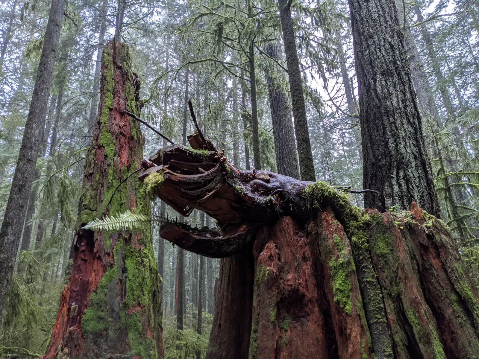
Photo: Jennifer C., Wikimedia Commons, CC BY 2.0
Blueridge is in the District of North Vancouver. The District lists it among the neighbourhoods of its Seymour community, and the province's place name record puts Blueridge within the District. On October 11, 2026, one third of the listings here stated "North Vancouver District" and the others left that line blank, so confirm it on the property tax notice.
What Blueridge is like
Blueridge covers a hillside in the east of the District of North Vancouver. Mount Seymour Parkway runs along the bottom, the Seymour River canyon is on the west side and McCartney Creek runs down the east side. At the top, the streets end at the forest. Berkley Road is the main street. It climbs north from the parkway, becomes Berkley Avenue and bends east toward Hyannis Drive.
The climb is long. Natural Resources Canada's elevation data gives 63 metres above sea level for Berkley Road at the parkway, 99 metres at Carnation Street and 138 metres where Berkley Road becomes Berkley Avenue. Hill Drive at Blairview Avenue is at 188 metres, and the north end of Blairview Avenue is at 200 metres. The highest homes therefore stand 137 metres above the parkway.
Listings use the name Blueridge for the whole slope. The District's list for its Seymour community names Blueridge, Seymour Heights and McCartney Woods as separate neighbourhoods. Many streets carry the family names of well-known poets and novelists, among them Byron Road, Keats Road, Shelley Road and Bronte Drive. No source we read says who chose them.
In our view, Blueridge suits a family that wants a large detached house, a school within walking distance and a forest trail near home. Errands need a car or a bus, because the shops are outside the area.
Live from the MLS® system
Homes for sale in Blueridge
9 houses, townhouses and duplex homes are listed for sale in Blueridge today, checked against the MLS® system within the last hour. Condos and apartments are not shown on this page.


.jpg)
Prices
What a home in Blueridge costs
Two kinds of numbers, kept apart. The dots are asking prices of the homes listed in Blueridge today, counted on this page. The cards are Greater Vancouver REALTORS benchmark prices for all of North Vancouver, which describe a typical home sold anywhere in North Vancouver.
Asking prices today
Each dot is one home for sale. The dark line marks the middle price.
Detached house
$2,042,000
- One year
- down 6.2%
- Ten years
- up 18.7%
North Vancouver benchmark, Greater Vancouver REALTORS, September 2026
Townhouse
$1,230,400
- One year
- down 4.9%
- Ten years
- up 43.2%
North Vancouver benchmark, Greater Vancouver REALTORS, September 2026
All home types
$1,290,400
- One year
- down 3.9%
- Ten years
- up 16.9%
North Vancouver benchmark, Greater Vancouver REALTORS, September 2026
What the homes are like
Every home this page listed in Blueridge on October 11, 2026 was a detached house. Few homes were for sale that day, so one new listing can change the shares below. Condos were also listed in the area, and this page leaves them out. The streets with homes listed were Hill Drive, Bendale Road, Blairview Avenue, Byron Place, Tompkins Crescent, Violet Street, Dresden Way and Byron Road.
The houses are large, and none listed that day was built after the 1980s. The 1970s were the largest group at 44%, followed by the 1980s at one third and the 1960s at 22%. The typical house dated from 1976 and had four bedrooms and more than 3,400 square feet of floor space.
Those eight streets cover the full height of the hill. Bendale Road and Violet Street are between 76 and 92 metres above sea level, and Hill Drive, Dresden Way and Blairview Avenue are between 161 and 200 metres. On that date, 44% of listings said the home had a view, and the others left that line blank.
Among the house listings that day, 11% named a licensed suite, 11% named an unauthorized suite, 11% said the house had no suite and two thirds left the line blank. The word unauthorized means the suite was added without the District's approval.
When the homes were built
Year built of the 9 listings that state it.
- 1960s2
- 1970s4
- 1980s3
Bedrooms
Bedrooms in the 9 listings that state it.
- 45
- 52
- 6 or more2
Suites: of the 3 houses for sale whose listing states it, 1 list a legal or licensed suite, 1 list a suite the municipality has not approved, and 1 list none. The rest leave the field blank.
The homes listed today have been on the market for 48 days at the middle, counted from each listing date to today. That is how long they have waited so far, which is a different number from how long homes take to sell.
Blueridge on the map
- Home for sale
- Public school
- Park
History
How Blueridge began
Two local names have records with the province. The BC Geographical Names Office says McCartney Creek is named after Alan Edward McCartney, a Vancouver civil engineer and land surveyor who had land nearby in the early 1890s and who petitioned in 1891 for the District of North Vancouver to be incorporated. The same office adopted Blueridge as an official community name on July 19, 1979, on the District's recommendation. Its record gives no origin for the name.
The homes for sale here on October 11, 2026 were finished in the 1960s, the 1970s and the 1980s. A North Shore News report of January 28, 1987 described Blueridge as a neighbourhood of mostly detached single family houses. The report covered a public hearing where more than 500 residents of the Seymour Heights area opposed the District's plan for McCartney Woods, the land on the east side between Hyannis Drive and Emerson Way. The plan included condominiums.
The west edge of Blueridge is the top of a steep slope above Riverside Drive and Chapman Way. Engineers call it the Berkley Escarpment. CBC News reported that a coroner counted at least six landslides there caused by storms since 1972, three of them in December 1979. In the early morning of January 19, 2005, a slide began in the backyard of a house at the top of the slope on Berkley Avenue and carried two homes down the bank. Eliza Kuttner, who was 43, died. The coroner's report, published in 2008, called the slide predictable and preventable.
With help from the province, the District then bought eight properties, four at the top of the slope on Berkley Avenue and four at the bottom on Chapman Way and Treetop Lane. Engineers working for the District studied 75 places along the crest where a slide could start. Their 2010 summary records that the houses on six properties were demolished, that fill was removed to make the slope less steep, and that every property on the crest was connected to the storm sewer. In 2009 the District adopted written safety limits for landslides. The District's park data now lists Eliza Kuttner Park, and OpenStreetMap places it on the slope between Berkley Avenue and Chapman Way.
Daily life
Daily life in Blueridge
Blueridge is a residential area with no shopping street. The map on this page shows no supermarket, pharmacy or clinic inside the area, and one cafe, on Mount Seymour Parkway near Emerson Way. The nearest supermarket on the map is a Safeway beside the Parkgate branch of the public library. Both are near the corner of the parkway and Mount Seymour Road, which the District's street data puts 2.7 kilometres east of Berkley Road.
The Ron Andrews Community Recreation Centre is at 931 Lytton Street, on the south side of the parkway. North Vancouver Recreation and Culture runs it and lists a 37.5 metre pool, a squash court, a fitness centre and a small meeting room called the Blueridge Room. Windsor Secondary and its sports field are next to the centre on Broadview Drive.
In our experience, children here walk to one of the two elementary schools, and most adults drive or ride the bus down to the parkway each morning. The 214 bus makes a loop through the upper streets, so a home near Berkley Road, Sechelt Drive or Carnation Street has a stop close by.
Grocery stores
Nearest: Safeway, 2.1 km away.
Cafes
- United Strangers630 m
Libraries and rec centres
- Ron Andrews Community Recreation Centre880 m
- Windsor Bubble1.1 km
How far it is
- Downtown Vancouver (Waterfront Station)9.1 km
- Lonsdale Quay and the SeaBus6.3 km
- Lions Gate Hospital5.0 km
- Park Royal shopping centre10.1 km
Places from OpenStreetMap, read October 10, 2026. Distances are in a straight line from the middle of the area, so the trip by road is longer.
Outdoors
Forest trails, local parks and Mount Seymour
Blueridge Park is in the 2400 block of Berkley Avenue, at the top of the neighbourhood. The District's park data calls it a community sports park and notes that the parking lot gate is locked at dusk. McCartney Creek Park is entered from south of Larkhall Crescent. OpenStreetMap shows a grass field for baseball and soccer, two tennis courts and a playground there, and the District requires a leash for dogs in it. Byron Park and Trillium Park are small parks among the houses.
The forest starts where the top streets end. The District's trail data names the Baden Powell Trail, the Bridle Path, the Hyannis Trail and the Berkley Loop here. On OpenStreetMap, the Baden Powell Trail passes Blueridge Park and goes down to a bridge over the Seymour River that the map labels Pipeline Bridge. The Bridle Path runs through the forest north and east of Hill Drive, and the Hyannis Trail leads north from the end of Hyannis Drive.
These trails lead north into the Lower Seymour Conservation Reserve, which Metro Vancouver runs. Its website gives the reserve 5,668 hectares and more than 100 kilometres of trails for hiking and cycling. Dogs must be on a leash in its busy areas and are banned from the paved Seymour Valley Trailway.
Mount Seymour Park is the nearest provincial park. BC Parks says it was established in 1936, has 14 hiking trails and is entered from Mount Seymour Road, north of the parkway. A company named Mount Seymour Resorts Ltd. runs the skiing and snowshoeing inside the park. BC Parks adds that visitors may need a free day-use parking pass in winter.
Schools
Schools in and near Blueridge
Blueridge is in the North Vancouver School District, and two public elementary schools are inside the area. Blueridge Elementary is at 2650 Bronte Drive, on the upper part of the hill. Seymour Heights Elementary is at 2640 Carnation Street, on the lower part. The district's list of feeder schools groups both of them, and Lynnmour Elementary, with Windsor Secondary at 931 Broadview Drive, on the south side of the parkway.
The province's school data shows no French immersion program at either elementary school. The nearest early French immersion school on the map is Dorothy Lynas Elementary on Inlet Crescent, to the east. The district's list of French immersion feeder schools sends Dorothy Lynas students on to Windsor Secondary.
The nearest independent schools on the map are Lions Gate Christian Academy on Tollcross Road and Kenneth Gordon on Seymour River Place. The school table on this page gives the distance to each school. Type each address into the district's school locator before you write an offer, because it shows which of the two elementary schools must take a child from that address.
| School | Type | French programs | Distance |
|---|---|---|---|
Blueridge Elementary 2650 Bronte Dr, North Vancouver, BC | Public, elementary | None listed | 250 m |
Seymour Heights Elementary 2640 Carnation St, North Vancouver, BC | Public, elementary | None listed | 350 m |
Lynnmour Elementary School 800 Forsman Ave, North Vancouver, BC | Public, elementary | None listed | 2.5 km |
Dorothy Lynas Elementary 4000 Inlet Cres, North Vancouver, BC | Public, elementary | Early immersion | 2.8 km |
Windsor Secondary 931 Broadview Dr, North Vancouver, BC | Public, secondary | Early immersion | 980 m |
Seycove Secondary Community 1204 Caledonia Ave, North Vancouver, BC | Public, secondary | None listed | 3.5 km |
Lions Gate Christian Academy 919 Tollcross Rd, North Vancouver, BC | Independent, elementary-secondary | None listed | 1.0 km |
Kenneth Gordon 420 Seymour River Pl, North Vancouver, BC | Independent, elementary-secondary | None listed | 1.9 km |
St. Pius X Elementary School 1150 Mt. Seymour Road, North Vancouver, BC | Independent, elementary | None listed | 2.3 km |
Brockton Preparatory School 3467 Duval Rd, North Vancouver, BC | Independent, elementary-secondary | None listed | 2.8 km |
Your address decides your assigned school, which can differ from the closest one. Check any address with the North Vancouver School District school locator. School list from the BC Ministry of Education, updated October 8, 2026.
Getting around
Getting around
Mount Seymour Parkway is the main road, with four lanes in the District's street data. Berkley Road, Lytton Street and Emerson Way all lead down to it. From Berkley Road, the street data gives 1.7 kilometres west along the parkway to Lillooet Road, where the Highway 1 ramps for the Ironworkers Memorial Second Narrows Crossing begin. In our experience, the time a drive to Vancouver or Burnaby takes depends on the traffic at that bridge.
Two bus routes serve Blueridge, and the table on this page counts the weekday trips on each. The 214 climbs Emerson Way, Carnation Street and Berkley Road, makes a loop along Berkley Avenue, Hyannis Drive and Sechelt Drive, and returns the same way. TransLink's schedule for September 7, 2026 to January 3, 2027 has weekday buses leaving Sechelt Drive at Hyannis Drive from 5:57 a.m. to 11:03 p.m., and they reach Phibbs Exchange in 12 to 17 minutes. Five morning buses, from 6:52 to 8:37 a.m., continue to Burrard Station in 45 to 47 minutes. Two afternoon 214 buses, at 4:39 and 5:06 p.m., run from Burrard Station to Berkley Road at Carnation Street in 50 minutes.
The 211 runs along the parkway. The same schedule gives 36 to 44 minutes from the stop at Berkley Road to Burrard Station for weekday buses that leave between 7 and 9 a.m., and 44 to 49 minutes back for buses that leave Burrard Station between 4 and 6 p.m. The last weekday 211 that continues downtown passes Berkley Road at 6:02 p.m. People who cycle should plan for the hill: Berkley Road climbs 75 metres between the parkway and Berkley Avenue.
Routes that stop in Blueridge
Trips on a regular weekday that stop at one of the 22 stops inside the area, from TransLink's published schedule valid to January 3, 2027.
- 211Seymour/Phibbs Exchange/Burrard Station89 trips
- 214Blueridge/Phibbs Exchange/Burrard Station75 trips
Before you buy
Things to check in Blueridge
The slope on the west edge
The District's Slope Hazard area covers lots within 20 metres of the top or bottom of a slope that is steeper than 20 degrees and more than 10 metres high. On October 11, 2026, its map data showed these areas within 40 metres of three of the eight streets that had homes listed that day: Hill Drive, Bendale Road and Violet Street. They also lay beside Berkley Avenue, Layton Drive and Chapman Way. A lawful house inside the area may stay as it is, and the District reviews any change to it. For a house near the top of the west slope, ask the seller for any engineer's report and whether the roof and driveway drains go to the storm sewer.
Creeks through the middle
Blueridge Creek runs south through the middle of the area and McCartney Creek runs down the east side, in the District's creek data. On the same date, Creek Hazard areas that the District labels a potential flood hazard lay within 40 metres of Bendale Road, Violet Street and Byron Road. GeoWeb, the District's online property map, shows which lots they cover. Ask the seller whether water has ever entered the lower floor.
Forest edge and wildfire
Wildfire Hazard areas lay within 40 metres of all eight streets that had homes listed. The District's data labels 75 of the 76 areas in and around Blueridge as Wildfire Interface Area. In April 2026 the District received funding to reduce wildfire risk on 32.8 hectares at two sites, one of them beside the Seymour River, with work scheduled to start in September or October 2026. Phone an insurer with the address before your offer becomes firm.
Snow on the hill
The District clears snow by three priority levels and aims to make first-level streets passable within 12 hours after the snow stops, second-level streets within 48 hours and third-level streets within 96 hours. Its map data puts Berkley Road, Berkley Avenue and Sechelt Drive, which carry the 214 bus, in the first level. Byron Road and Bronte Drive are in the second. Bendale Road, Violet Street, Blairview Avenue, Dresden Way, Tompkins Crescent, Byron Place and most of Hill Drive are in the third.
Suites in large houses
The District says it has allowed secondary suites since 1997, that a suite cannot be sold separately from the main house, and that the lot needs three off-street parking spaces. Every suite must be registered with the District, with or without a building permit, and registration adds a yearly water and sewer charge to the tax bill. Ask the District what it has on file for the address.
Buying
Buying a home in Blueridge
Decide first how high on the hill you want to live. The lower streets, such as Bendale Road and Violet Street, are a short walk from the parkway, the 211 bus, Seymour Heights Elementary and the recreation centre. The upper streets, such as Hill Drive and Blairview Avenue, are close to the trails and Blueridge Park, and the District's plan clears them of snow later.
Before you write an offer, search the address on GeoWeb for the slope, creek and wildfire areas described on this page. None of the houses listed on October 11, 2026 was built after the 1980s, so book a full inspection and ask for the permits behind any suite or addition. If you plan to count rent from a suite, ask a mortgage broker whether the lender accepts rent from a suite the listing calls unauthorized.
Gary Paul helps buyers across North Vancouver. Use the form on this page to send your budget, the number of bedrooms you need and how high on the hill you want to live. He will answer with the Blueridge homes that fit and set up the showings.
Selling
Selling a home in Blueridge
Few homes were for sale in Blueridge on October 11, 2026, and all of them were detached houses, so a buyer compares your house directly with the others on this page. In our experience, the same buyer also looks at Windsor Park, Northlands and Lynn Valley. The cards on this page show how many homes are listed here today and the range of their asking prices.
In our view, four things decide the price of a Blueridge house: the view, the condition of the kitchen, bathrooms and roof, whether a suite is registered with the District, and what the hazard maps show for the lot. Before you list, print the GeoWeb map for your address and gather any engineer's report, drainage record and permit, because a buyer's agent will search the address.
Real estate board rules keep sold prices off this public page, so it shows asking prices only. Gary Paul can review recent Blueridge sales with you and suggest a list price. Ask for a price review with the form on this page.
Houses listed
9
$1.90M to $2.78M
Our view
Who buys in Blueridge
In our experience, the most common buyer here is a family with school-age children that is moving from a townhouse or a smaller house on the North Shore or in East Vancouver. They want four bedrooms, a yard and an elementary school the children can walk to.
A second group, in our experience, is two generations of one family who want a large house with a separate suite for parents or adult children. A third group is people who hike, run or ride in the forest most weeks and want a trail at the end of their street.
Blueridge and the areas next to it
Homes listed for sale today, counted on this page.
| Area | For sale | Middle asking price | Houses, middle price |
|---|---|---|---|
| Blueridge | 9 | $2.35M | $2.35M |
| Windsor Park | 5 | $1.47M | $2.10M |
| Seymour | 9 | $1.80M | $2.08M |
| Northlands | 9 | $1.50M | $850K |
| Lynnmour | 21 | $1.27M | $2.00M |
Questions about Blueridge
Is Blueridge in the City or the District of North Vancouver?
Blueridge is in the District of North Vancouver, which lists it as a neighbourhood of its Seymour community. On October 11, 2026, two thirds of listings here left the municipality line blank, so check the property tax notice for each home.
Where is Blueridge, and is it the same as Seymour Heights?
Blueridge is the slope north of Mount Seymour Parkway and east of the Seymour River, around Berkley Road. Listings use the name for the whole slope. The District lists Blueridge, Seymour Heights and McCartney Woods as separate neighbourhoods.
What kind of homes are for sale in Blueridge?
On October 11, 2026, every home this page listed in Blueridge was a detached house. The typical one was finished in 1976 and had four bedrooms and more than 3,400 square feet. Condos were also listed in the area, and this page leaves them out.
How much does a house in Blueridge cost?
The price dots on this page mark the asking price of each house listed in Blueridge today, and the middle price is shown beside them. The page also gives the monthly benchmark price that Greater Vancouver REALTORS publishes for a detached house across North Vancouver.
Which schools serve Blueridge?
Blueridge Elementary on Bronte Drive and Seymour Heights Elementary on Carnation Street are both inside the area, and the North Vancouver School District groups them with Windsor Secondary on Broadview Drive. Check each address in the district's school locator to learn which elementary school applies.
How long is the bus ride from Blueridge to downtown Vancouver?
TransLink's schedule for September 7, 2026 to January 3, 2027 gives five morning 214 buses 45 to 47 minutes from Sechelt Drive at Hyannis Drive to Burrard Station. From Mount Seymour Parkway at Berkley Road, the 211 takes 36 to 44 minutes on weekdays between 7 and 9 a.m.
Is Blueridge good for families?
In our view, yes. Two elementary schools are inside the area, a recreation centre with a pool is across the parkway, and parks and forest trails are close to most streets. The trade-offs are a long hill, a drive or bus trip for groceries, and hazard checks on each address.
What happened in the 2005 landslide in Blueridge?
In the early morning of January 19, 2005, a landslide began behind a house at the top of the slope on Berkley Avenue and carried two homes down the bank, and one resident died. The District then bought eight properties, removed fill from the crest and connected the crest homes to the storm sewer.
Are there slope, flood or wildfire risks in Blueridge?
Some lots are in the District's hazard areas. On October 11, 2026, its map data showed wildfire areas near all eight streets that had homes listed, slope areas near Hill Drive, Bendale Road and Violet Street, and potential flood areas near Bendale Road, Violet Street and Byron Road. Search each address on GeoWeb.
Do Blueridge houses have suites?
Some do. On October 11, 2026, 11% of house listings named a licensed suite and 11% named an unauthorized suite, and most listings left the line blank. The District requires every suite to be registered, so ask it what is on file for the address.
Where does the name Blueridge come from?
No source we read gives the origin. The BC Geographical Names Office adopted Blueridge as an official community name on July 19, 1979, on the recommendation of the District of North Vancouver, and its record has no note on what the name means.
How do I find out what my Blueridge home is worth?
Send the form on this page and ask for a price review. Gary Paul will compare your house with recent Blueridge sales and with the houses for sale now, and he will explain in private the list price he would suggest.
Who should I talk to about buying or selling in Blueridge?
Gary Paul, REALTOR®, Personal Real Estate Corporation, with Grand Central Realty, works with buyers and sellers across North Vancouver for MultiLiving. Send the form on this page or phone him at 778-828-7476.
Sources
Written content checked October 11, 2026. Listing numbers counted from the MLS® system on October 12, 2026.
- Seymour (the community and its neighbourhoods; page last edited October 2, 2026), District of North Vancouver. Read October 11, 2026.
- Blueridge (name record 6717), BC Geographical Names Office, Government of British Columbia. Read October 11, 2026.
- McCartney Creek (name record 8384), BC Geographical Names Office, Government of British Columbia. Read October 11, 2026.
- NV residents oppose district development (McCartney Woods proposal), January 28, 1987, page 3, archived text, North Shore News. Read October 11, 2026.
- Fatal North Vancouver landslide preventable: report (July 26, 2008), CBC News. Read October 11, 2026.
- Berkley Landslide Risk Management, Phase 2 Assessment of Risk Control Options, final report (BGC Engineering, May 11, 2006), District of North Vancouver. Read October 11, 2026.
- Landslide Risk Summary (BGC Engineering, November 12, 2010), District of North Vancouver. Read October 11, 2026.
- Public map service (streets, boundary, creeks, parks, dogs in parks, trails, snow routes and hazard areas), District of North Vancouver. Read October 11, 2026.
- Slope Hazard Development Permit Area: frequently asked questions (2024), District of North Vancouver. Read October 11, 2026.
- Community Wildfire Protection Plan (page last edited May 14, 2026), District of North Vancouver. Read October 11, 2026.
- Preparing for and removing snow, District of North Vancouver. Read October 11, 2026.
- Build or register a secondary suite, District of North Vancouver. Read October 11, 2026.
- Elevation service, Canadian Digital Elevation Model (heights at street corners), Natural Resources Canada. Read October 11, 2026.
- Ron Andrews Community Recreation Centre, North Vancouver Recreation and Culture Commission. Read October 11, 2026.
- Lower Seymour Conservation Reserve, Metro Vancouver. Read October 11, 2026.
- Mount Seymour Park, BC Parks. Read October 11, 2026.
- Families of Schools (feeder schools and French immersion feeder schools), North Vancouver School District. Read October 11, 2026.
- TransLink schedule data (GTFS), in effect September 7, 2026 to January 3, 2027, TransLink. Read October 11, 2026.
- MLS® Home Price Index, September 2026 stats package, Greater Vancouver REALTORS. Read October 9, 2026.
- K-12 school locations (school names, addresses and programs), BC Ministry of Education and Child Care, through the BC Data Catalogue. Read October 9, 2026.
- Places, parks and shops, OpenStreetMap contributors (Open Database License). Read October 9, 2026.
- Bus, SeaBus and train schedules (GTFS feed 26SEP_20261009), TransLink. Read October 9, 2026.
General information only. The prices, benchmarks, strata rules, tax and fee figures, lease terms, permit rules and school details on this page are based on the sources and dates listed above. They are not financial, mortgage, tax or legal advice, and not a guarantee of any outcome. Prices, tax rates, fees, municipal rules and school catchments change. Before you buy or sell, confirm each one with its source and speak with a licensed REALTOR®, a mortgage broker and a real estate lawyer.